

Wandelgids Guide to the Lake District - AA
Het Lake District is een bergachtige streek.

Korte omschrijving
Wandelgidsen Cumbria, England van AA Publishing. Ideaal voor tochten in United Kingdom, Great Britain.
Wandelgids - Guide to the Lake District - AA Productomschrijving: Cumbria op zich werd al eens enkel gelend voor de Lake District, maar is uiteraard veel meer dan dat. Veel van de regio houd...

Specificaties
- Uitgever: AA Publishing
- ISBN-13: 9780749579432
- HOOFDCATEGORIEËN: Wandelgids
- Regio: Cumbria, England
- Land: United Kingdom, Great Britain
- Nationale parken: Lake District NP, Cumbria England
- Taal: Engels
- Iconische Wandelroutes: Lake district, Cumbria England
- De Nationale Parken: Lake district National Park, England
Volledige omschrijving
Wandelgids - Guide to the Lake District - AA
Productomschrijving: Cumbria op zich werd al eens enkel gelend voor de Lake District, maar is uiteraard veel meer dan dat. Veel van de regio houd wel degelijk deze prachitge plaats in. Een nationaal park van formaat, die geen enkel natuurliefhebber onontroerd laat. The Lake District national park, is een plaat uit de duizend in Engeland, alhoewel niet dicht bij de deur voor alle zuiderlijk gelegen regio's. Het Lake District is een bergachtige streek. Alle toppen in Engeland hoger dan 900 meter boven zeeniveau liggen in dit gebied. De plaats staat evengoed op de lijst van de UHESCO werelderfgoed lijst. Deze gids biedt u alles die u maar kunt vinden in dit park en meer
Omschrijving van de uitgever zelf: To some a walker's paradise, to others a foodie's heaven, the delights of the Lake District might be world-famous, yet picturesque peace and solitude is always surprisingly easy to find. The AA Guide to Lake District & Cumbria gives you all you need to know to get the most out of your visit to this wonderful area. From the 'most beautifully located' theatre in Britain to the last working slate mine in the country, the home of William Wordsworth to the landscapes that inspired Beatrix Potter, each entry is packed with the very best sites to see, things to do, recommendations for eating and drinking, and places to explore nearby. With everything from local legends to must-see festivals and events, this authoritative and practical guide ensures you will never be lost for something to do.
Locatie op kaart
Artikelen uit dezelfde regio

Wandelgids 015 Pathfinder guides Yorkshire Dales NP - OS • 9780319090404
Wandelgids Yorkshire Dales NP - OS Productomschrijving: Pathfinder Yorkshire Dales covering parts of the National Park, Ribblesdale and Swaledale. This selection offers interest, regional variety and balance of routes in the Yorkshire Dales providing the best walks in the area. From an easy stroll through Ingleton Waterfalls to the much more challenging walks in Gunnerside, this volume co…

Wandelkaart OL05 English Lakes - North Eastern area - OS • 9780319264003
Wandelkaart English Lakes - North Eastern area - OS Productomschrijving: Een topografische wandelkaart van het noordoostelijke deel van de Lake District National park. Omvat: English Lakes - North Eastern area, Penrith, Patterdale & Caldbeck, Parts of the Lake District, and The Cumbria Way. Ontdek de OL-serie van Ordnance Survey: De OL-serie (Outdoor Leisure) van Ordnance Survey …

Wandelgids Hadrian's Wall Path - Rucksack Readers • 9781913817312
Wandelgids Hadrian's Wall Path Productomschrijving: Hadrian's Wall Path runs for 86 miles (135 km) between Bowness-on-Solway and Wallsend (Newcastle) along the line of the Roman Wall completed in AD122 under the Emperor Hadrian. This National Trail crosses northern England from Irish Sea to North Sea and offers many chances to look at the forts, milecastles and interpretation centres withi…

Wandelkaart 89 West Cumbria England - OSI • 9780319261873
Wandelkaart West Cumbria - England Productbeschrijving: West Cumbria staat bekend om zijn aantrekkelijke landschap en het Lake District National Park & Wast Water Lakes, die zich uitstrekken over 3 mijl langs de Washdale valley. De OS Landranger kaart nummer 89 van West Cumbria omvat ook Cockermouth, Workington, Maryport, Dovenby, Uldale, Ennerdale Bridge, Egermont, Gosforth, Keswick, Scaf…
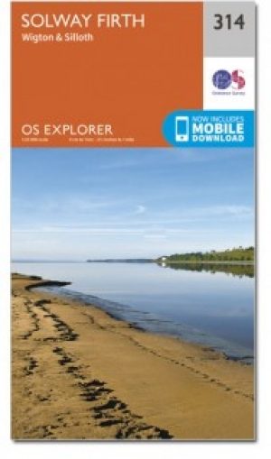
Wandelkaart 314 Solway Firth- Wigton & Silloth - OSI • 9780319245668
Wandelkaart Solway Firth- Wigton & Silloth - Cumbria England Productbeschrijving: OS Explorer 314 toont de Solway Firth, Annan, Wigton en Silloth. Het omvat ook een deel van het nationale Scenic gebied van Nith estuarium, en de Solway Coast gebied van buitengewone natuurlijke schoonheid AONB. Er zijn eveneens de Cumbria Costal Way, Allerdale Ramble en deel van de Haridlan Wall Path. De OS …