

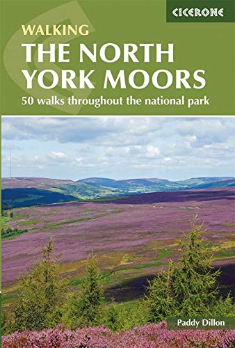
Wandelgids North York Moors walking guide - Cicerone
Een dikke 50 wandelingen doorheen dit nationale park

Korte omschrijving
Wandelgidsen Yorkshire, England van CICERONE Press. Ideaal voor tochten in England.
Wandelgids - North York Moors walking guide - Cicerone Productomschrijving: Dit zeer bekende nationale park behoort tot de mooiste van Engeland. Het park is waliswaar zonder hoge bergtoppen,...

Specificaties
- Uitgever: CICERONE Press
- ISBN-13: 9781852849511
- HOOFDCATEGORIEËN: Wandelgids
- Activiteiten: Wandelen, Hiking & Trekking
- Auteur: Paddy Dylan
- Regio: Yorkshire, England
- Land: England
- Nationale parken: North York Moors NP, England
- Editie: 2
- Taal: Engels
- De Engelse Graafschappen: North Yorkshire
- De Nationale Parken: North Yorkshire Moors National Park, England
Volledige omschrijving
Wandelgids - North York Moors walking guide - Cicerone
Productomschrijving: Dit zeer bekende nationale park behoort tot de mooiste van Engeland. Het park is waliswaar zonder hoge bergtoppen, maar is en blijft een prachtig gebied, waar de Engelsen goed voor zorgen. Deze gids brengt u een dikke 50 wandelingen doorheen de North York Moors Nationaal Park. Kies er éne uit en neem een duik in de Engelse binnenlandse fauna & flora.
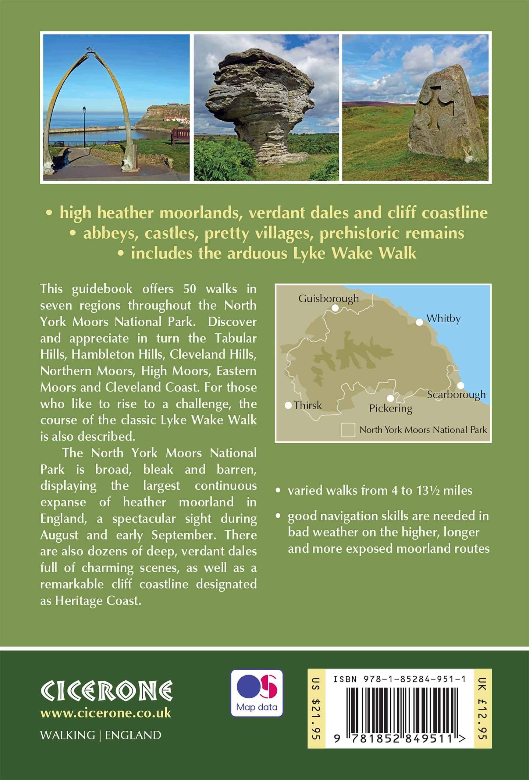
Product description : This guidebook describes 50 circular day walking routes in the North York Moors. The moors offer no great height but cover seven regions; the Tabular Hills, Hambleton Hills, Cleveland Hills, Northern Moors, High Moors, Eastern Moors and Cleveland Coast. There is also a four-day route following the classic Lyke Wake Walk.
Regions; the Tabular Hills, Hambleton Hills, Cleveland Hills, Northern Moors, High Moors, Eastern Moors and Cleveland Coast. There is also a four-day route following the classic Lyke Wake Walk. Seasons: Spring and autumn are ideal to explore the North York Moors. Weather an issue on unsheltered moorland in winter; and accommodation is busy in summer.Centres: Great Ayton, Helmsley, Hutton-le-Hole, Pickering, Whitby, Osmotherley, Scarborough, Thisk, Guisborough.
Difficulty: Varied walks from 4 to 14 miles. Exposed moorland walks to coastal strolls.
Must See: Rievaulx Abbey, Kilburn white horse, industrial archaeology, the high moors, coastal path Whitby – Robin Hood’s Bay.

Locatie op kaart
Artikelen uit dezelfde regio
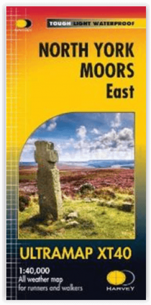
Wandelkaart North York Moors Oost XT40 - Harvey Maps • 9781851376230
Wandelkaart North York Moors Oost - Harvey Maps Productomschrijving: Omvat een groot gebied maar is praktisch en compact, zakformaat. Gedetailleerde kaart voor lopers en wandelaars van het oostelijk gedeelte van het Nationaal Park North York Moors. Omvat: Robin Hood's Bay, Flyingdales Moor en het populaire Rosedale Abbey. - De North Yorkshire Steam spoorweg en de Lyke Wake Walk zij…
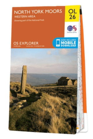
Wandelkaart OL26 North York Moors Western area - OS • 9780319242650
Wandelkaart North York Moors, Western area - OS Productomschrijving: Een topografische wandelkaart van het westerse deel van het North York Moors National Park. Omvat: Het Howardian Hills AONB gebied, deel van het nationale park van de North York Moors, Tees Forest Community Forest, The Cleveland Street Walk, Cleveland Way, E2 European long distance Path, Ebor Way, England Coast PAth, …

Wandelkaart 07 Yorkshire Dales Centraal - AA • 9780749573157
Wandelkaart 07 - Yorkshire Dales Centraal - AA Productomschrijving: AA, in samenwerking met Ordinance Survey, heeft een reeks kaarten ontwikkeld die zich op populaire toeristische bestemmingen van de UK richten, zodat meerdere OS-kaarten niet vereist zijn. Deze kaart richt zich op de centrale Yorkshire Dales uit Lofthouse in het oosten aan Settle in het westen en uit Malham in de Zuid-toLa…

Wandelgids 50 walks in West Yorkshire - AA Publi. • 9780749583798
50 walks in West Yorkshire - AA Publishing Productomschrijving: West Yorkshire, een regio die de perfecte balans biedt tussen natuur en stedelijke charme, heeft veel te bieden voor wandelaars. De gids "50 Walks in West Yorkshire" neemt je mee langs schilderachtige routes door glooiende landschappen, historische locaties en levendige steden. Wat Kun Je Verwachten? Prachtige Natuur: …
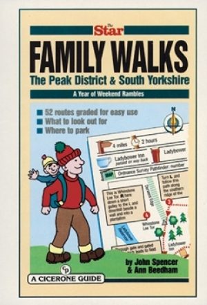
Wandelgids Peak District & South Yorkshire - Cicerone • 9781852842574
Wandelgids - Peak District & South Yorkshire - Cicerone Productomschrijving: Een gids naar 52 korte circulaire wandelingen in het Peak District en Zuid-Yorkshire, in Noord-Engeland, aangepast door plaatselijke Sheffield krant "The Star Weekend walking kolom". Routes zijn 2 tot 3 uur lang, dus ideaal voor gezinnen. Winnaar van de beste gids van COLA/OWG 1998. Allemaal binnen een uur van She…