

Wandelgids Part 3 SWCP Map Booklet PLymouth to pool - Cicerone
Van Plymouth naar Poole langs de kustlijn van Devon en Dorset


Korte omschrijving
Wandelgidsen South West England, Devon, England en Dorset, England van CICERONE Press. Ideaal voor tochten in United Kingdom, Great Britain.
Map booklet South West Coast Path - Cicerone Productomschrijving: Kaart van een deel van het zuidelijke deel van het 630 mijl (1014 km) lange South West Coast Path National Trail. Omvat het ...

Specificaties
- Uitgever: CICERONE Press
- ISBN-13: 9781786312006
- HOOFDCATEGORIEËN: Wandelgids
- Activiteiten: Wandelen, Hiking & Trekking
- Regio: Devon, England, Dorset, England, South West England
- Land: United Kingdom, Great Britain
- Schaal: 1:25000
- Editie: 2
- Taal: Engels
- Reeks/Serie: Map Booklet, Cicerone
- Iconische Wandelroutes: South West coast Path, Cornwall UK
Volledige omschrijving
Map booklet South West Coast Path - Cicerone
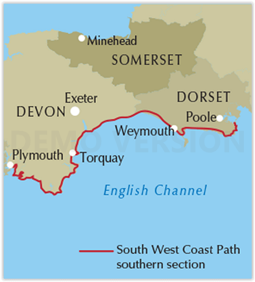
Productomschrijving: Kaart van een deel van het zuidelijke deel van het 630 mijl (1014 km) lange South West Coast Path National Trail. Omvat het pad van Plymouth naar Poole langs de kustlijn van Devon en Dorset. Dit handige en compacte boekje met Ordnance Survey 1:25.000 kaarten toont de route en biedt alle kaarten die je nodig hebt om het pad in beide richtingen te lopen.
Engelse omschrijving: Map of part of the southern section of the 630 mile (1014km) South West Coast Path National Trail. Covers the trail from Plymouth to Poole along the coastline of Devon and Dorset. This convenient and compact booklet of Ordnance Survey 1:25,000 maps shows the route, providing all of the mapping you need to walk the trail in either direction.
Seasons:
This National Trail may be walked year-round: be aware that winter accommodation availability may be limited, while high summer will be extremely busy and the weather often hot.
Centres:
Many centres are passed along the route, including Plymouth, Salcombe, Brixham, Weymouth, Swanage and Poole.
Difficulty:
The South West Coast path is a long walk! Most paths are easy to moderate, with some walks along rugged and exposed coastal cliff paths and some steep gradients.
Must See:
Exmoor National Park, Areas of Outstanding Natural Beauty, numerous Heritage Coasts, National and Local Nature Reserves, Sites of Special Scientific Interest and National Trust holdings.
Gekoppelde artikelen

Wandelgids SWCP guide - Cicerone Press • 9781786310682
standaard versieThe South West Coast Path - Cicerone Productomschrijving: Omvat spectaculaire plaatsen die dit deel van het Engelse landschap rijk is, zoals Exmoor National Park, met 5 AONB's of Areas of Outstanding Natural Beauty, de Jurassic Coast Natural World Heritage Site. Deze route bestaat al heel lang. De route start of eindigd natuurlijk in Minehead, in Somerset, loopt langs de kust richting de v…
Artikelen uit dezelfde regio
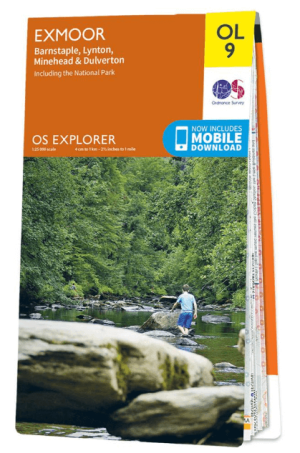
Wandelkaart OL09 Exmoor NP Devon England - OS • 9780319242483
Wandelkaart Exmoor NP Devon England - OS Productomschrijving: Exmoor National Park, Devon England Omvat: Exmoor National Park, Devon England, Barnstaple, Lynton, Minehead & Dulverton. Ontdek de OL-serie van Ordnance Survey: De OL-serie (Outdoor Leisure) van Ordnance Survey is dé referentie voor wie gaat wandelen op de Britse eilanden. Deze topografische kaarten maken deel uit va…

Landkaart Wegenkaart 2 Engeland Centr. Zuid - AA • 9780749584078
Wegenkaart Centraal Zuid Engeland - AA Productomschrijving: AA Road Map Central Southern England is a practical and slimline, foldable map from the experts at the AA. Encased in a durable, weatherproof cover, the mapping is produced at a scale of 3 miles to 1 inch (1:200,000 / 2km to 1cm) combining clear design, an easy-to-read scale and more road detail to ensure that you never lose you…

Wandelgids 011 Pathfinder guides Dorset England - OS • 9780319090367
Wandelgids Dorset - OS Productomschrijving: Dorset must rank as one of the most unspoilt counties in England. Dominating the landscape are the chalk downs open, sweeping, grassy uplands that stretch from the former forest lands of Cranborne Chase on the Wiltshire and Hampshire borders right across the middle of the county to the coast. The many ridge-top footpaths (including one start…
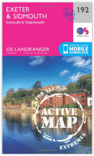
Wandelkaart 192 Exeter- Sidmouth & Exmouth - OSI • 9780319475157
Wandelkaart Exeter- Sidmouth & Exmouth - Devon England Productbeschrijving: Kaart nummer 192 in de OS Landranger kaarten, is de ideale kaart voor de planning van uw daguitstapjes en vakanties naar Exeter en Sidmouth. Verken het oosten van Devon, met inbegrip van de stad van Exeter en de steden van Honiton en badplaats steden zoals Exmouth, Sidmouth, Teignmouth, Seaton en Budleigh Salterton…

Wandelgids 069 Pathfinder guides South West England Coastal walks • 9780319091135
Wandelgids South West England Coastal walks - OS Productomschrijving: Immerse yourself in 28 beautiful walks along the South West Coast of England with the OS Pathfinder Guidebooks, graded by length and ranging from 3 to 9 miles. The routes range from extended strolls to longer hikes, something for all levels! Each walk includes a detailed description, an OS map, GPS waypoints and notes of…