
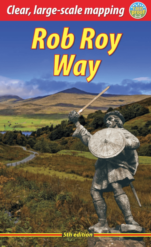
Wandelgids Rob Roy Way Schotland, 5e editie - Rucksack Readers
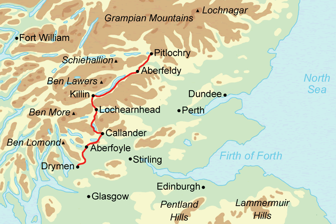
Starts at Drymen (near Glasgow) and ends at Pitlochry
Korte omschrijving
Wandelgidsen Perthshire, Schotland van RUCKSACK READERS. Ideaal voor tochten in Schotland.
The Rob Roy Way - Rucksack Readers Productomschrijving: The Rob Roy Way is one of Scotland’s Great Trails and is very popular with both walkers and cyclists. It runs through many places link...


Specificaties
- Uitgever: RUCKSACK READERS
- ISBN-13: 9781913817381
- HOOFDCATEGORIEËN: Wandelgids
- Activiteiten: Wandelen, Hiking & Trekking
- Auteur: Jacquetta Megarry
- Regio: Perthshire, Schotland
- Land: Schotland
- Toepasselijke bergketen: Schotse Highlands, Schotland
- Historische wandelroutes: Rob Roy Way, Schotland (127 km)
- Lange afstand wandelroutes: Rob Roy Way, Schotland (128 km)
- Nationale parken: Trossachs NP, Schotland
- Schaal: 1:110000
- Editie: 5
- Taal: Engels
- Iconische Bergketens van Europa: De Schotse Highlands
- Scotlands Great Trails: Rob Roy Way
Volledige omschrijving
The Rob Roy Way - Rucksack Readers
Productomschrijving: The Rob Roy Way is one of Scotland’s Great Trails and is very popular with both walkers and cyclists. It runs through many places linked with Scotland’s most famous outlaw, Rob Roy MacGregor (1671-1734). The route starts at Drymen (near Glasgow) and ends at Pitlochry in the eastern Highlands, so it takes you away from the crowds following the West Highland Way to some of Scotland’s finest lochs and glens. Its main spine runs for 79 miles (127 km) and is waymarked. There is an optional extra 17 miles if you take the wilderness extension through Glen Almond and Glen Quaich. Most walkers complete it in 6-8 days and most cyclists in 3-4 days.
The route goes through Loch Ard forest to Aberfoyle; heads east and north beside Lochs Venachar, Lubnaig and Tay; and passes through superb scenery, with interesting aqueducts, viaducts and a 3600 year-old stone circle. The terrain is a mixture of forest tracks, cycleway, disused railway trackbed and moorland footpaths. The Way passes through a succession of friendly villages with welcoming pubs and B&Bs.
Our fourth edition has more content, with full coverage for cyclists and detailed description of the Glen Quaich alternative. It is now longer, 80 pages in place of 64, with 111 colour photos, many of them fresh. However thanks to its robust perfect binding it is 10 grams lighter than the previous edition and more pocketable.
This guidebook contains all you need to plan and enjoy the Rob Roy Way:
- details of distance, terrain and food/drink for walkers and cyclists
- eight-page section for the extension via Glen Quaich
- visitor attractions, side-trips and mountains to climb including Ben Ledi
- planning information for travel by car, train, bus or plane
- concise biography of Rob Roy MacGregor
- background on pre-history, heritage and wildlife
- detailed mapping on 18 pages at 1:50,000
- in full colour, with 111 colour photos
- rucksack-friendly and on rainproof paper.
Gekoppelde artikelen

Rob Roy Way 6-pack Map Booklet - Rucksack Readers • 9781913817374
standaard versieThe Rob Roy Way 6-pack map booklet - Rucksack Readers Productomschrijving: The Rob Roy Way is one of Scotland’s Great Trails and is very popular with both walkers and cyclists. It runs through many places linked with Scotland’s most famous outlaw, Rob Roy MacGregor (1671-1734). The route starts at Drymen (near Glasgow) and ends at Pitlochry in the eastern Highlands, so it takes you away fr…
Artikelen uit dezelfde regio
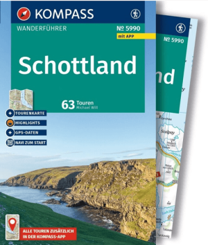
Wandelgids 5990 Schottland - Kompass • 9783991545132
Wandelgids Schottland - Kompas Productomschrijving: De KOMPASS wandelgids 5990 Schotland, bevat 63 wandelroutes door de Schotse Laaglanden, de Schotse Hooglanden, de eilanden en de ruige kustgebieden van het land. De selectie loopt van korte wandelingen langs kastelen, stranden en historische plaatsen tot lange bergtochten over afgelegen Munro’s. Ook enkele routes vlak bij de grens met En…
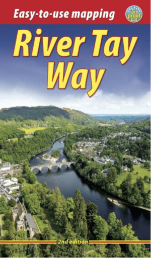
Wandelgids The River Tay Way - Rucksack Readers • 9781913817411
The River Tay Way - Rucksack Readers Productomschrijving: De wandel- en fietsgids River Tay Way volgt de langste rivier van Schotland door het afwisselende landschap van Perthshire. Wandelaars leggen ongeveer 80 kilometer af van Kenmore aan Loch Tay naar Perth. Fietsers volgen een langere route van circa 105 kilometer, die via Perth doorloopt naar Dundee. Beide trajecten kunnen ook in afz…

Wandelkaart OL49 Pitlorchry & Loch Tummel & Aberfeldy - OS • 9780319242889
Wandelkaart Pitlorchry & Loch Tummel & Aberfeldy - OS Productomschrijving: Een topografische wandelkaart van een deel van het Cairngorms National Park, Omvat: Pitlorchry & Loch Tummel & Aberfeldy, Kinloch Rannoch & Schiehallion, part of the Cairngorms National Park, the Rob Roy Way. Tay Forest Park National Scenic area, Loch Rannach & len Lyon & Loch Tummel. Ontdek de OL-serie van…
Wandelkaart OL52 Glen Shee- Braemar & Cairnwell - OSI • 9780319469705
Wandelkaart Glen Shee- Braemar & Cairnwell - Perthshire Omvat ook: The Cairnwell & Glas Maol Productbeschrijving: Beroemd om Schotland's grootste skigebied te zijn, omvat OS Explorer kaart OL 52 ook een onderdeel van het Cairgorms National Park, 12 Munros, de Cateran Trail en het dorp van Braemar, bekend om het Braemar Gathering, waar de traditionele Highland Games vaak bijgewoond word…
Wandelkaart OL51 Atholl Glen Tilt & Beinn Dearg - OSI • 9780319469699
Wandelkaart Atholl- Glen Tilt & Beinn Dearg - Perthshire Schotland Omvat ook: Glen Tilt, Beinn Dearg & Carn nan Gabhar Productbeschrijving: Het Cairngorms National Park, en met inbegrip van tien van de Munros. OS Explorer kaart OL 51 is een ruig gebied met weinig wegen of gemarkeerde paden. Deze kaart vervangt de vorige OS Explorer kaart 394 voor dit gebied. Neem de tijd om te verkenn…