

Wandelgids Thames Path - Trailblazer
Thames Head - Thames Barrier - Woolwich (London)
Korte omschrijving
Wandelgidsen Greater London, England van Trailblazer Publications. Ideaal voor tochten in England.
Wandelgids Thames Path - Trailblazer Productomschrijving: Het Thames Path is een nationaal pad van 220 km dat loopt van de bron van de rivier bij Thames Head nabij Kemble tot de Thames Barri...

Specificaties
- Uitgever: Trailblazer Publications
- ISBN-13: 9781912716272
- HOOFDCATEGORIEËN: Wandelgids
- Activiteiten: Wandelen, Hiking & Trekking
- Auteur: Anna Udagawa, Joel Newton, William Allberry
- Regio: Greater London, England
- Land: England
- Editie: 3
- Taal: Engels
- National Trails UK, England & Wales: Thames Path, England
Volledige omschrijving
Wandelgids Thames Path - Trailblazer
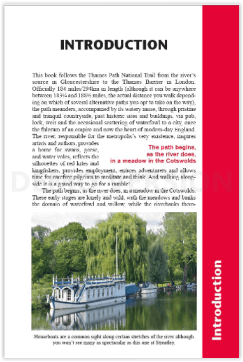
Productomschrijving: Het Thames Path is een nationaal pad van 220 km dat loopt van de bron van de rivier bij Thames Head nabij Kemble tot de Thames Barrier in Londen. Het pad begint, net als de rivier, in een weiland in de Cotswolds, de bovenloop is eenzaam en wild. Naarmate het water dieper wordt, nemen de nederzettingen langs de oevers in omvang en grootsheid toe en wanneer men Oxford bereikt, verdwijnt de eenzaamheid van de rivier langzaam en gaat het pad evenzeer over historische steden, kerken, abdijen en kastelen als over de rivier.
Engelse omschrijving: The Thames Path is a national trail running for 184 miles from the river’s source at Thames Head near Kemble to the Thames Barrier in London. The path begins, as the river does, in a meadow in the Cotswolds, its upper reaches lonely and wild. As the waters deepen the settlements along its banks begin to grow in both size and grandeur and, reaching Oxford, the solitude of the river slowly subsides and the trail becomes as much about historic towns, churches, abbeys and castles as it does the river.
Lechlade, Abingdon, Wallingford, Henley ... they all owe their location to the Thames, and different eras, when the river was a life source, a place of conflict, a boundary, a mode of transport and the provider of leisure, which, thankfully – for us, at least – it remains to this day. Squeezing through the ancient Goring Gap, loomed over by the Chiltern Hills, you pass Runnymede, the site of the signing of Magna Carta, and Windsor Castle. Passing by so many ancient sites, this is as much a walk through history as an easy ramble along a river bank.
The route through London – particularly along the south bank – remains relatively countrified, at least as far as Putney, from which the approaching sights of Westminster and Tower Bridge offer vistas as impressive as any others along the river’s green and scenic upper reaches. Leaving central London, the regenerated dockland areas of East London lure you to your journey’s end at the Thames Barrier and the conclusion of a most enjoyable and magnificently-varied riparian ramble, quite unlike any other in Britain.
Features:
1. Classic Trailblazer style – In many walking guides the reader has to read a route description then try to relate it to the map. Our guides are easier to use because walking directions, tricky junctions, places to stay and eat, points of interest and walking times are all written onto the maps themselves in the places to which they apply.
With their uncluttered clarity, these are not general-purpose maps but fully-edited maps drawn by walkers for walkers. Downloadable GPS waypoints also included.
2. The largest scale walking maps available – At just under 1:20,000 (8cm or 31/8 inches to 1 mile) our maps are bigger than even the most detailed walking maps currently available in the shops.
3. An all-in-one guide – Trailblazer guides include practical information not usually found in walking guides to the UK: reviews of places to stay, places to eat, attractions along the way and detailed public transport information showing all access points on the path, for weekend and day walkers.
Artikelen uit dezelfde regio
Reisgids Ongekend Londen - Edicola • 9789493160231
Reisgids Ongekend Londen - Edicola Productomschrijving: Schattige straatjes met bontgekleurde huizen, talloze gezellige foodmarkets en prachtige groene parken; Londen heeft zo veel meer te bieden dan de Big Ben en Piccadilly Circus. Wie de Britse hoofdstad beter leert kennen, ontdekt al snel wat een opvallend gezellige en veelzijdige stad Londen is. De miljoenenstad bestaat eigenlijk uit t…
Stadsplattegrond Wandelkaart London walk - Urban maps - OS • 9780319091944
Stadskaart Wandelkaart London walk - OS Productomschrijving: Een zigzag gevouwde wandel & Stadskaart van de Engelse hoofdstad London, met alle bezienswaardigheden die de stad te bieden heeft, zijn parken en zichten van de meest bijzondere plaatsen. Ook is er de Thames path inbegrepen op de keerzijde van de kaart. Engelse omschrijving: This brand new OS Urban Map will help you discover …

Stadskaart & plattegrond Londen geplastificeerd - Michelin • 9782067267053
Stadskaart Londen geplastificeerd - Michelin Productomschrijving: De gelamineerde MICHELIN Londen kaart op 1:15.000 (1cm = 150m) is ideaal om de Engelse hoofdstad te verkennen. U vindt alle praktische informatie die u nodig hebt om u te voet, met de auto of op de fiets door Londen te verplaatsen: vervoer, routebeschrijving, parkeren, praktische informatie (openbare gebouwen, sportfacilitei…

Reisgids London - DK Eyewitness • 9780241368749
Reisgids London - Eyewitness Productomschrijving: Ontdek de musea van wereldklasse in Londen, ontdek de geschiedenis van de stad in Westminster Abbey en de Tower of London, of geniet van een show in The West End: alles wat u moet weten is overzichtelijk weergegeven in kleurgecodeerde hoofdstukken. Ontdek het beste van Londen met deze onmisbare reisgids. Engelse omschrijving: Exp…
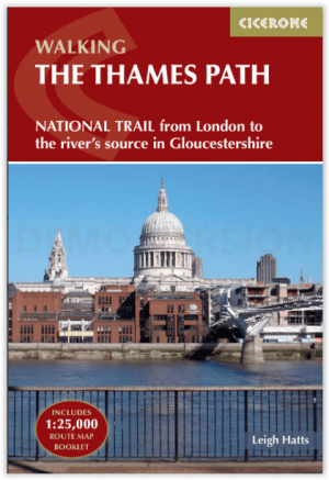
Wandelgids Walking the Thames Path National Trail - Cicerone • 9781786311481
Thames Path National Trail - Cicerone Productomschrijving: Een gloednieuwe wandelgids vover het Theemspad, een National Trail van 180 mijl tussen de Thames Barrier in Londen en de bron van de rivier in Gloucestershire, door Windsor, Oxford en het platteland. Biedt volledige informatie over deze gemakkelijke route langs de rivier die ongeveer twee weken in beslag neemt. Inclusief een 1:25K …