

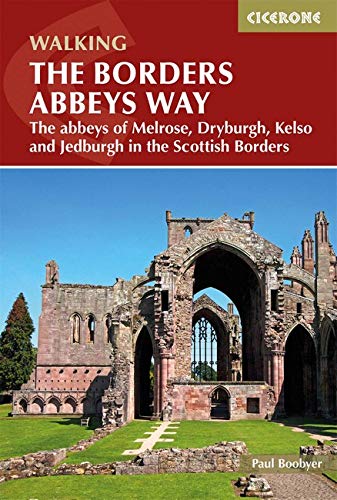
Wandelgids The Borders Abbeys Way - Cicerone
Een 109 km lange afstand pad op het Schotse grensgebied


Korte omschrijving
Wandelgidsen Schotse grenzen van CICERONE Press. Ideaal voor tochten in Schotland.
Wandelgids - The Borders Abbeys Way - Cicerone Productomschrijving: Deze gids brengt u langs een 109 km lange afstand pad op- en rond het Schotse grensgebied. Langs de route bevinden zich 4 ...

Specificaties
- Uitgever: CICERONE Press
- ISBN-13: 9781852849801
- HOOFDCATEGORIEËN: Wandelgids
- Activiteiten: Wandelen, Hiking & Trekking
- Regio: Schotse grenzen
- Land: Schotland
- Lange afstand wandelroutes: The Borders Abbeys Way (109 km)
- Editie: 1
- Taal: Engels
Volledige omschrijving
Wandelgids - The Borders Abbeys Way - Cicerone
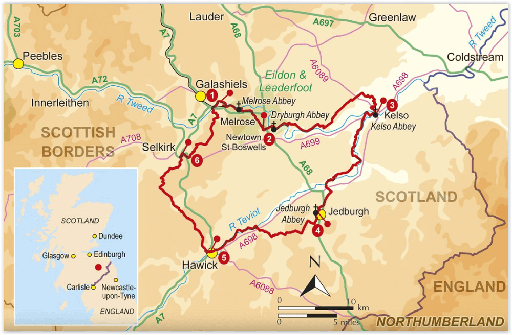
Productomschrijving: Deze gids brengt u langs een 109 km lange afstand pad op- en rond het Schotse grensgebied. Langs de route bevinden zich 4 van de beroemste oude Schotse Abbey's. De route start en eindigd in Tweedbank Schotland, en loopt voor zo'n dikke 109 km. De gids beschrijft een dikke 6 etappes en is zeer geschiedenisrijk. Goed voor mensen met een gemiddelde fizieke conditie, en kan bewandeld worden het ganse jaar door..
Product description:: Guidebook to the Borders Abbeys Way, a 68 mile circuit in the beautiful Scottish Borders. Taking in four of Britain's grandest ruined medieval abbeys, the route which begins and ends in Tweedbank, is described over 6 stages, and is as rich in history as it is pastoral charm. Relatively flat, it is suitable for people with a moderate level of fitness, and can be undertaken at any time of year.
In addition to clear route description and OS mapping extracts, the guidebook also includes information about the history of the Borders abbeys, the ever-intriguing Borders reivers, and the region's geology and agriculture. Invaluable practical information relating to accommodation, transport, mapping and public access is also included. As historically enchanting as it is visually delightful, the Borders Abbeys Way will connect walkers with a truly fascinating period of history. In fact, some of the paths on the Way are the very same routes that monks used to travel between the Borders abbeys, and no doubt were also used by the notorious reivers.
Artikelen uit dezelfde regio

Wandelgids 088 Pathfinder guides Scottish Borders - OS • 9780319092583
Wandelgids Scottish Borders - OS Productomschrijving: Opening with a gentle short walk at Hawick, visiting Wilton Lodge Park is the company of the River Teviot, and concluding with a more challenging ramble to the north of Melrose, walks are arranged in the book by completion time, with shorter and easier routes at the start and longer outings at the end. Walks are professionally authored …

Wandelkaart St Cuthbert's Way XT40 - Harvey Maps • 9781851377237
Wandelkaart St Cuthbert's Way - Harvey Maps Productomschrijving: De gehele route op één kaart, Eén van de bekendste routes van Schotland. De St Cuthbert's Way verbindt plaatsen die verband houden met het leven van de Heilige uit de 7e eeuw, Cuthbert. Van Melrose Abbey naar Holy Island (Lindisfarne). 100 km (62 mijl). - De kaart is sterk, licht, duurzaam en 100% waterbestendig - …

Wandelkaart 331 Teviotdale South - Schotisch Borders - OSI • 9780319245835
Wandelkaart Teviotdale South - Schotisch Borders Omvat ook: Hawick. Productbeschrijving: OS Explorer kaart 331 omvat de rivier Teviot in Teviotdale, de stad van Hawick en de omliggende dorpen. Het terrein is gevarieerd, met zachte valleien oplopend tot enkele steile hellingen en halfhoge pieken. De OS Explorer kaart voor Teviotdale zuiden is beschikbaar in zowel de standaard papieren v…

Wandelkaart 338 Galashiels Selkirk & Melrose - OSI • 9780319472101
Wandelkaart Galashiels- Selkirk & Melrose - Scotisch Borders Omvat ook: St-Boswell’s & Lauder. Productbeschrijving: Kaart nummer 338 dekt Galashiels, Selkirk en Melrose. Hoogtepunten zijn onder andere Eilon en Leaderfoot, Southern Upland Way en Borders Abbeys Way. Omvat ook Lauder, St. Boswells, Bloomfield en Fountainhall. De OS Explorer kaart voor Galashiels, Selkirk & Melrose is besc…
Wandelkaart OL39 Loch Lomond North & Tyndrum - OS • 9780319242780
Wandelkaart Loch Lomond North & Tyndrum - OS Productomschrijving: Loch Lomond North & Tyndrum, Crianlarich & Arrochar, part of Loch Lomond & The Trossachs National Park. Omvat: Loch Lomond North & Tyndrum, Crianlarich & Arrochar, part of Loch Lomond & The Trossachs National Park. Ontdek de OL-serie van Ordnance Survey: De OL-serie (Outdoor Leisure) van Ordnance Survey is dé refe…