

Regio
Taal
Editie
Schaal
Auteur:
Reeks/Serie:
Lange afstand wandelroutes
Historische wandelroutes
Bedevaart routes
Nationale parken
Regionale parken
AONB - Area of Outstanding Beauty
UNESCO werelderfgoed
TOPO's & Stafkaarten
Toepasselijke bergketen
HOOFDCATEGORIEËN
Uitgever

 Wandelen in Engeland
Wandelen in Engeland ligt naast Wales, Schotland en Noord-Ierland één van de 4 gebieden die samen het Verenigd Koninkrijk vormen. Het volledige landmassa van dit grote eiland wordt meestal aangeduid met de naam "Groot-Brittannië". In de volksmond wordt echter heel vaak over een uitstapje naar "Engeland" gesproken als men in het algemeen ergens in Groot-Brittannië is geweest. Interessant is de collectie van de 40 meest Iconische wandelroutes van Europa, de pagina is gloednieuw.
Bij Bibliotrek bedoelen we met Engeland wel degelijk het specifieke gebied. De Wandelgidsen Engeland vallen onder de grootste categorieën die Bibliotrek heeft. We hebben meer dan 1.200 wandelgidsen van verschillende uitgevers zoals Harper Collins, Sunflower books, het zeer gekende Cicerone, Elmar, en de nationale uitgever AA. Dit zijn stuk voor stuk professionele uitgevers met schitterende wandelgidsen voor Engeland. Het land bestaat uit vele graafschappen, die ten tijde van de Angelsaksen "Shires" werden genoemd. Dit blijkt nog uit de namen van een groot aantal graafschappen zoals Bedfordshire, Hampshire enz.
In Engeland hebben ze er aan nationale sport van gemaakt, en dat met de uitzinnige "National Trails". Dit zijn wandelroutes van formaat, die je natuurlijk niet enkel met een Wandelgids kan doen, maar ook met onze Wandelkaarten Engeland. De National Trails zijn heel bekend en vormen zelfs de bakermatr van de Engelse Wandelsport. Om er maar enkele te noemen:
The South Downs Way, door Sussex van Winchester naar Eastbormne, door The South Downs AONB.
The South West Coast Path, rond South West England, van Minehead bij Exmoor NP tot Pool in Dorset
The Yorkshire Wolds Way, van Hessle, East Riding of Yorkshire, tot Filey, North Yorkshire, 127 Km.

Wandelgids 100 outstanding British Walks - Ordnance Survey • 9780319090862
100 outstanding British Walks - OS Productomschrijving: Deze gloednieuwe wandelgids van Ordnance Survey, brengt u een hoop prachtige wandelingen over het ganse Britse landschap verdeeld. Onderaan vindt u de lijst, opgedeeld in de verschillende regio's van de Britse eilanden. Engelse omschrijving: This magnificent compendium of outstanding British walks brings together the finest sele…

Trailrunning gids Yorkshire Dales NP - Cicerone • 9781852849221
Trailrunning gids, 40 runs in the National Park-Three Peaks Productomschrijving: Guidebook to 40 great trail and fell runs in the Yorkshire Dales National Park. Ranging from 5 to 24 miles, the graded runs start from bases such as Hawes, Settle, Ingleton, Dent, Sedbergh, Malham and Grassington and take in the region's diverse delights, from castles and waterfalls to iconic mountains such a…

Wandelgids Epic British Walks - Ordnance Survey • 9780319092064
Wandelgids Epic British Walks - Ordnance Survey Productomschrijving: OS Epic British Walks allows the reader to take their walking dreams one step further with this inspiring introduction to distance walking and with thirty-eight amazing trails of immense diversity, each graded by difficulty, there are routes for first-time hikers as well as for the super-fit, seasoned multi-day rambler. …

Wandelgids Day Walks in Lincolnshire England - Vertebrate Publ. • 9781839812262
Day Walks in Lincolnshire England - Vertebrate Publ. Productomschrijving: 20 coastal and countryside routes Day Walks in Lincolnshire features 20 routes between 7 and 14 miles (11km and 22km) in length, suitable for hillwalkers of all abilities. Researched and written by outdoor adventure expert Anna Paxton, the walks range from gentle rambles to more challenging day walks, all explor…

Wandelgids Walk Britain - Vertebrate Publishing • 9781839811449
Wandelgids Walk Britain - Vertebrate Productomschrijving: 90 inspirational car-free walks in England, Scotland and Wales Walk Britain by Elise Downing is an inspirational collection of 90 walking routes accessible by public transport which can enable you to see the best of Great Britain in an environmentally friendly way. The book is organised into easily accessible base locations thr…

Wandelgids Mountain Walks Helvellyn - Vertebrate Publ. • 9781839812521
Mountain Walks Helvellyn - Vertebrate Publ. Productomschrijving: 15 routes to enjoy on and around Helvellyn Mountain Walks Helvellyn by Tina Codling is a guide to walking routes to the summit of Helvellyn in the Lake District National Park. Alongside the summit routes, there are also lower-level alternatives for mixed weather or shorter days and those new to mountain walking. Amon…

Wandelgids Groot-Brittanië - Lannoo • 9789020906035
Wandelgids Groot-Brittanië - Lannoo Productomschrijving: Lonely Planet laat je actief genieten van het mooiste van Groot-Brittannië. Ontdek Groot-Brittannië op een actieve manier met deze kant-en-klaar uitgestippelde routes van Lonely Planet. Je kiest uit panoramatochten, kustroutes, bergritten, gastronomische circuits en wildlife tours. Tips voor de beste reistijd en de ultieme paklijst z…

Wandelgids The Cumbria Way - Rucksack Readers • 9781913817299
The Cumbria Way - Rucksack Readers Productomschrijving: The Cumbria Way, begins at Ulverston and heads north through the Lake District for 73 miles (123 km) through unspoiled dales, passing stone-built farms, going around charming lakes and running beneath rugged fells. Busy tourist towns and villages contrast with woodland, wild fellside, high passes and remote moorlands. The Way passes …

Wandelgids Kent walking guide - Cicerone • 9781786312822
Kent walking guide - Cicerone. 40 circular short walks and day walks Productomschrijving: A guidebook describing 40 walks in the county of Kent. Covering west Kent and The Weald and north and east Kent, including the Kent Downs and the Greensand Hills. Walks of 5 to 9 miles explore rivers and coastline, beautiful countryside and historic villages. With outlines of 11 longer walks rangi…
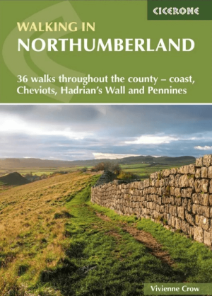
Wandelgids Northumberland walking guide - Cicerone • 9781786311818
Wandelgids Northumberland walking guide - Cicerone Press Productomschrijving: Guidebook to walking in Northumberland. 36 graded walks of 4 to 14 miles, from the beautiful coast with its immense, empty beaches and dramatic, crag-top castles to the remote hills of the Cheviots and Pennines AONB. Includes Hadrian's Wall, Lindisfarne Priory, Kielder, Berwick, Bamburgh and Dunstanburgh Castles …
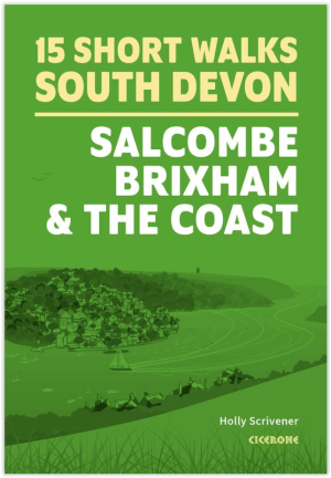
Wandelgids South Devon 15 short walks - Cicerone Press • 9781786312532
Wandelgids South Devon 15 short walks - Cicerone Productomschrijving: Would you like to explore the best of Salcombe, Brixham and the coast? This guidebook covers 15 of the best short walks in South Devon (all under three hours), including Start Point, Bigbury-on-Sea, Hope Cove and Bolberry Down, Brixham and Berry Head and Dartmouth Castle. Why choose this guidebook? - Easy to mode…

Wandelgids King Charles III England Coast Path Map Booklet • 9781786310415
King Charles III England Coast Path Map Booklet - Cicerone Productomschrijving: This map booklet to the Lancashire and Merseyside section of the England Coast Path contains detailed mapping for walking the route in either direction. With easy access at many points along the way, the Lancashire/Merseyside section can be enjoyed as a trek of around 12 days or in shorter sections. - Full…

Wandelgids King Charles III England Coast Path - Cicerone • 9781786310279
King Charles III England Coast Path - Cicerone Productomschrijving: A guidebook to walking the northwest section of the King Charles III England Coast Path between Gretna and Chester. Covering 590km (367 miles), this straightforward trail along the Cumbria, Lancashire and Merseyside coast takes around 1 month to hike. The route is described from north to south in 28 stages between 13 a…

Wandelgids 001 Pathfinder guides South Devon & Dartmoor NP - OS • 9780319090084
Wandelgids South Devon & Dartmoor NP - OS Productomschrijving: Each of the Pathfinder titles features 28 circular routes, all tried and tested by seasoned walkers. The routes range from extended strolls to exhilarating hikes, so there is something for everyone. 28 circular walks • Graded by length ranging from 3 to 12 miles • Clear, large scale Ordnance Survey maps • GPS referen…

Wandelgids 012 Pathfinder New Forest & South Downs NP Hampshire • 9780319090107
Wandelgids New Forest & South Downs NP Hampshire - OS Productomschrijving: This Pathfinder walking guidebook covers the New Forest National Park, Hampshire and the South Downs National Park, including the Itchen and Test valleys. There are 28 outstanding circular walks in the Hampshire countryside ranging from two to ten miles in length, and graded by difficulty by expert outdoor writer D…

Wandelgids 054 Pathfinder guides Hertfordshire & Bedfordshire- OS • 9780319090077
Wandelgids Hertfordshire & Bedfordshire - OS Productomschrijving: This walkers guide contains 28 outstanding circular walks in Hertfordshire and Bedfordshire ranging from 5.5km to 15km. Each route has easy-to-follow route descriptions, clear Ordnance Survey route maps, GPS waypoints, where to park, good pubs and places of interest en route. All of the routes have been researched and writt…

Wandelgids 064 Pathfinder guides South Pennines - OS • 9780319090046
Wandelgids South Pennines - OS Productomschrijving: This book gives details of 28 amazing walks across the Pennines (Lancashire and Yorkshire), including South Pennines’ most famous viewpoint at Stoodley Pike and the parts of the Pennine Way. Each of the routes has information on local amenities, a detailed route description, and extract of the large-scale OS Map for the area and notes an…

Wandelgids 045 Pathfinder guides Norfolk - OS • 9780319090152
Wandelgids Norfolk East England - OS Productomschrijving: These 28 circular, graded walks around Norfolk are all tried and tested by seasoned walkers. The routes range from extended strolls of four miles to exhilarating hikes of eleven, so there is something for everyone. Each route includes information on parking and local amenities, detailed route description, a large-scale OS map a…

Wandelgids 060 Pathfinder guides Lake District NP - OS • 9780319090169
Wandelgids Lake District NP - OS Productomschrijving: The Pathfinder Guide for the Lake District NP is the ideal companion to gaining an appreciation of England's most mountainous region with its balanced range of walks across the whole of the National Park. There are a total of 28 outstanding circular walks in the Lake District National Park from 3 to 10 miles with easy-to-follow route de…

Wandelgids 009 Pathfinder guides Exmoor NP & the Quantocks - OS • 9780319090114
Wandelgids Exmoor National Park & the Quantocks - OS Productomschrijving: Exmoor National Park comprises 265 square miles, of which about two-thirds lie in west Somerset and the remaining third in north Devon. This walking guidebook contains 28 circular, graded walks in Exmoor, all tried and tested by seasoned walkers. The routes range from extended strolls to longer hikes, so there is som…

Wandelgids 008 Pathfinder guides Kent - OS • 9780319090183
Wandelgids Kent South-East England - OS Productomschrijving: This walking guidebook for Kent has 28 great walks exploring coastal and inland Kent, including the Isle of Sheppey. Kent contains a wealth of history from Roman times to modern day, with many of the key sites visited on these pre-planned walks. Each walk includes easy-to-follow route directions and are accompanied by large-scal…

Wandelgids 028 Pathfinder guides North York Moors NP - OS • 9780319090251
Wandelgids North York Moors National Park - OS Productomschrijving: The Pathfinder guidebook for The North York Moors is designed to help you make the most of your time in the area. It contains 28 walks, each graded by difficulty and ranging from 3.5 miles up to 11 miles in length. All the routes are created by seasoned walkers, and designed to help you make the most of the area. High…
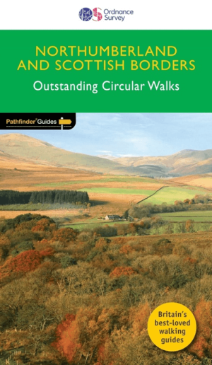
Wandelgids 035 Pathfinder guides Northumberland- Scottish Borders • 9780319090268
Wandelgids Northumberland & Scottish Borders - OS Productomschrijving: This revised version of the Pathfinder walking guidebook for Northumberland and the Scottish Borders contains 28 carefully selected walking routes to help you make the most of the area. All the routes have been created and tested by seasoned walkers, and range from two to thirteen miles in length. Each route include…
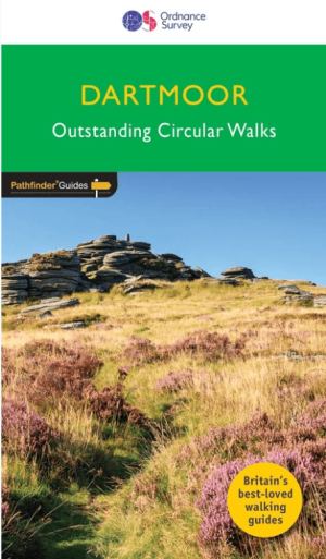
Wandelgids 026 Pathfinder guides Dartmoor National Park - OS • 9780319090305
Wandelgids Dartmoor National Park Devon - OS Productomschrijving: Discover the rugged, iconic landscape of Dartmoor National park, with this selection of 28 walks designed to help you find the best it has to offer. While largely uninhabited wilderness with few villages, farms and roads, there are still plenty of opportunities for walks of all levels. Some of the most significant featu…

Wandelgids 042 Pathfinder guides Cheshire England - OS • 9780319090312
Wandelgids Cheshire - OS Productomschrijving: This walking guidebook for Cheshire contains 28 outstanding walks all tried and tested by experienced walkers. The routes range from extended strolls to exhilarating hikes - four to eleven miles in length. Each walk includes a detailed description of both the route and the areas you will pass through, as well as an extract of the OS map for th…
Wandelvakantie in Engeland
Wandelvakantie in Engeland. Engeland bestaat uit 9 grote wandelregio’s, elk met hun eigen karakteristieken en natuurpracht. In bijna elke regio is wel ergens een natuurgebied te vinden dat tot de zogenaamde AONB regio’s behoort, voluit geschreven, een “Area of Outstanding Natural Beauty”. Vertaald betekent dit “gebied van uitmuntend natuurschoon”. Hoe meer u naar het noorden trekt, hoe meer het landschap zich open trekt. Maar dit betekent in geen geval dat de omgeving er minder interessant op wordt. Hoe verder u Engeland in trekt, hoe mooier het wordt voor de wandelaar. Dit dankzij de vele Nationale parken en Regionale parken die Engeland rijk is.
Met behulp van onze wandelgidsen zit u uiteraard goed! Maar met de Wandelkaarten Engeland heeft u een beter overzicht. Zo krijgt u met een kaart minder informatie. Europese reisgidsen bieden u dan weer de toeristische informatie die ook best nuttig is.
Deze parken zijn tot ver buiten de Engelse grenzen gekend. Gebieden als de Chilterns, Cornwall, de Cotswolds, Forest of Bowland, de Kent Downs, de Isle of Wight, Nidderdale, Zuid Engeland, Kent, Yorkshire, Lake district, Stonehenge ... kleuren het Engelse landschap. Ze maken het grote eiland tot een schitterend natuurfenomeen. Uiteraard zijn er de Wandelgidsen Engeland door een pak verschillende uitgevers gerealiseerd. Zij hebben meestal de AONB regio’s uitgebreid en tot in detail in hun gamma opgenomen. De AONB’s zijn niet alleen in Engeland te vinden, maar ook in de andere gebieden van Groot-Brittannië. Het aanbod aan Wandelgidsen voor het gebied Engeland alleen al, is zodanig groot dat u best eerst bepaalt waar in Engeland u precies op wandel wil. Daarna kunt u dan de wandelgidsen selecteren die uw gekozen regio specifiek behandelen. Iconische wanelroutes, een 40-tal toppers uit Europa en omstreken.
Van Southhampton tot in Cumbria
Van Southhampton tot in Cumbria, Engeland leent zich werkelijk uitstekend als wandelgebied. De uitgebreide waaier aan wandelgidsen laat u toe het gebied Engeland in verschillende regio's op te splitsen. Op die manier kunt u de specifieke cultuur- en natuuraspecten per gebied ontdekken. De verschillende regio’s bieden soms compleet verschillende wandelmogelijkheden.
Soms kunt u wandelen van steden naar dorpen, naar natuurgebieden, naar universiteitssteden, nationale en regionale parken en zelfs bergen. Regio’s als Cheshire, Cumbria, Yorkshire, Manchester, Lancashire, Merseyside, ... bezorgen Engeland unieke wandeltroeven die om het even welk type wandelaar nieuwsgierig zullen maken. Met een beetje creativiteit weet u als Wandelaar precies wat er interessant is de buurlanden, zo kunt u als wandelaar steeds naar die buurlanden gaan kijken op de pagina: Hebben we het over Wales, dan is deze pagina belangrijk Wandelgidsen Wales of is het Schotland dan zijn het de Wandelgidsen Schotland.
FAQ: Wandelgidsen ENGELAND
Ordnance Survey voor kaartbasis (de reeks Explorer OL op schaal 1:25.000, of de serie Landranger op schaal 1:50.000); Harvey Maps voor trailgerichte detailkaarten. Selecteer titel per Regio of Trail. Filter op Uitgever & Serie, links op uw scherm.
Dagtochten: Lake District en Peak District. Lange trajecten: South West Coast Path, Cotswolds, Yorkshire Dales. Kies gids met duidelijke Etappes en Hoogtemeters. Filter op Regio en Moeilijkheid, links op uw scherm.
De beste periode is tijdens de Lente of het Najaar. Weer wisselt snel; kies Waterbestendige gidsen. Toegang via Public Rights Of Way en gemarkeerde paden. Controleer Parkeren/Startpunt per route in de gids.