

Wandelgids 026 Pathfinder guides Dartmoor National Park - OS
The Graveyard - Sheeps Tor, Kes Tor & Hound Tor


Korte omschrijving
Wandelgidsen Devon, England van Ordnance Survey. Ideaal voor tochten in England.
Wandelgids Dartmoor National Park Devon - OS Productomschrijving: Discover the rugged, iconic landscape of Dartmoor National park, with this selection of 28 walks designed to help you find ...

Specificaties
- Uitgever: Ordnance Survey
- ISBN-13: 9780319090305
- HOOFDCATEGORIEËN: Wandelgids
- Activiteiten: Wandelen, Hiking & Trekking
- Regio: Devon, England
- Land: England
- Nationale parken: Dartmoor NP, Devon England
- Taal: Engels
- Reeks/Serie: Outstanding Circular Walks, Pathfinder Series, OS
- De Engelse Graafschappen: Devon
Volledige omschrijving
Wandelgids Dartmoor National Park Devon - OS
Productomschrijving: Discover the rugged, iconic landscape of Dartmoor National park, with this selection of 28 walks designed to help you find the best it has to offer. While largely uninhabited wilderness with few villages, farms and roads, there are still plenty of opportunities for walks of all levels.
Some of the most significant features of this often treeless landscape are the large numbers of tors that dominate Dartmoor. These are the remnants of hard masses of granite, drastically reduced in size and moulded into their present shapes by millions of years of weathering. Sheeps Tor, Kes Tor and Hound Tor are included on walks, as is the man-made, but equally fascinating 'The Graveyard' standing stones.
All 28 of the walks are graded for difficulty and tried and tested by seasoned walkers. The routes range from 3.5miles to 9 miles and include route descriptions, maps, notes and key features to look for.

Overzichtskaarten

Overzicht Pathfinder guides - OS
Overzicht Pathfinder guides - OS

Producten op de overzichtskaart
Klik op een product om naar de detailpagina te gaan.
- Wandelgids 001 Pathfinder guides South Devon & Dartmoor NP - OS
- Wandelgids 003 Pathfinder guides Isle of Skye - OS
- Wandelgids 004 Pathfinder guides Cairngorms NP - OS
- Wandelgids 005 Pathfinder guides Cornwall England - OS
- Wandelgids 006 Pathfinder guides Cotswolds AONB - OS
- Wandelgids 007 Pathfinder guides Fort William & Glen Coe - OS
- Wandelgids 008 Pathfinder guides Kent - OS
- Wandelgids 009 Pathfinder guides Exmoor NP & the Quantocks - OS
- Wandelgids 010 Pathfinder guides Snowdonia NP Wales - OS
- Wandelgids 011 Pathfinder guides Dorset England - OS
- Wandelgids 012 Pathfinder New Forest & South Downs NP Hampshire
- Wandelgids 015 Pathfinder guides Yorkshire Dales NP - OS
- Wandelgids 018 Pathfinder guides Brecon Beacons Wales - OS
- Wandelgids 019 Pathfinder guides Dumfries & Galloway - OS
- Wandelgids 020 Pathfinder guides Sherwood Forest - OS
- Wandelgids 022 Pathfinder guides More Lake District - OS
- Wandelgids 023 Pathfinder guides Loch Lomond, Trossachs NP - OS
- Wandelgids 025 Pathfinder guides Thames Valley & Chilterns - OS
- Wandelgids 026 Pathfinder guides Dartmoor National Park - OS
- Wandelgids 027 Pathfinder Perthshire "big county" Angus & Five OS
- Wandelgids 028 Pathfinder guides North York Moors NP - OS
- Wandelgids 029 Pathfinder guides Wye Valley AONB & Forrest of Dean
- Wandelgids 030 Pathfinder guides Loch Ness & Iverness - OS
- Wandelgids 031 Pathfinder guides Oban, Mull & Kintyre - OS
- Wandelgids 034 Pathfinder guides Pembrokeshire Wales - OS
- Wandelgids 035 Pathfinder guides Northumberland- Scottish Borders
- Wandelgids 039 Pathfinder Durham, North Pennines & Tyne & Wear OS
- Wandelgids 041 Pathfinder guides Central Wales - OS
- Wandelgids 042 Pathfinder guides Cheshire England - OS
- Wandelgids 044 Pathfinder guides Essex England - OS
- Wandelgids 045 Pathfinder guides Norfolk - OS
- Wandelgids 046 Pathfinder guides Aberdeen & Royal Deeside - OS
- Wandelgids 047 Pathfinder Edinburgh, Pentlands & Lothians - OS
- Wandelgids 048 Pathfinder guides Suffolk East England - OS
- Wandelgids 049 Pathfinder guides Vale of York East England - OS
- Wandelgids 050 Pathfinder guides Lincolnshire & the Wolds - OS
- Wandelgids 051 Pathfinder guides Cambridgeshire & The Fens - OS
- Wandelgids 053 Pathfinder guides Lancashire NW En England - OS
- Wandelgids 054 Pathfinder guides Hertfordshire & Bedfordshire- OS
- Wandelgids 055 Pathfinder guides Gower, Swansea & Cardiff - OS
- Wandelgids 060 Pathfinder guides Lake District NP - OS
- Wandelgids 063 Pathfinder guides Peak District England - OS
- Wandelgids 064 Pathfinder guides South Pennines - OS
- Wandelgids 065 Pathfinder guides Surrey England - OS
- Wandelgids 066 Pathfinder guides West Sussex & South Downs - OS
- Wandelgids 067 Pathfinder guides South Downs NP & East Sussex- OS
- Wandelgids 068 Pathfinder guides Devon North & Mid - OS
- Wandelgids 069 Pathfinder guides South West England Coastal walks
- Wandelgids 071 Pathfinder guides High Fells of Lakeland - OS
- Wandelgids 073 Pathfinder guides More Peak District - OS
Artikelen uit dezelfde regio
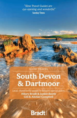
Reisgids Go Slow Devon South & Dartmoor - Bradt Travel guides • 9781804691007
Devon South & Dartmoor NP - Bradt Productomschrijving: Deze nieuwe, grondig bijgewerkte derde editie van South Devon and Dartmoor maakt deel uit van Bradt's kenmerkende 'Slow travel' serie van gidsen over Britse regio's en biedt een diepgaande verkenning van een van de meest populaire gebieden van Engeland. Geschreven door Hilary Bradt, wijlen Janice Booth, en Gill en Alistair Campbell, bl…

Wandelgids Devon 50 walks in Devon - AA Publishing • 9780749583712
Wandelgids Devon 50 walks in Devon - AA Publishing Productomschrijving: Devon, gelegen in het zuidwesten van Engeland, is een waar wandelparadijs met een adembenemend gevarieerd landschap. Met 50 prachtige wandelroutes biedt het voor iedere wandelaar iets bijzonders, van dramatische kliffen langs de kust tot weelderige groene valleien en pittoreske dorpen in het binnenland. 1. Kustwand…

Wandelgids SWCP part 3 - Dorset & South Devon - Trailblazer • 9781912716340
Wandelgids SWCP part 3 - Dorset & South Devon - Trailblazer Productomschrijving: Dorset & South Devon Coast Path (South-West Coast Path Part 3) This guide covers the third and last section of the South West Coast Path, from Plymouth to Poole Harbour (217 miles). This beautiful route includes 95 miles within England’s only Natural World Heritage Site, the Jurassic Coast, and passes dram…
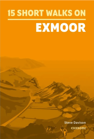
Wandelgids Short walks Exmoor NP - Cicerone • 9781786311900
Wandelgids Short walks Exmoor - Cicerone Productomschrijving: Would you like to explore the best of Exmoor? This guidebook covers 15 of the area's best short walks (between 4.5 and 11km, all under three hours) Includes: Dunkery Beacon, Valley of Rocks, Allerford, Selworthy, Tarr Steps, Great Hangman, Dunster and Malmsmead. Why choose this guidebook? - Easy to moderate walks su…

Wandelkaart 13 Exmoor National park - AA • 9780749573195
Wandelkaart 13 - Exmoor National park - AA Productomschrijving: AA, in samenwerking met Ordinance Survey, heeft een reeks kaarten ontwikkeld die zich op populaire toeristische bestemmingen van de UK richten, zodat meerdere OS-kaarten niet vereist zijn. Deze kaart richt zich op Exmoor van Wiliton in het oosten aan Ilfracombe in het westen en van Utrecht in het zuiden tot Lynton in het noord…