

Wandelkaart 101 Cache La Poudre- Big Thompson Colorado - Nat Geo
Vormt deel van het Rocky Mountain National Park

Korte omschrijving
Wandelkaarten Colorado, USA van National Geographic. Ideaal voor tochten in Verenigde Staten van Amerika (USA).
Cache La Poudre, Big Thompson Colorado - Nat Geo Productomschrijving: Canyon Lakes Ranger District, dat is het bezienswaardige bosgebied, of zeg maar wildernis gebied dat naast Fort Collins ...

Specificaties
- Uitgever: National Geographic
- ISBN-13: 9781566953900
- HOOFDCATEGORIEËN: Wandelkaart
- Activiteiten: Wandelen, Hiking & Trekking
- Auteur: National Geographic
- Regio: Colorado, USA
- Land: Verenigde Staten van Amerika (USA)
- TOPO's & Stafkaarten: Topografisch wandelen
- Schaal: 1:40000
- Taal: Engels
Volledige omschrijving
Cache La Poudre, Big Thompson Colorado - Nat Geo
Productomschrijving: Canyon Lakes Ranger District, dat is het bezienswaardige bosgebied, of zeg maar wildernis gebied dat naast Fort Collins Colorado ligt. Outdoor enthousiastelingen die willen genieten van de recreatieve mogelijkheden net ten oosten van Rocky Mountain National Park zullen National Geographic's Trails Illustrated kaart van Cache La Poudre en Big Thompson een essentiële reisgenoot vinden. Deskundig onderzocht en gemaakt in samenwerking met de U.S. Forest Service en anderen, bestrijkt de kaart delen van het Roosevelt National Forest, waaronder Cache La Poudre River en Wilderness, Big Thompson River en Canyon, Lake Estes en Bulwark Ridge.
Omvat onder meer: Cache La Poudre Wilderness, Roosevelt National Forest.
Engelse omschrijving: Outdoor enthusiasts looking to enjoy the recreational opportunities just east of Rocky Mountain National Park will find National Geographic's Trails Illustrated map of Cache La Poudre and Big Thompson an essential travel companion. Expertly researched and created in partnership with the U.S. Forest Service and others, the map covers parts of the Roosevelt National Forest, including Cache La Poudre River and Wilderness, Big Thompson River and Canyon, Lake Estes and Bulwark Ridge.
Get off the beaten path and back on again by following the map to clearly marked trailheads and then along trails, marked according to their designated usage, including trails which are part of the National Recreation Trail system. Also shown are Forest Service roads, many of which serve as ATV trails. To aid in your navigation, the map includes contour lines, elevations, labeled peaks and summits, water features, areas of wooded cover and color-coded boundaries between different land management organizations. Some of the recreational points of interest are campgrounds, interpretive trails, fishing areas, boat launch points and picnic areas. The Cache la Poudre Scenic Byway is marked for those who are interested in taking in the scenery by car.
Every Trails Illustrated map is printed on "Backcountry Tough" waterproof, tear-resistant paper. A full UTM grid is printed on the map to aid with GPS navigation.
Other features found on this map include: Cache La Poudre Wilderness, Roosevelt National Forest.
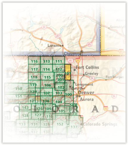
Locatie op kaart
Artikelen uit dezelfde regio

Wandelkaart 1302 Colorado 14'ers- Noord - Nat geo • 9781566956994
TOPO Wandelkaart 1302 - Colorado 14'ers- Noord - Natgeo Productomschrijving: De Colorado 14'ers bestaat uit 14 van de meest indrukwekkende bergmassieven in Colorado, verdeeld over drie verschillende regio's als Front Range, Momsquito Tenmile Ranges en de Sawatch Range. een indrukwekkende locatie om te gaan trekken uiteraard. Front Range: Mount Bierstadt, Mount Evans, Grays Peak, Longs …

Wandelkaart 208 Colorado National Monument - Natgeo • 9781566954013
TOPO Wandelkaart 208 - Colorado National Monument - Natgeo Productomschrijving: recreatie regio's doorheen Colorado's 'Grand Valley' omvatten de steden: Grand Junction, Fruita, Palisade & Loma. Dit veel gebruikte gebied is gekend onder de de mensen die in Colorado wonen. Dit gebied is nationaal bekend voor zijn speciale mountainbiketrails en evengoed gekend voor de start van het Kokepelli …

Wandelkaart 220 Dinosaur National Monument - Natgeo • 9781566954037
TOPO Wandelkaart 220 - Dinosaur National Monument - Nat Geo Productomschrijving: Dinosaur National Monument in de United States, gelegen op de zuidoostelijke kant van de Uinta Mountains op de grens tussen Colorado en Utah met invloeden van de Green & Yampa Rivieren. Ondanks dat het grootste deel ervan gelegen is in Moffat County, Colorado, is Dinosaur gelegen in Utah net ten noorden van de…

Landkaart Wegenkaart Colorado State guide map - Nat Geo • 9781566957779
Wegenkaart Colorado State guide map - Nat Geo Productomschrijving: National Geographic's Colorado Guide Map is designed to meet the needs of travelers with detailed and accurate cartography and loads of helpful information about the state's many attractions. Cities and towns are easy to find with the map's helpful index. Highways, roadways, toll roads, scenic routes, and other roads are cl…

Wandelkaart 144 Durango & Cortez- Colorado - Natgeo • 9781566954631
TOPO Wandelkaart 144 - Durango & Cortez- Colorado - Natgeo Productomschrijving: Deze kaart biedt u alle soorten routes aan in de regio tussen Durango & Cortez in Colrado. UIteraard hebben wij het hier over de wandelroutes, maar eveneens kan er hier aan moutainbiken worden gedaan, of paardrijden op dezelfde routes. Engelse omschrijving: National Geographic's Trails Illustrated map of D…