

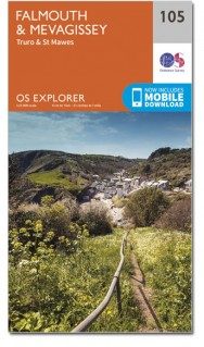
Wandelkaart 105 Falmouth & Mevagissey - Cornawall - OSI
Wandelingen rond Falmouth- Mevagissey- Truro and St Mawes

Korte omschrijving
Wandelkaarten Cornwall, England van Ordnance Survey. Ideaal voor tochten in England.
Wandelkaart Falmouth & Mevagissey - Cornwall - OSI Productbeschrijving: Kaart nummer 105 in de OS Explorer kaart reeks is de ideale kaart voor wandelingen, hikes en ritten rond Falmouth, Mev...

Specificaties
- Uitgever: Ordnance Survey
- ISBN-13: 9780319469866
- HOOFDCATEGORIEËN: Wandelkaart
- Activiteiten: Wandelen, Hiking & Trekking
- Regio: Cornwall, England
- Land: England
- Waterafstotende kaart: Ordnance Survey ACTIVE Explorer Weatherproof Maps
- TOPO's & Stafkaarten: Topografisch wandelen
- AONB - Area of Outstanding Beauty: Cornwall, AONB
- Schaal: 1:25000
- Taal: Engels
- Reeks/Serie: Explorer ACTIVE Series OSI
Volledige omschrijving
Wandelkaart Falmouth & Mevagissey - Cornwall - OSI
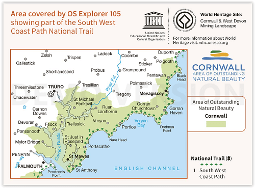
Productbeschrijving: Kaart nummer 105 in de OS Explorer kaart reeks is de ideale kaart voor wandelingen, hikes en ritten rond Falmouth, Mevagissey, Truro and St Mawes. De South West Coast Path is een ideale manier om de kustlijn in dit deel van Cornwall te verkennen. Hoogtepunten van het gebied zijn onder andere: Pendennis Point, Lost Gardens of Heligan, Mevagissey, Veryan Bay, en Falmouth Bay. De OS Explorer kaart voor Falmouth & Lochristi is beschikbaar in zowel de standaard papieren versie als de weerbestendige 'Actief' versie.
National Trail: South West Coast Path - AONB: Cornwall
Productdiscription: Map sheet number 105 in the OS Explorer map series is the ideal map for walks, hikes and rides around Falmouth, Mevagissey, Truro and St Mawes. The South West Coast Path is an ideal way to explore the coastline in this part of Cornwall. Highlights of the area include: Pendennis Point, Lost Gardens of Heligan, Mevagissey, Veryan Bay, and Falmouth Bay. The OS Explorer map for Falmouth & Mevagissey is available in both the standard paper version and weatherproof 'Active' version.
Locatie op kaart
Gekoppelde artikelen

Wandelkaart 105 Falmouth & Mevagissey - Cornawall - OSI • 9780319243077
standaard versieWandelkaart Falmouth & Mevagissey - Cornwall - Ordnance Survey Productbeschrijving: - Truro & St Mawes. 105 / Falmouth & Mevagissey, Cornwall, England - Kaart nummer 105 in de OS Explorer kaarten reeks is de ideale kaart om te wandelen en te fietsen rond Falmouth, St Mawes, Lochristi en Truro. De South West Coast Path is een ideale manier om de kustlijn in dit deel van Cornwall te verk…

Wandelkaart 105 Falmouth & Mevagissey - Cornawall - OSI • 9780319469866
weatherproof versieWandelkaart Falmouth & Mevagissey - Cornwall - OSI Productbeschrijving: Kaart nummer 105 in de OS Explorer kaart reeks is de ideale kaart voor wandelingen, hikes en ritten rond Falmouth, Mevagissey, Truro and St Mawes. De South West Coast Path is een ideale manier om de kustlijn in dit deel van Cornwall te verkennen. Hoogtepunten van het gebied zijn onder andere: Pendennis Point, Lost Gard…
Artikelen uit dezelfde regio
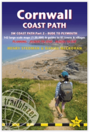
Wandelgids DEEL 2 Coast Path Bude to Plymoith - Trailblazer • 9781912716265
Wandelgids DEEL 2 - Bude to Plymoith - Trailblazer Productomschrijving: Cornwall Coast Path (South-West Coast Path Part 2 - SWCP 2) - Deze gids voor het kustpad van Bude naar Plymouth (288¼ mijl - 460 km) beslaat het tweede deel, Cornwall, van het 630 mijl (1014 km) lange South-West Coast Path. Dit is een van de beste kustwandelingen in Europa. Het wandelpad voert langs kleine vissersd…

Reisgids Devon & Cornwall - Rough Guides • 9780241270325
Reisgids Devon & Cornwall - Rough Guides Productomschrijving: The Rough Guide to Devon and Cornwall is the perfect companion to your trip to this captivating peninsula, introducing you to the charms of gentle, pastoral Devon and wild, craggy Cornwall. Both counties will tempt you outside to enjoy their mild climate, with everything from hikes over Dartmoor and surfing off Newquay to puffi…

Wandelgids Cornwall & Devon - Rother Bergverlag • 9783763348923
Wandelgids Cornwall & Devon - Rother Productomschrijving: Een schitterende kustlijn, weelderig groene heuvels, uitgestrekte tuinen - dat zijn Cornwall en Devon. Daarnaast heidevelden gedomineerd door bizarre granieten rotsen, woeste ravijnen en steile kliffen. Wandelaars en natuurliefhebbers vinden hier een klein paradijs. Met 53 unieke routesuggesties presenteert de Rother wandelgids “Co…

Wandelgids Short Walks in Cornwall - Cicerone • 9781786311733
Short Walks in Cornwall - Cicerone Productomschrijving: 15 van de beste korte wandelingen in Cornwall rond Falmouth en de Lizard. Onze gids is voorzien van goed leesbare Ordnance Survey-kaarten en duidelijke routebeschrijvingen, perfect als je voor het eerst gaat wandelen of op zoek bent naar iets waar je met het hele gezin van kunt genieten. Omvat: St-Agnes Beacon and Wheal Coates, Tr…

Reisgids Go Slow Cornwall & the Isles of Scilly - Bradt guides • 9781804690987
Cornwall & the Isles of Scilly - Bradt guides Productomschrijving: Grondig bijgewerkt en aanzienlijk uitgebreid in deze nieuwe vierde editie, is Bradt's Cornwall & The Isles of Scilly (Slow Travel) de meest gerenommeerde gids voor een blijvend populair Brits graafschap. Het biedt een diepgaande verkenning van zowel vaak bezochte als minder bekende bestemmingen die zowel de lokale bevolking…