
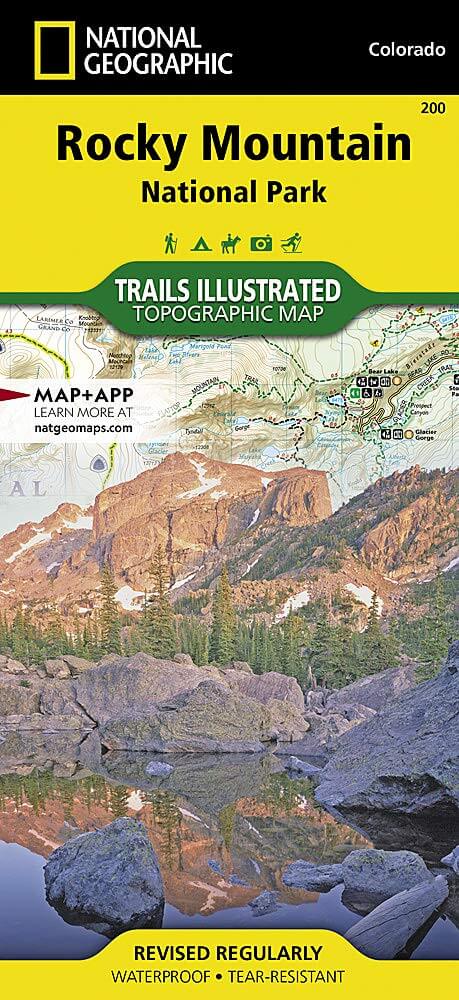
Wandelkaart 200 Rocky Mountain NP- Colorado - Nat Geo
Rocky Mountain NP bezit majestueuze berggezichten
Korte omschrijving
TOPO Wandelkaart 200 - Rocky Mountain NP- Colorado - National Geographic Productomschrijving: Rocky Mountain National Park is een Amerikaans nationaal park in de Southern Rocky Mountains in ...

Specificaties
- Uitgever: National Geographic
- ISBN-13: 9781566953429
- HOOFDCATEGORIEËN: Wandelkaart
- Activiteiten: Wandelen, Hiking & Trekking
- Regio: Colorado, USA
- Land: Verenigde Staten van Amerika (USA)
- Nationale parken: Rocky Mountain NP, Colorado USA
- Schaal: 1:50000
- Afmeting: 10x19
- Taal: Engels
Volledige omschrijving
TOPO Wandelkaart 200 - Rocky Mountain NP- Colorado - National Geographic
Productomschrijving: Rocky Mountain National Park is een Amerikaans nationaal park in de Southern Rocky Mountains in het noorden van de staat Colorado. Rocky Mountain National Park bezit majestueuze berggezichten, gevarieerde klimaten en omgevingen – van bossen tot bergtoendra – en makkelijk te bereiken wandelroutes en kampplaatsen.
Engelse omschrijving: National Geographic's Trails Illustrated map of Rocky Mountain National Park delivers unmatched detail and valuable information to assist you in your exploration of this breathtaking wilderness. Whatever the season, you'll find this map a useful tool in pursuing a host of recreational activities from camping and fishing to skiing and snowmobiling. Created in partnership with local land management agencies, this expertly researched map features key areas of interest including Trail Ridge Road, Longs Peak, Arapaho National Forest, Routt National Forest, Roosevelt National Forest, Never Summer Wilderness, Comanche Peak Wilderness, and the Continental Divide Trail.
The Rocky Mountain National Park map can guide you off the beaten path and back again with over 400 miles of mapped trails including hiking, horse, snowmobile, cross-country ski, ATV, and mountain bike trails. The map base includes contour lines and elevations for summits, passes and major lakes. Many recreation features are noted as well, including campgrounds, trailheads, interpretive trails, boat launches, fishing access, and horse rental locations. Every Trails Illustrated map is printed on "Backcountry Tough" waterproof, tear-resistant paper. A full UTM grid is printed on the map to aid with GPS navigation.
Other features found on this map include: Arapaho National Forest, Comanche Peak Wilderness, Grand Lake, Indian Peaks Wilderness, Lake Granby, Longs Peak, Neota Wilderness, Never Summer Wilderness, Rocky Mountain National Park, Roosevelt National Forest, Routt National Forest, Stones Peak.
(1).png)
Locatie op kaart
Overzichtskaarten

NAT GEO Colorado trail maps
NAT GEO Colorado trail maps

Producten op de overzichtskaart
Klik op een product om naar de detailpagina te gaan.
- Wandelkaart 110 Leadville & Fairplay - Colorado - Nat Geo
- Wandelkaart 127 Aspen - Independence Pass - Colorado USA
- Wandelkaart 137 Pikes Peak & Cañon City - Nat Geo
- Wandelkaart 138 Sangre de Cristo Mountains - Nat Geo
- Wandelkaart 139 La Garita Caldera - Cochetopa - Nat Geo
- Wandelkaart 140 Weminuche Wilderness Colorado USA - Nat Geo
- Wandelkaart 141 Telluride- Silverton- Ouray & Lake City - Nat Geo
- Wandelkaart 144 Durango & Cortez- Colorado - Natgeo
- Wandelkaart 200 Rocky Mountain NP- Colorado - Nat Geo
- Wandelkaart 208 Colorado National Monument - Natgeo
- Wandelkaart 245 Black Canyon of the Gunnison NP - Natgeo
- Wandelkaart 301 Longs Peak -Trails Illustrated N. Trails - Nat Geo
- Wandelkaart 601 Aspen Local Trails - Nat Geo
Artikelen uit dezelfde regio

Wandelkaart 1303 Colorado 14ers- Zuid - Nat geo • 9781566957007
TOPO Wandelkaart 1303 - Colorado 14ers- Zuid - Natgeo Productomschrijving: De colorad 14'ers Zuid, zijn de 14 meest indrukwekkende bergmassieven in het zuiden van Colorado. De locatie is onderverdeeld in drie regio's zoals: De Elk Range, San Juan Range & Sangre De Cristo Range. Elk Range: Capitol Peak, Castle Peak, Conundrum Peak, Maroon Peak, North Maroon Peak, Pyramid Peak, Snowmass …

Reisgids Colorado - Insight Guides ENG • 9781786715319
Colorado - Insight Guides ENG Productomschrijving: The Rocky Mountain State of Colorado offers soaring peaks, world-class skiing and vibrant cities that lure travellers from all over the world to America's alpine heartland. Be inspired to visit by the new edition of Insight Guide Colorado, a comprehensive full-colour guide to the state. Inside Insight Guide Colorado: A fully-overh…

Wandelkaart 100 Boulder & Golden Colorado USA - Nat Geo • 9781566953351
Wandelkaart Boulder & Golden Colorado USA - Nat Geo Productomschrijving: National Geographic's Trails Illustrated kaart van Boulder en Golden combineert ongeëvenaarde details met nuttige informatie om een onschatbaar hulpmiddel te bieden om het meeste uit uw verkenning van de centrale Colorado Front Range te halen. Deskundig onderzocht en gemaakt in samenwerking met lokale landbeheerders. …

Reisgids Colorado - Insight Guides ENG • 9781789198393
Reisgids Colorado USA - Insight Guides ENG Productomschrijving: Van het beslissen wanneer je gaat, tot het kiezen van wat te zien als je aankomt, deze gids voor Colorado is alles wat je nodig hebt om je perfecte reis te plannen, met insider informatie over must-see, top attracties zoals Denver Art Museum, Pikes Peak en het Old Fort National Historic Site, en culturele juweeltjes zoals de g…

Wandelkaart 1201 Colorado Trail Zuid - NAT GEO • 9781566956949
TOPO Wandelkaart 1201 - Colorado Trail Zuid - Durango tot Monarch Productomschrijving: The Colorado Trail is een lange-afstands wandelroute van om en bij de 782 km. Deze loopt van de mond van Waterton Canyon ten zuidwesten van Denver tot Durango in Colorado. Zijn hoogste punt is 4,045 meter boven zeeniveau, en de overgrote meerderheid van de route loopt boven de 3,000 meter. Ondanks zijn h…