
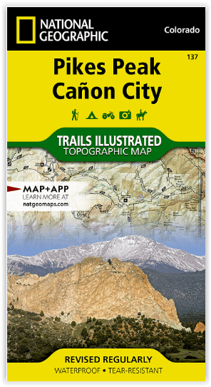
Wandelkaart 137 Pikes Peak & Cañon City - Nat Geo
Colorado Springs- Pike National Forest & Pikes Peak
Korte omschrijving
Pikes Peak & Cañon City Colorado - National Geographic Productomschrijving: De hoogste top in de zuidelijke Front Range van de Rocky Mountains, Pikes Peak torent boven Colorado Springs uit a...

Specificaties
- Uitgever: National Geographic
- ISBN-13: 9781566953986
- HOOFDCATEGORIEËN: Wandelkaart
- Activiteiten: Wandelen, Hiking & Trekking
- Regio: Colorado, USA
- Land: Verenigde Staten van Amerika (USA)
- Waterafstotende kaart: Nat Geo waterproof series
- Schaal: 1:63360
- Afmeting: 10x19
- Taal: Engels
Volledige omschrijving
Pikes Peak & Cañon City Colorado - National Geographic
Productomschrijving: De hoogste top in de zuidelijke Front Range van de Rocky Mountains, Pikes Peak torent boven Colorado Springs uit als een granieten schildwacht. Verken deze en andere geologische attracties zoals Garden of the Gods, Florrisant Fossil Beds en de Royal Gorge met National Geographic's Trails Illustrated kaart van Pikes Peak, Canon City. Deze kaart, die deskundig is onderzocht en gemaakt in samenwerking met lokale beheerders, toont de belangrijkste bezienswaardigheden zoals Pike National Forest, Arkansas River, Mueller State Park, Dome Rock State Wildlife Area, Rampart Reservoir en Shelf Road. De gedrukte versie van de kaart bevat gedetailleerde inzetstukken van Garden of the Gods en Palmer Park.
Omvat: Colorado Springs, Pike National Forest, Pikes Peak, Royal Gorge, Seven Falls.
Engelse omschrijving: The highest summit in the southern Front Range of the Rocky Mountains, Pikes Peak towers over Colorado Springs like a granite sentinel. Explore this and other geological attractions such as Garden of the Gods, Florrisant Fossil Beds, and the Royal Gorge with National Geographic's Trails Illustrated map of Pikes Peak, Canon City. Expertly researched and created in partnership with local land management agencies, this map features key points of interest including Pike National Forest; Arkansas River; Mueller State Park; Dome Rock State Wildlife Area; and Rampart Reservoir and Shelf Road recreation areas. The print version of the map includes detailed insets of Garden of the Gods and Palmer Park.
This map can guide you off the beaten path and back again with miles of mapped trails including mountain bike routes, and snowmobile, ATV, and interpretive trails. Scenic byways are clearly noted for those taking in the scenery by car. Recreation features are clearly marked, including campgrounds, trailheads, fishing and boat access, and cross country ski and climbing areas. The map base includes contour lines and elevations for summits, passes and many lakes.
Every Trails Illustrated map is printed on "Backcountry Tough" waterproof, tear-resistant paper. A full UTM grid is printed on the map to aid with GPS navigation.
Locatie op kaart
Overzichtskaarten

NAT GEO Colorado trail maps
NAT GEO Colorado trail maps

Producten op de overzichtskaart
Klik op een product om naar de detailpagina te gaan.
- Wandelkaart 110 Leadville & Fairplay - Colorado - Nat Geo
- Wandelkaart 127 Aspen - Independence Pass - Colorado USA
- Wandelkaart 137 Pikes Peak & Cañon City - Nat Geo
- Wandelkaart 138 Sangre de Cristo Mountains - Nat Geo
- Wandelkaart 139 La Garita Caldera - Cochetopa - Nat Geo
- Wandelkaart 140 Weminuche Wilderness Colorado USA - Nat Geo
- Wandelkaart 141 Telluride- Silverton- Ouray & Lake City - Nat Geo
- Wandelkaart 144 Durango & Cortez- Colorado - Natgeo
- Wandelkaart 200 Rocky Mountain NP- Colorado - Nat Geo
- Wandelkaart 208 Colorado National Monument - Natgeo
- Wandelkaart 245 Black Canyon of the Gunnison NP - Natgeo
- Wandelkaart 301 Longs Peak -Trails Illustrated N. Trails - Nat Geo
- Wandelkaart 601 Aspen Local Trails - Nat Geo
Artikelen uit dezelfde regio

Reisgids Colorado - Insight Guides ENG • 9781786715319
Colorado - Insight Guides ENG Productomschrijving: The Rocky Mountain State of Colorado offers soaring peaks, world-class skiing and vibrant cities that lure travellers from all over the world to America's alpine heartland. Be inspired to visit by the new edition of Insight Guide Colorado, a comprehensive full-colour guide to the state. Inside Insight Guide Colorado: A fully-overh…

Wandelkaart 113 Cowdrey- North Sand Hills Colorado - Nat Geo • 9781566952880
Cowdrey- North Sand Hills Colorado - Nat Geo Productomschrijving: Geniet van de overvloedige recreatieve mogelijkheden in het noorden van Colorado met de hulp van National Geographic's Trails Illustrated kaart van Cowdrey en North Sand Hills. Deskundig onderzocht en gemaakt in samenwerking met de U.S. Forest Service, Bureau of Land Management, Colorado State Parks en anderen, zal de kaart …

Reisgids Colorado - Gallimard • 9782742433438
Reisgids Colorado USA - Gallimard Productomschrijving: Van Denver, de "koningin van de Great Plains", tot Creede, een klein mijnstadje dat zich vastklampt aan de zijkant van de San Juan Mountains, van Aspen, het skioord van de sterren, tot Steamboat Rock, een ontmoetingsplaats voor rafting-liefhebbers aan de samenvloeiing van de Yampa en de Green Rivers, van Pawnee National Grassland, een…

Wandelkaart 104 Idaho Springs & Loveland Pass - Nat Geo • 9781566952491
Wandelkaart Idaho Springs & Loveland Pass Colorado Productomschrijving: Deskundig onderzocht en gemaakt in samenwerking met lokale landbeheerders, biedt National Geographic's Trails Illustrated kaart van Idaho Springs, Loveland Pass een ongeëvenaard hulpmiddel voor het verkennen van deze schilderachtige regio. Ongeacht het seizoen, zult u deze kaart handig vinden voor het uitoefenen van e…

Wandelkaart 100 Boulder & Golden Colorado USA - Nat Geo • 9781566953351
Wandelkaart Boulder & Golden Colorado USA - Nat Geo Productomschrijving: National Geographic's Trails Illustrated kaart van Boulder en Golden combineert ongeëvenaarde details met nuttige informatie om een onschatbaar hulpmiddel te bieden om het meeste uit uw verkenning van de centrale Colorado Front Range te halen. Deskundig onderzocht en gemaakt in samenwerking met lokale landbeheerders. …