

Wandelkaart 202 Torbay - South Dartmoor NP - OSI
Totnes- Salcombe- Totcross- Brixham- Paignton- Torquay


Korte omschrijving
Wandelkaarten Devon, England van Ordnance Survey. Ideaal voor tochten in England.
Wandelkaart Torbay - South Dartmoor NP - OSI Productomschrijving: De Landranger kaart nummer 202 is een kaart voor alle doeleinden, boordevol informatie om u te helpen een gebied echt te ler...

Specificaties
- Uitgever: Ordnance Survey
- ISBN-13: 9780319263976
- HOOFDCATEGORIEËN: Wandelkaart
- Activiteiten: Wandelen, Hiking & Trekking
- Regio: Devon, England
- Land: England
- Nationale parken: Dartmoor NP, Devon England
- TOPO's & Stafkaarten: Topografisch wandelen
- Schaal: 1:50000
- Taal: Engels
- Reeks/Serie: Landranger Series OSI
Volledige omschrijving
Wandelkaart Torbay - South Dartmoor NP - OSI
Productomschrijving: De Landranger kaart nummer 202 is een kaart voor alle doeleinden, boordevol informatie om u te helpen een gebied echt te leren kennen. Elke kaart bestrijkt een gebied van 40 km bij 40 km.
Deze kaart van Torbay & South Dartmoor omvat ook: Totnes, Salcombe, Totcross, Brixham, Paignton, Torquay, Newton Abbot, Ivybridge, Holbeton, Cornwood, een deel van het Dartmoor National Park en een deel van het South Wets Coast Path.
Engelse omschrijving: The Landranger map number 202 is an all purpose map packed full of information to help you really get to know an area. Each map covers an area of 40 km by 40 km (25 miles by 25 miles).
This map of Torbay & South Dartmoor also includes: Totnes, Salcombe, Totcross, Brixham, Paignton, Torquay, Newton Abbot, Ivybridge, Holbeton, Cornwood, part of the Dartmoor National Park and part of the South Wets Coast Path.

Locatie op kaart
Overzichtskaarten

OSI Landranger & Landranger Active - Land's End - Devon - Cornwall
OSI Landranger & Landranger Active - Land's End - Devon - Cornwall
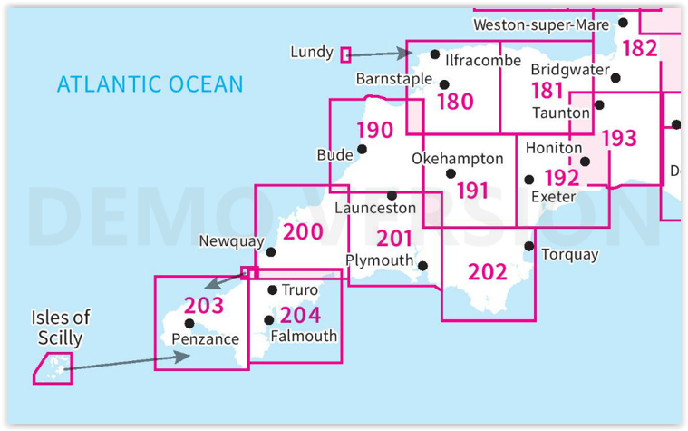
Producten op de overzichtskaart
Klik op een product om naar de detailpagina te gaan.
- Wandelkaart 180 Barnstable & Ilfracombe- Devon England - OSI
- Wandelkaart 180 Barnstaple & Ilfracombe- Devon England - OSI
- Wandelkaart 181 Minehead & Brendon Hills- England - OSI
- Wandelkaart 181 Minehead & Brendon Hills- England - OSI
- Wandelkaart 182 Weston-super-Mare & Bridgwater- England - OSI
- Wandelkaart 182 Weston-super-Mare- Somerset England - OSI
- Wandelkaart 190 Bude & Clovelly- Cornwall England - OSI
- Wandelkaart 190 Bude- Clovelly & Boscastle - OSI
- Wandelkaart 191 Okehampton & North Dartmoor NP - OSI
- Wandelkaart 191 Okehampton & North Dartmoor NP - OSI
- Wandelkaart 192 Exeter & Sidmouth- Devon - OSI
- Wandelkaart 192 Exeter- Sidmouth & Exmouth - OSI
- Wandelkaart 193 Taunton & Lyme Regis- England - OSI
- Wandelkaart 193 Taunton & Lyme Regis- Somerset - OSI
- Wandelkaart 200 Newquay- Bodmin & Camelford - OSI
- Wandelkaart 200 Newquay & Bodmin Cornwall - OSI
- Wandelkaart 201 Plymouth & Launceston England - OSI
- Wandelkaart 201 Plymouth & Launceston England - OSI
- Wandelkaart 202 Torbay - South Dartmoor NP - OSI
- Wandelkaart 202 Torbay & South Dartmoor - OSI
- Wandelkaart 204 Truro- Falmouth & Roseland - OSI
- Wandelkaart 204 Truro & Falmouth- Cornwall England - OSI
- Wandelkaart 203 Land's End & Isles of Scilly - OSI
- Wandelkaart 203 Land's End & Isles of Scilly - OSI
Artikelen uit dezelfde regio
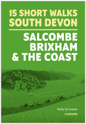
Wandelgids South Devon 15 short walks - Cicerone Press • 9781786312532
Wandelgids South Devon 15 short walks - Cicerone Productomschrijving: Would you like to explore the best of Salcombe, Brixham and the coast? This guidebook covers 15 of the best short walks in South Devon (all under three hours), including Start Point, Bigbury-on-Sea, Hope Cove and Bolberry Down, Brixham and Berry Head and Dartmouth Castle. Why choose this guidebook? - Easy to mode…
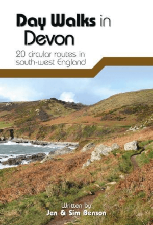
Wandelgids Day Walks in Devon - Vertebrate Publ. • 9781910240977
Day Walks in Devon - Vertebrate Productomschrijving: Day Walks in Devon features 20 circular routes, between 8.8 and 17.6 miles (14.1km and 28.3km), suitable for hillwalkers of all abilities. Local authors Jen and Sim Benson share their favourite walks in North Devon and Exmoor, Torridge and West Devon, Mid and East Devon, Dartmoor, and South Devon and the South Hams. The routes are s…
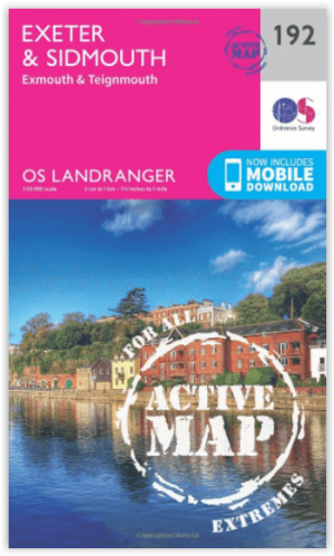
Wandelkaart 192 Exeter- Sidmouth & Exmouth - OSI • 9780319475157
Wandelkaart Exeter- Sidmouth & Exmouth - Devon England Productbeschrijving: Kaart nummer 192 in de OS Landranger kaarten, is de ideale kaart voor de planning van uw daguitstapjes en vakanties naar Exeter en Sidmouth. Verken het oosten van Devon, met inbegrip van de stad van Exeter en de steden van Honiton en badplaats steden zoals Exmouth, Sidmouth, Teignmouth, Seaton en Budleigh Salterton…

Mountainbike kaart Exmoor NP & Quantocks Hills AONB - Goldeneye • 9781859652855
MTB map Exmoor NP & Quantocks Hills AONB - Goldeneye Productomschrijving: Herewith, 10 of the best off-road touring routes to Exmoor, North Devon and The Quantock Hills AONB which include Public Rights of Way; bridlepaths & quiet lanes. These routes have also been checked out and approved by the Exmoor National Park Authority. The routes are graded: easy, moderate and more strenuous al…

Wandelgids DEEL 1 Coast Path Exmoor & North Devon - Trailblazer • 9781912716241
Wandelgids DEEL 1 - Exmoor & North Devon Coast Path Productomschrijving: Exmoor & North Devon kustpad (South-West Coast Path Deel 1) Minehead naar Bude. Deze gids omvat het eerste deel van het South West Coast Path, van Minehead naar Bude (124,5 mijl). Deze spectaculaire 10- tot 12-daagse route loopt door het Exmoor National Park langs de hoogste kustlijn van Engeland (meer dan 800…