

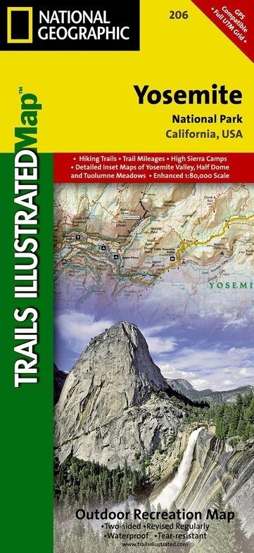
Wandelkaart 206 Yosemite NP - California - Nat Geo
Een wereldtopper van formaat
Korte omschrijving
Wandelkaarten Californië, USA van National Geographic. Ideaal voor tochten in Verenigde Staten van Amerika (USA).
TOPO Wandelkaart 206 - Yosemite NP- California - Nat geo Productomschrijving: Yosemite National Park, wat een parel van schoonheid en tegelijk wereld bekend, is een nationaal park in het oos...

Specificaties
- Uitgever: National Geographic
- ISBN-13: 9781566952996
- HOOFDCATEGORIEËN: Wandelkaart
- Activiteiten: Wandelen, Hiking & Trekking
- Auteur: National Geographic
- Regio: Californië, USA
- Land: Verenigde Staten van Amerika (USA)
- Nationale parken: Yosemite NP, California USA
- TOPO's & Stafkaarten: Topografisch wandelen
- Schaal: 1:80000
- Taal: Engels
Volledige omschrijving
TOPO Wandelkaart 206 - Yosemite NP- California - Nat geo
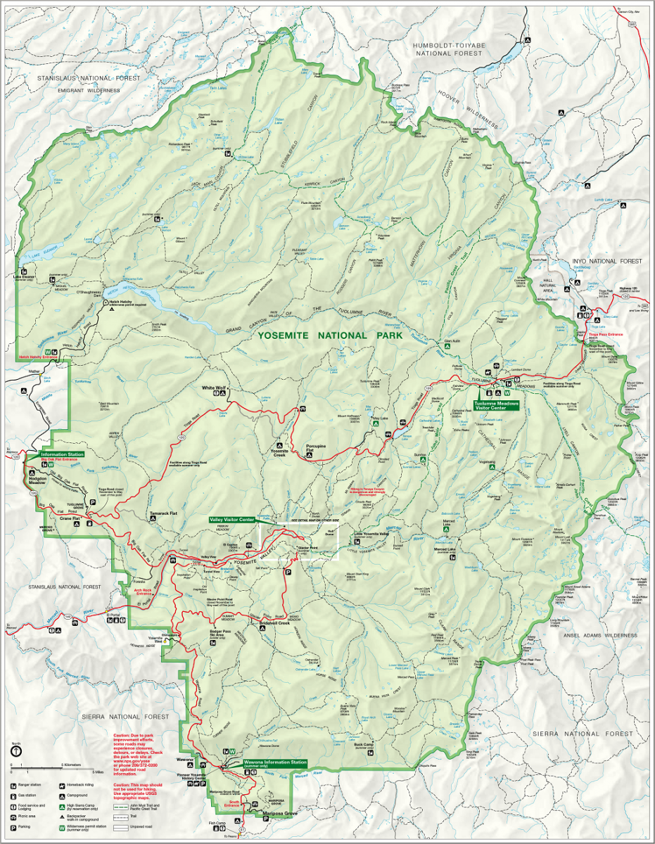
Productomschrijving: Yosemite National Park, wat een parel van schoonheid en tegelijk wereld bekend, is een nationaal park in het oosten van de Amerikaanse staat Californië. Hij ligt op de westelijke flanken van de centrale Sierra Nevada, in het oosten van Tuolumne, Mariposa en Madera County.
Engelse omschrijving: Explore the majesty of Yosemite National Park with National Geographic's Trails Illustrated map. Loaded with helpful information on camping, hiking, lodging, transportation, regulations, and safety, this map is an invaluable tool for casual park visitors and avid adventurers alike. Expertly researched and created in partnership with local land management agencies, the map features key areas of interest including Stanislaus National Forest, Emigrant Wilderness, Carson Iceberg Wilderness, Toiyabe National Forest, Hoover Wilderness, Inyo National Forest, Yosemite Wilderness, Sierra National Forest, and Ansel Adams Wilderness. Detail of the popular Tuolumne Meadows and Yosemite Valley are provided in inset maps.
With almost 800 miles of mapped trails, the Yosemite National Park map can guide you off the beaten path and back again. The clearly marked trails include mileages between intersections. The map base includes contour lines and elevations for summits, passes and major lakes. Some of the many recreation features include: campgrounds, trailheads, tram tours, ski areas, river access, scenic overlooks, scenic byways, and interpretive trails. Every Trails Illustrated map is printed on "Backcountry Tough" waterproof, tear-resistant paper. A full UTM grid is printed on the map to aid with GPS navigation.
Other features found on this map include: Ansel Adams Wilderness, Bridalveil Fall, Cathedral Range, El Capitan, Emigrant Wilderness, Excelsior Mountain, Hoover Wilderness, Illilouette Falls, Inyo National Forest, Lake Eleanor, Lower Yosemite Fall, Matterhorn Peak, Mount Dana, Mount Lyell, Mount Ritter, Nevada Fall, Ribbon Fall, Ritter Range, Sierra National Forest, Silver Strand Falls, Stanislaus National Forest, Tioga Pass, Toiyabe National Forest, Upper Yosemite Falls, Vernal Fall, Yosemite National Park, Yosemite Valley.
Artikelen uit dezelfde regio

Stadskaart plattegrond San Francisco USA - Borch • 9783866093317
Wandelkaart San Francisco USA - Borch Productomschrijving: Our soft-laminated folded map of San Francisco in the 16th edition shows: San Francisco Downtown 1:13 000, Alcatraz Island 1: 15 000, Golden Gate Park 1:13 000, San Francisco and Region 1:150 000, San Francisco Bay Area 1:400 000, Public Transport San Francisco, Top 30 Sights and USA administrative and time zones. Borch maps are ea…
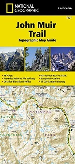
Wandelkaart 1001 - John Muir Trail - Nat Geo • 9781566956895
TOPO Wandelkaart 1001 - John Muir Trail - National Geographic Productomschrijving: De John Muir Trail - is een langeafstandswandelpad in het Sierra Nevada-gebergte in de Amerikaanse staat Californië. Het is vernoemd naar de Schots-Amerikaanse natuurvorser en schrijver John Muir, die een cruciale rol speelde in de bescherming van de nationale parken van Californië. Het 338,6 kilometer lange…
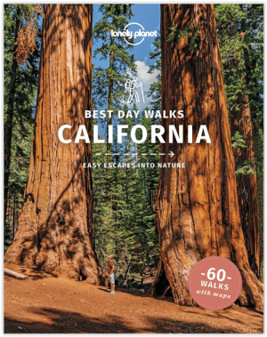
Wandelgids Best Day Walks California - Lonely Planet • 9781838691172
Best Day Walks California - Lonely Planet Productomschrijving: Lonely Planet's Best Day Walks Californië is uw paspoort met 60 gemakkelijke wandel ontsnappingen in de natuur. Strek je benen weg van de stad door een wandeling te kiezen die bij je past, van een paar uur tot een hele dag, van gemakkelijk tot zwaar. Verken Yosemite National Park, bewonder de sequoia's en wandel door Gold Count…

Wandelkaart 803 Lake Tahoe Basin - California - Nat Geo • 9781566953344
TOPO Wandelkaart 803 - Lake Tahoe Basin - California - Nat Geo Productomschrijving: Lake Tahoe Basin is een bosgebied in het Sierra Nevada-gebergte in de Verenigde Staten, dat als National Forest. Het bosgebied ligt verspreid over Placer, El Dorado en Alpine County in Californië en Washoe en Douglas County en Carson City in Nevada. Engelse omschrijving: The largest alpine lake in North…

Reisgids Los Angeles California - Top 10 - DK Eyewitness • 9780241367957
DK Eyewitness TOP 10 Los Angeles California Omvat: West Hollywood and Midtown, Santa Monica Bay, Downtown & Coastal Orange County Productomschrijving: Ga wandelen in de Hollywood Hills, breng tijd door op Venice Beach, verken Beverly Hills of bezoek het Los Angeles County Museum of Art. Van de Top 10 stranden tot de Top 10 bioscopen - ontdek het beste van Los Angeles met deze gebruiksv…