
Wandelkaart 744 Adirondack Park - Northville & Raquette Lake
Raquette Lake is de oorsprong van Raquette River
Korte omschrijving
Wandelkaart 744 -Adirondack Park - Northville & Raquette Lake Productomschrjiving: Adirondack park of mountains, een groter bebost deel van de staat New York. In dit geval gaat het over Nort...

Specificaties
- Uitgever: National Geographic
- ISBN-13: 9781566953108
- HOOFDCATEGORIEËN: Wandelkaart
- Regio: New York State, USA
- Land: Verenigde Staten van Amerika (USA)
- Regionale parken: Adirondack Park/Mountains NY, USA
- Schaal: 1:75000
- Afmeting: 10x19
- Taal: Engels
Volledige omschrijving
Wandelkaart 744 -Adirondack Park - Northville & Raquette Lake
Productomschrjiving: Adirondack park of mountains, een groter bebost deel van de staat New York. In dit geval gaat het over Northville & Raquette Lake. Raquette Lake is de oorsprong van Raquette River in de Adirondack Mountains in New York State.
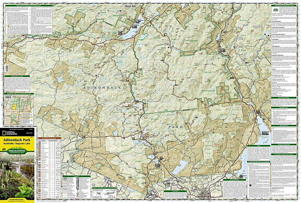
Engelse omschrijving: National Geographic's Trails Illustrated map of Adirondack Park, Northville / Raquette Lake is designed to meet the needs of outdoor enthusiasts by combining valuable information with unmatched detail of this distinct portion of the park.
Created in partnership with local land management agencies, this expertly researched map features a variety of recreation areas including Raquette, Caroga, Indian, Blue Mountain, and Piseco lakes. Some of the wilderness areas included are Silver Lake, Siamese Ponds, and Little Moose; and Ferris Lake, Shaker Mountain, and Moose River Plains are among the wild forests covered.
With miles of clearly marked trails that include mileages between intersections, this map will prove invaluable in your exploration of the region. The Central Trail Chart will help you choose a trail that's right for your activity level and recreation use whether you're hiking, horseback riding, biking, snowshoeing, cross country skiing, or snowmobiling. Recreation features are clearly marked, including campgrounds, climbing areas, fishing access, swimming areas, marinas, and ski areas. The map base includes contour lines and elevations for summits, passes and many lakes. Every Trails Illustrated map is printed on "Backcountry Tough" waterproof, tear-resistant paper. A full UTM grid is printed on the map to aid with GPS navigation.
Other features found on this map include: Baldhead Mountain, Blue Mountain, Gloversville, Indian Lake, Panther Mountain, Piseco Lake.
Locatie op kaart
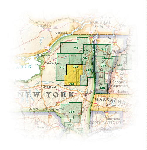
Overzichtskaarten

NAT GEO New York trail map
NAT GEO New York trail map

Producten op de overzichtskaart
Klik op een product om naar de detailpagina te gaan.
- Wandelkaart 738 Allegheny National Forest North - Nat Geo
- Wandelkaart 742 Adirondack Park - Lake Placid - Natgeo
- Wandelkaart 745 Adirondack Park - Old Forge & Oswegatchie
- Wandelkaart 746 Adirondack Park - Saranac & Paul Smiths
- Wandelkaart 747 Green Mountain National Forest- Vermont
- Wandelkaart 743 Adirondack Park - Lake George - Natgeo
- Wandelkaart 744 Adirondack Park - Northville & Raquette Lake
- Wandelkaart 748 Green Mountain National Forest
- Wandelkaart 756 Harriman- Bear Mountain & Sterling Forest parks
Artikelen uit dezelfde regio

Wandelkaart 756 Harriman- Bear Mountain & Sterling Forest parks • 9781566956079
Harriman- Bear Mountain & Sterling Forest State Parks - Nat Geo Engelse omschrijving: At over 46,000 acres, Harriman State Park is the second largest state park in New York and is located only 30 miles north of New York City. It is a haven for hikers with over 200 miles of trails, and water-sport enthusiasts flock to its three beaches and 31 lakes and reservoirs. On the northeastern edge, …

Reisgids New York City - Anwb Extra • 9789018053413
Reisgids New York - Anwb Productomschrijving: Beleef New York met de vernieuwde reisgids ANWB Extra New York! De eindeloze optocht van extravagant geklede dames op Fifth Avenue, de straatventers met exotische waar in Chinatown, de muzikanten op Washington Square en de straatfeesten in Harlem. Al deze ingrediënten maken New York tot dé bestemming voor een leuke citytrip. De ANWB Extra r…

Reisgids New York & the Mid-Atlantic - Lonely Planet • 9781788680936
Reisgids New York & the Mid-Atlantic van Lonely Planet Productomschrijving: Er wacht je een meeslepende mix van avontuur: monumenten en musea, stranden en slagvelden, bossen en wild water. Oesters schieten en bluegrass jams brengen het feest. Lonely Planet brengt je naar het hart van New York & the Mid-Atlantic, met geweldige reiservaringen en het beste planningsadvies. Lonely Planet's…

Wandelkaart 745 Adirondack Park - Old Forge & Oswegatchie • 9781566954198
Topografische Wandelkaart 745 - Adirondack Park - Old Forge & Oswegatchie, New York State. Productomschjrijving: Adirondack park of mountains, een groter bebost deel van de staat New York. In dit geval gaat het over Old Forge, een bekende toegang tot het Old Forge deel van het pak. De locatie blijft een principieel toeristische regio, en zoals reeds vermeld, één van de westelijk gelegen to…

Reisgids New York city pocket guide - Lonely Planet • 9781838691929
New York city van Lonely Planet Productomschrijving: Lonely Planet's Pocket New York City is uw paspoort voor het meest relevante, up-to-date advies over wat je moet zien en overslaan, en welke verborgen ontdekkingen op je wachten. Wandel over de High Line voor een hoog uitzicht over de stad, geniet van oude en nieuwe kunst in de Met en MoMA, loop over de Brooklyn Bridge voor een dozijn ic…