

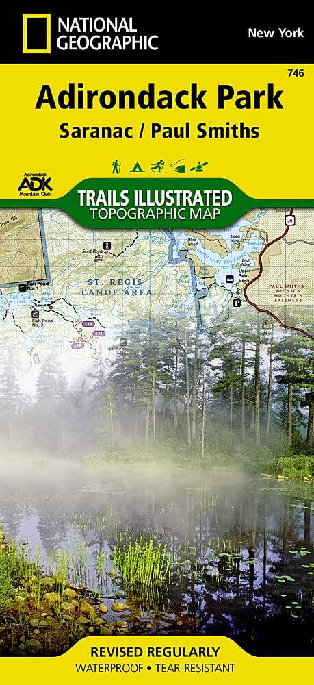
Wandelkaart 746 Adirondack Park - Saranac & Paul Smiths
Het dorp Saranac Lake omvat stukjes van 3 verschillende dorpen
Korte omschrijving
Wandelkaarten New York State, USA van National Geographic. Ideaal voor tochten in Verenigde Staten van Amerika (USA).
TOPO Wandelkaart 746 - Adirondack Park - Saranac & Paul Smiths Productomschrijving: Adirondack park of mountains, een groter bebost deel van de staat New York. In dit geval gaat het over Sar...

Specificaties
- Uitgever: National Geographic
- ISBN-13: 9781566953726
- HOOFDCATEGORIEËN: Wandelkaart
- Auteur: National Geographic
- Regio: New York State, USA
- Land: Verenigde Staten van Amerika (USA)
- Regionale parken: Adirondack Park/Mountains NY, USA
- TOPO's & Stafkaarten: Topografisch wandelen
- Schaal: 1:75000
- Taal: Engels
Volledige omschrijving
TOPO Wandelkaart 746 - Adirondack Park - Saranac & Paul Smiths
Productomschrijving: Adirondack park of mountains, een groter bebost deel van de staat New York. In dit geval gaat het over Saranac Lake & Paul Smiths dorp. Het dorp Saranac Lake omvat stukjes van 3 verschillende dorpen, Harrietstown, St. Armand- en North Elba, Als ook twee regio's Franklin & Essex.
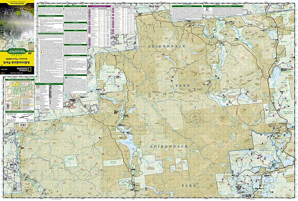
Engelse omschrijving: Explore the beauty and serenity of the Saranac Lakes region of the Adirondacks with National Geographic's Trails Illustrated map of Adirondack Park, Saranac / Paul Smiths. Created in partnership with local land management agencies including the Adirondack Mountain Club, this expertly researched map combines unmatched detail with useful information to help you get the most from your visit. Key areas of interest featured on this map include Saranac Lakes, Carry Falls Reservoir, Racquette River, Lake Placid, St. Regis Canoe Area, and Debar Mountain Wild Forest.
An extensive trail chart will help you choose a trail that's right for your activity level and recreation use whether you're hiking, horseback riding, biking, snowshoeing, cross country skiing, or snowmobiling. Trails are clearly marked and include mileage between intersections. The map base includes contour lines and elevations for summits, passes and major lakes. Recreation features are clearly marked, including campgrounds, fishing and canoe access, ski areas, scenic viewpoints, and more. A variety of helpful safety information is included as well. Every Trails Illustrated map is printed on "Backcountry Tough" waterproof, tear-resistant paper. A full UTM grid is printed on the map to aid with GPS navigation.
Other features found on this map include: Carry Falls Reservoir, Lake Placid, Loon Lake Mountains, Lower Saranac Lake, Lyon Mountain, Sable Mountains, Sentinel Range, Whiteface Mountain.
Locatie op kaart
Overzichtskaarten
NAT GEO New York trail map
NAT GEO New York trail map

Producten op de overzichtskaart
Klik op een product om naar de detailpagina te gaan.
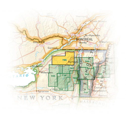
- Wandelkaart 738 Allegheny National Forest North - Nat Geo
- Wandelkaart 742 Adirondack Park - Lake Placid - Natgeo
- Wandelkaart 745 Adirondack Park - Old Forge & Oswegatchie
- Wandelkaart 746 Adirondack Park - Saranac & Paul Smiths
- Wandelkaart 747 Green Mountain National Forest- Vermont
- Wandelkaart 743 Adirondack Park - Lake George - Natgeo
- Wandelkaart 744 Adirondack Park - Northville & Raquette Lake
- Wandelkaart 748 Green Mountain National Forest
- Wandelkaart 756 Harriman- Bear Mountain & Sterling Forest parks

NAT GEO Maine trails map
NAT GEO Maine trails map

Producten op de overzichtskaart
Klik op een product om naar de detailpagina te gaan.
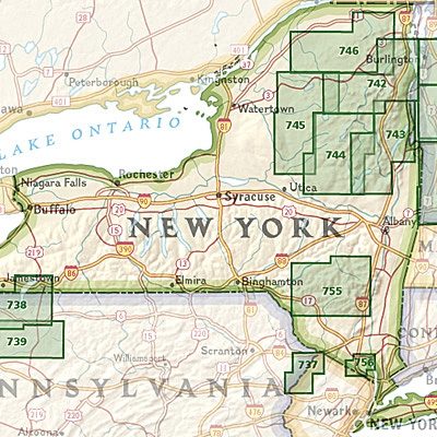
- Wandelkaart 212 Acadia National Park - Natgeo
- Wandelkaart 742 Adirondack Park - Lake Placid - Natgeo
- Wandelkaart 743 Adirondack Park - Lake George - Natgeo
- Wandelkaart 744 Adirondack Park - Northville & Raquette Lake
- Wandelkaart 746 Adirondack Park - Saranac & Paul Smiths
- Wandelkaart 747 Green Mountain National Forest- Vermont
Artikelen uit dezelfde regio

Reisgids Guides VOIR New York - Hachette • 9782017197621
Reisgids New York - Hachette Productomschrijving: Les guides Voir, les guides les plus illustrés du marché, vous montrent ce que les autres racontent ! Un concept unique qui vous dévoile les merveilles de New York : des dessins et des plans en 3D des plus beaux monuments et des quartiers historiques, avec des centaines de photos. Quartier par quartier, découvrez tout ce qu’il faut voir…

Stadskaart & plattegrond New York geplastificeerd - Michelin • 9782067214002
Stadskaart New York geplastificeerd - Michelin Productomschrijving: Deze wateraftotende nieuwe stadskaart van New York City omvat vele bekende locaties. Omvat: Liberty Island- Manhatten- The Bronx- Queens- Harlem. De 1:20.000 schaal (1cm = 200m) gelamineerde MICHELIN kaart van New York is ideaal om de stad te verkennen. Hij bevat alle praktische informatie die je nodig hebt om je …

Reisgids New York City - Marco Polo • 9783829758482
Reisgids New York City - Marco Polo Productomschrijving: Marco Polo reisgids voor New York City! Handig pocket formaat, boordevol informatie, met uitneembare kaart van de stad en 20 bladzijden met plattegronden. Met 'insider tips' om het échte New York te ontdekken, de TOP 15 van bezienswaardigheden in één oogopslag, up-to-date informatie in overzichtelijke hoofdstukken: sightseeing, eten…
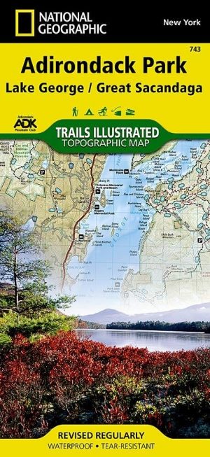
Wandelkaart 743 Adirondack Park - Lake George - Natgeo • 9781566953634
TOPO Wandelkaart 743 - Adirondack Park - Lake George Productomschrijving: Adirondack park of mountains, een groter bebost deel van de staat New York. In dit geval gaat het over de locatie van Lake George in het noord oostelijk deel. Engelse omschrijving: National Geographic's Trails Illustrated map of Adirondack Park, Lake George - Great Sacandaga combines unmatched detail with helpful…

Reisgids New York & the Mid-Atlantic - Lonely Planet • 9781837584918
Travel Guide New York & the Mid-Atlantic - Lonely Planet Productomschrijving: A compelling mix of adventure awaits: monuments and museums, beaches and battlefields, woods and white water. Oyster shooters and bluegrass jams bring the party. Lonely Planet will get you to the heart of New York & the Mid-Atlantic, with amazing travel ex-periences and the best planning advice. Lonely Planet…