

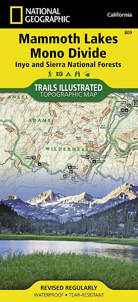
Wandelkaart 809 Mammoth Lakes - Mono Divide - Nat Geo
Gelegen direct ten oosten van Mammoth Mountain
Korte omschrijving
Wandelkaarten Californië, USA van National Geographic. Ideaal voor tochten in Verenigde Staten van Amerika (USA).
TOPO Wandelkaart 809 - Mammoth Lakes - Mono Divide - National Geographic Productomschrijving: Mammoth Lakes is een stadje in Mono County, California, de enige geintegreerde community in de r...

Specificaties
- Uitgever: National Geographic
- ISBN-13: 9781566952668
- HOOFDCATEGORIEËN: Wandelkaart
- Auteur: National Geographic
- Regio: Californië, USA
- Land: Verenigde Staten van Amerika (USA)
- TOPO's & Stafkaarten: Topografisch wandelen
- Schaal: 1:63360
- Taal: Engels
Volledige omschrijving
TOPO Wandelkaart 809 - Mammoth Lakes - Mono Divide - National Geographic
Productomschrijving: Mammoth Lakes is een stadje in Mono County, California, de enige geintegreerde community in de regio. Gelegen direct ten oosten van Mammoth Mountain.
Engelse omschrijving: Explore the magnificent alpine landscape of Mammoth Lakes, Mono Divide with National Geographic's Trails Illustrated map. Expertly researched and created in partnership with local land management agencies, this map features key points of interest including John Muir, Ansel Adams, and Dinkey Lakes wilderness areas; Devils Postpile National Monument; and the northern portion of Kings Canyon National Park. Loaded with helpful information on wilderness camping, safety tips, and regulations, this map is an invaluable tool for casual visitors and avid adventurers alike.
The Mammoth Lakes, Mono Divide Trails Illustrated Map can guide you off the beaten path and back again with miles of mapped trails including portions of the Pacific Crest and John Muir trails. The trails are clearly marked for their usage, and mileage between intersections is noted. Road types are differentiated as well, so you know if the route you choose is a paved, dirt, four-wheel-drive, or high-clearance road. The map base includes contour lines and elevations for summits, passes and some lakes. A variety of recreation features are noted, including campgrounds, trailheads, interpretive trails, boat launch sites, horse pack stations, and more. Every Trails Illustrated map is printed on "Backcountry Tough" waterproof, tear-resistant paper. A full UTM grid is printed on the map to aid with GPS navigation.
Other features found on this map include: Ansel Adams Wilderness, Courtright Reservoir, Dinkey Lakes Wilderness, Inyo National Forest, John Muir Wilderness, Kings Canyon National Park, Lake Crowley, Lake Thomas A Edison, Mount Darwin, Mount Goddard, Mount Morgan, Mount Powell, Mount Ritter, Nelson Mountain, Ritter Range, Sierra National Forest.
.png)
Locatie op kaart
Artikelen uit dezelfde regio

Wandelkaart 252 Channel Islands National Park - Nat Geo • 9781566954105
Channel Islands National Park - Nat Geo Productomschrijving: De Channel Islands Nationaal Park, gelegen voor de kust van Californië, zijn de thuisbasis van vele unieke soorten flora en fauna. National Geographic's Trails Illustrated kaart van Channel Islands National Park bestrijkt met ongeëvenaard detail de vijf eilanden die het park omvat, inclusief The Nature Conservancy gebied van Sant…

Reisgids San Francisco - Gallimard • 9782742453474
Reisgids San Francisco - Gallimard Productomschrijving: Van Chinatown tot de Golden Gate Bridge, van Mission tot Twin Peakes, van SFMoMa tot het Asian Art Museum, van Potrero tot Haight-Ashbury, San Francisco ontvouwt zich in een oogwenk met een gids als geen ander. Franse omschrijving: De Chinatown au Golden Gate Bridge, de Mission à Twin Peakes, du SFMoMa à l'Asian Art Museum, …

Wandelkaart 308 Yosemite NE- Tuolumne Meadows - Nat Geo • 9781566953696
Yosemite North East - Tuolumne Meadows - Nat Geo Productomschrijving: National Geographic's Trails Illustrated kaart van Yosemite NE: Tuolumne Meadows and Hoover Wilderness is ontworpen om te voldoen aan de behoeften van outdoor enthousiastelingen door het combineren van waardevolle informatie met ongeëvenaarde details van deze prachtige regio van het park. Deskundig onderzocht en gemaakt …

Reisgids L'essentiel de Californie - Lonely Planet • 9782816171204
L'essentiel de Californie du Lonely Planet Description de produits: Le guide Lonely Planet qui va à l'essentiel, pour découvrir le meilleur de la Californie. Un guide tout en couleurs, illustré par des centaines de photos. Sonoma Valley, la Pacific Coast Highway, Yosemite, les parcs à thème, San Francisco, Lake Tahoe, Death Valley… tous les incontournables de la région réunis dans ce volum…

Wandelkaart 804 Tahoe National Forest West - Nat Geo • 9781566954259
Tahoe National Forest West - Nat Geo Omvat: Donner Pass, Eldorado National Forest, Granite Chief Wilderness, Mosquito Ridge, Plumas National Forest, Sawtooth Ridge, Tahoe National Forest, Truckee. Engelse omschrijving: Expertly researched and created in partnership with the U.S. Forest Service and others, National Geographic's Trails Illustrated map of Yuba and American Rivers region o…