
Wandelkaart Hike & Climb the Cederberg - Tracks4Afrika
The Cederberg mountains are located near Clanwilliam


Korte omschrijving
Wandelkaart Hike & Climb the Cederberg - Slingsby Maps Productomschrijving: Unleash Your Adventure: The Revised Edition 5 Has Arrived! The updates in this version to fuel your wanderlust...

Specificaties
- Uitgever: Tracks4Africa
- ISBN-13: 9781776322879
- HOOFDCATEGORIEËN: Wandelkaart
- Activiteiten: Wandelen, Hiking & Trekking
- Regio: West Coast, Western Cape South africa, Zuid Afrika
- Land: Zuid-Afrika
- Regionale parken: Cederberg, Wilderness Area, South Africa
- Schaal: 1:40000
- Editie: 5
- Taal: Engels
- Reeks/Serie: Slingsby Maps, Afrika
- Klimmen: Boulderen & Slackline, Rotsklimmen
- VTT / MTB: Mountainbike
Volledige omschrijving
Wandelkaart Hike & Climb the Cederberg - Slingsby Maps
Productomschrijving: Unleash Your Adventure: The Revised Edition 5 Has Arrived!
The updates in this version to fuel your wanderlust are:
Over 200 new bouldering sites added – discover hidden climbing gems!
Official CapeNature trail names and codes – making your journey easier to navigate and even more memorable.
There are two double-sided A1-sized maps in the set (i.e., four maps in all), covering the entire Cederberg Wilderness and extending north to Wolfdrif and south to Mount Ceder.
The maps are printed on Duraflex waterproof material and are packaged together in a folding slipcase. The maps are not available separately.
More than a hundred hikers, mountaineers, conservationists and locals have contributed their special knowledge to the project, which has been proudly endorsed by CapeNature.
Every single public footpath has been researched on foot, and the maps include distances between path junctions, as well as GPS coordinates, altitudes, etc. etc.
Whether you’re a seasoned climber or just starting your bouldering journey, this edition is your ultimate companion to explore and experience the great outdoors like never before.
The maps also detail:
Popular bouldering sites, as well as the complex of fine mountain biking trails around Dwarsrivier/Sanddrif and other locations
Caves, perennial water, pools, dramatic rock formations and sites of historical importance (but caves that have rock art are not shown except in supervised situations such as the Sevilla Trail)
The famous Cederberg shalebands, dense vegetation, cedar plantations, prominent rock screes and rockfalls, OVER 12 000 TREES!! etc etc
The best places to stay from which your hikes might be launched, with their telephone numbers
We spent many delightful days enjoying the warm hospitality of the local communities, gathering more than 500 authentic place names which have never appeared on any maps before. We can proudly claim that these are the best and most definitive hiking maps of the Cederberg ever produced.
Additional info:
Cederberg Mountains in the Western Cape Province on a set of two double-sided, waterproof and tear-resistant, GPS compatible hiking maps at 1:40,000 from Slingsby Maps, providing a vivid picture of the topog- raphy with hiking trails and detailed road network, tourist facilities and places of interest, etc.
The set shows the Cederberg Mountain range, complementing the publishers’ wider coverage of the Cederberg region on a touring map at 1:160,000. Contours at 20m intervals, enhanced by relief shading, altitude colouring, plus colouring and/or graphics for different types of terrain and vegetation, provide an excellent representation of the topography. Various ranges, peaks and passes are named and lots of additional spot heights are marked. An overprint highlights various hiking trails, indicating head trails, permit requirements, waymarking for special routes, etc. Also marked are tracks and footpaths not recommended for hikers.
Road network indicates untarred roads, 4WD routes or roads requiring high clearance, private roads where owners’ permission may be required, etc. Important junctions and other locations are annotated with GPS waypoints. Symbols indicate various facilities and places of interest including various types of tourist accommodation (lodges, guest houses, B&Bs, campsites, etc), restaurants, picnic places, local arts and crafts shops, petrol stations, wineries, sport and recreational facilities, etc. In addition to the GPS waypoints the maps have a latitude and longitude grid at intervals of 1’.
Don’t miss out—grab your copy today and start charting your next adventure!
Locatie op kaart
Artikelen uit dezelfde regio

Reisgids Country Guide Botswana 2025-2026 - Gallimard • 9782305116754
Reisgids Botswana 2025-2026 - Gallimard Productomschrijving: Malgré sa beauté, le Botswana reste une destination quasiment ignorée des pays francophones. On dit de sa région Nord qu'elle serait le dernier Eden sauvage de l'Afrique. Le Botswana offre comme un royaume, un dernier lambeau de l'Afrique authentique où les traces de l'homme ne recouvrent pas encore celles des animaux.

Reisgids South Africa - DK Eyewitness • 9780241368824
DK Eyewitness - South Africa Omvat: Cape Town; the Cape Winelands, the West Coast, the Southern Cape, the Garden Route to Grahamstown, the Wild Coast, Drakensberg and Midlands, Durban and Zululand, Gauteng and Sun City, Blyde River Canyon and Kruger & the Arid Interior. Productomschrijving: Ga op safari op zoek naar neushoorns, leeuwen en olifanten, proef een sappige Sauvignon Blanc in…
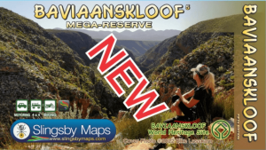
Landkaart Wegenkaart South Africa: Baviaanskloof - Slingsby Maps • 9781920377502
Wegenkaart Baviaanskloof South Africa - Slingsby Productomschrijving: South Africa: Baviaanskloof. Whether you’re a hiker, mountain biker or 4×4 enthusiast this is the map you need for your visit to the spectacular Baviaanskloof. The map is fully GPS-compatible and will enable you to explore this fabulous, rugged wilderness, its geological marvels, extraordinary flora and fauna, and t…
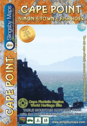
Wandelkaart Zuid Afrika - Slingsby Maps • 9781920377427
Wandelkaart Zuid Afrika - Slingsby Maps Productomschrijving: “Cape Point and Simon’s Town” is Map Three in our three map series of Table Mountain National Park. This brand new, fully redrawn and highly detailed map shows all approved paths and include full GPS information for this historically-fascinating hiking area. The double sided map with Cape Point on one side and Simon’s Town (…
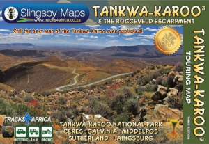
Landkaart Wegenkaart Tankwa-Karoo & Roggeveld Esc - Slingsby Maps • 9781776322817
Wegenkaart Tankwa-Karoo National Park & Roggeveld mountains Produductomschrijving: - Tankwa-Karoo National Park & the Roggeveld Escarpment/Mountains. - Ceres: Calvinia, Middelpos. - Sutherland: Laingsburg. The Tankwa-Karoo is scarcely a two hour drive from Cape Town, yet until recently the region has been known and explored by only the hardiest of travellers. It is a tr…