
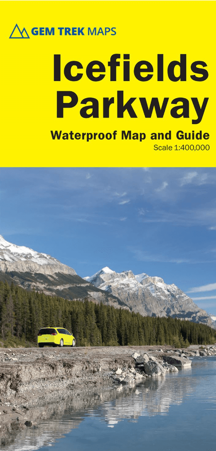
Wandelkaart Icefields Parkway Alberta Canada - Gem Trek Publ.
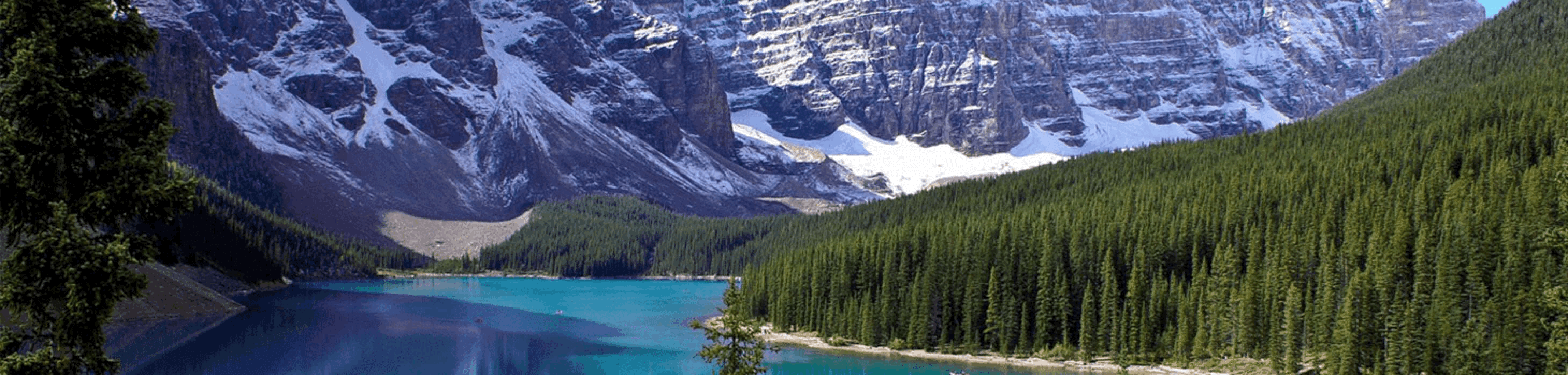
De Gletcher van Icefields Parkway met de Athabascca Pas


Korte omschrijving
Wandelkaarten Alberta, Canada en British Colombia, Canada van Gem Trek Publishing. Ideaal voor tochten in Canada.
Wandelkaart Icefields Parkway - Gem Trek Publ. Productomschrijving: In eerste instantie is wat u tegenkomt langs de weg tussen Banff & Jasper National Parks, de Gletcher zelf, zicht baar van...

Specificaties
- Uitgever: Gem Trek Publishing
- ISBN-13: 9781990161186
- HOOFDCATEGORIEËN: Wandelkaart
- Activiteiten: Wandelen, Hiking & Trekking
- Regio: Alberta, Canada, British Colombia, Canada
- Land: Canada
- Schaal: 1:400000
- Editie: 5
- Taal: Engels
Volledige omschrijving
Wandelkaart Icefields Parkway - Gem Trek Publ.
Productomschrijving: In eerste instantie is wat u tegenkomt langs de weg tussen Banff & Jasper National Parks, de Gletcher zelf, zicht baar vanop de weg. Tijdens de seizoensmaanden kunt u als toerist meegaan met een bus met gigantische wielen, die u dan tot bijna boven op de gletcher brengt. Een hele speciale belevenis, Bibliotrek deed het zelf!
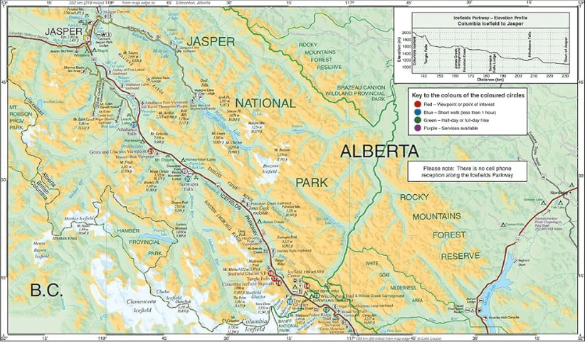
Engelse omschrijving: Whether you have a day or a week to spend exploring the sights along the spectacular Icefields Parkway highway, this combination map and guide will help you make the most of your time. Like our much-loved hiking maps, the Best of the Icefields Parkway map features detailed cartography and is printed on waterproof and tear-resistant paper.
The Best of the Icefields Parkway map shows all viewpoints, picnic areas, trailheads, campgrounds, hostels, lodges and other services along the Icefields Parkway, while the descriptions in the guide point you to the best of these – the best viewpoints of mountains and lakes, the most interesting points of interest and exhibits, and the best bets for spotting wildlife such as moose, bighorn sheep and mountain goats. Also included are short descriptions of the ten best walks and day hikes along the Icefields Parkway—from the short stroll to Peyto Lake Viewpoint to the rewarding hike through alpine meadows to Helen Lake.
To make it easier to plan your day, we’ve also provided information about campgrounds, lodges, visitor centres and other key services along the Icefields Parkway. A mileage chart, area map and elevation profile complete the map.
Artikelen uit dezelfde regio

Wandelkaart 901 Banff North - Banff and Yoho NP - Nat Geo • 9781566956598
TOPO Wandelkaart 901 - Banff North - Banff and Yoho NP - Natgeo Productomschrijving: Deze topografische wandelkaart van 2 van Canada's mooiste nationale parken heeft heel wat in petto. De kaart is meer dan voldoende voor deze 2 zeer grote weliswaar wilde plaatsen. Wat er ook te vinden valt is bijvoorbeeld het beeldschone Lake Louis, die te vinden is langs de grote en enige autoroute door d…
Stadskaart Vancouver city map - Lonely Planet • 9781786576606
Vancouver City map - Lonely Planet Productomschrijving: Durable and waterproof, with a handy slipcase and an easy-fold format, Lonely Planet Vancouver City Map is your conveniently-sized passport to traveling with ease. Get more from your map and your trip with images and information about top attractions, walking tour routes, transport maps, itinerary suggestions, extensive street and sit…

Wandelkaart 11 Banff Up-Close - Gemtrek • 9781895526776
Wandelkaart - Banff Up-Close - Gemtrek Productomschrijving: Banff, een begrip in Alberta en wereldwijd, als skigebied en als wandelgebied in de zomermaanden. Banff heeft maar een klein stukje dat echt kan worden betreden als skigebied, de meerderheid van de skiërs gaan in de richting van Lake Louis zo'n 35km verder richting Jasper National park, die zelf zo'n 400km van Banff ligt. In Banff…

Wandelkaart 902 Jasper NP South - Nat Geo • 9781566956604
TOPO Wandelkaart 902 - Jasper NP South - Alberta - Natgeo Productomschrijving: Het Jasper National Park is een nationaal park in Canada, gelegen in het westen van Alberta, en onderdeel van de Rocky Mountains. Het omvat onder meer het plaatsje Jasper en Maligne Lake. Het Banff National Park ligt ten zuiden van dit park. Jasper staat bekend om het vele wild. Dikhoornschapen, edelherten, beve…
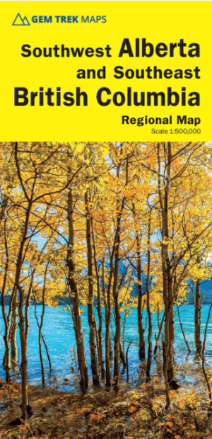
Wandelkaart Southwest Alberta & Southeast British Columbia - GT • 9781990161216
Southwest Alberta & Southeast British Columbia - Gem trek Productomschrijving: Gem Trek’s Southwest Alberta and Southeast British Columbia Map is designed for visitors looking to explore the regions east and west of the Canadian Rockies, including the Kootenays of British Columbia, the Alberta foothills (Kananaskis), and west-central Alberta. All the major highways are shown, as well as n…