

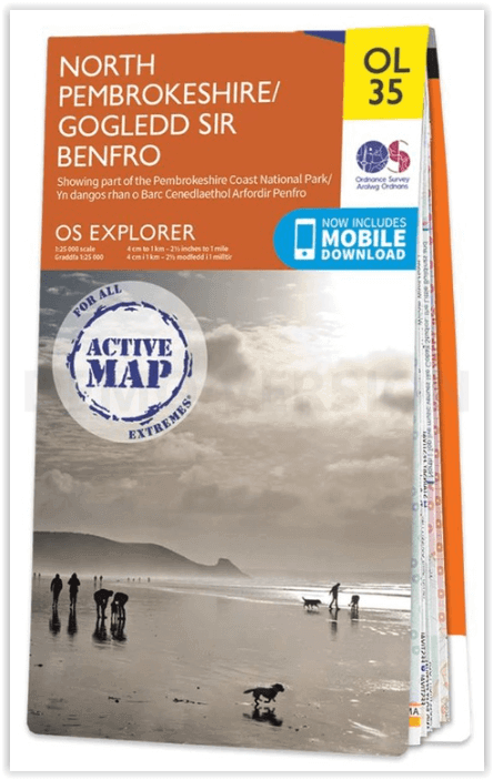
Wandelkaart OL35 North Pembrokeshire Wales - OSI
St Davids - Cardigan - Goodwick & Fishguard
Korte omschrijving
Wandelkaarten Pembrokeshire, Wales van Ordnance Survey. Ideaal voor tochten in Wales.
Wandelkaart North Pembrokeshire Wales - OSI Productomschrijving: Kaart nummer OL35 in de OS Explorer serie bestrijkt de kust van North Pembrokeshire en het Pembrokeshire Coast National Park ...

Specificaties
- Uitgever: Ordnance Survey
- ISBN-13: 9780319475744
- HOOFDCATEGORIEËN: Wandelkaart
- Activiteiten: Wandelen, Hiking & Trekking
- Regio: Pembrokeshire, Wales
- Land: Wales
- Waterafstotende kaart: Ordnance Survey ACTIVE Explorer Weatherproof Maps
- Nationale parken: Pembrokeshire Coast NP, Wales
- TOPO's & Stafkaarten: Topografisch wandelen
- Schaal: 1:25000
- Taal: Engels
- Reeks/Serie: Explorer ACTIVE Series OSI
Volledige omschrijving
Wandelkaart North Pembrokeshire Wales - OSI
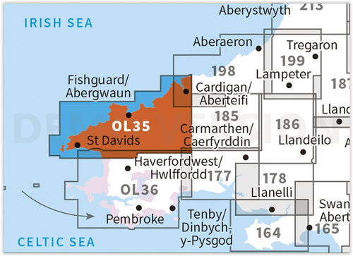
Productomschrijving: Kaart nummer OL35 in de OS Explorer serie bestrijkt de kust van North Pembrokeshire en het Pembrokeshire Coast National Park aan de westkust van Wales. Hoogtepunten van het gebied zijn: St Davids, Cardigan, Goodwick en Fishguard, samen met het Pembrokeshire Coast Path.
National Trails and recreation paths:
* Ceredigion Coast path * Pembrokeshire Coas path * Landsker Borderlands trail * Wales Coast PathEngelse omschrijving: Map sheet OL35 in the OS Explorer series covers the North Pembrokeshire coast and the Pembrokeshire Coast National Park on the West coast of Wales. Highlights of the area include: St Davids, Cardigan, Goodwick and Fishguard, along with the Pembrokeshire Coast Path. Also on the map is: St Davids, Cardigan, Goodwick, and Fishguard, and the Pembrokeshire Coast Path.

Locatie op kaart
Artikelen uit dezelfde regio
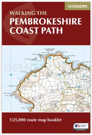
Map Nooklet Pembrokeshire Coast Path - Cicerone • 9781786312099
Pembrokeshire Coast Path - Cicerone Productomschrijving: OPGELET: Dit art. zit standard inbegrepen in de wandelgids van de route zelf. Pembrokeshire Coast Path National Trail, van 291 km langs de kust van de regio Pembrokeshire NP wales. Deze omvat de kaartjes boekje voor de route. Engelse omschrijving: Map of the 182 mile (291km) Pembrokeshire Coast Path National Trail, between …

Wandelkaart OL36 South Pembrokeshire- Wales - OSI • 9780319469545
Wandelkaart South Pembrokeshire - Wales Productbeschrijving: Kaart nummer OL36 is een all purpose kaart vol gepakt met informatie om u het gebied te helpen leren kennen. De kaarten bestrijken het land. Elke kaart heeft een oppervlakte van 40 km door 40 km (25 mijl door 25 mijl) en zoals andere kaarten van Ordnance Survey, National Grid-vierkanten worden verstrekt zodat elke functie een uni…

Wandelgids Park Rangers Favourite Walks Pembrokeshire - Collins • 9780008462734
Park Rangers Favourite Walks Pembrokeshire coast - Collins Productomschrijving: Wandelgids voor het Pembrokeshire Coast National Park, met 20 beste routes uitgekozen door de parkwachters. Elke wandeling varieert in lengte van 2 tot 10 km en kan worden voltooid in minder dan 4 uur. Engelse omschrijving: Walking guide to the Pembrokeshire Coast National Park, with 20 best routes chosen b…

Wandelkaart OL036 Pembrokeshire National Park South - OS • 9780319242759
Wandelkaart Pembrokeshire National Park South - OS Productomschrijving: Pembrokeshire National Park South Ontdek de OL-serie van Ordnance Survey: De OL-serie (Outdoor Leisure) van Ordnance Survey is dé referentie voor wie gaat wandelen op de Britse eilanden. Deze topografische kaarten maken deel uit van de Explorer-reeks en bieden ongeëvenaarde nauwkeurigheid en detail op een schaal …

Wandelgids Pembrokeshire Coast Path - Cicerone • 9781786312082
Pembrokeshire Coast Path - Cicerone Productomschrijving: Deze nieuwe gids omvat de Pembrokeshire Coast Path National Trail, een 291 km lange kust wandelroute langs het befaamde Pembrokeshire Coastline in Wales. Omvat: St-Dogmaels, Goodwick, St-David's, Milford Haven, Amroth. Engelse omschrijving: This guidebook describes the Pembrokeshire Coast Path National Trail. The scenic 180 …