

Wandelkaart XT40 South West Coast Path 1 - Harvey maps
1014 km lange route in Cornwall van Minehead tot St-Ives

Korte omschrijving
Wandelkaarten South & South East England, Devon, England en Summerset van HARVEY MAPS. Ideaal voor tochten in England.
Wandelkaart - South West Coast Path 1 - XT40 - Harvey maps Productomschrijving: Een wandelkaart die het zuidelijk deel beschrijft van het LAW wandelpad in de regio Devon / Cornwall, van Mine...

Specificaties
- Uitgever: HARVEY MAPS
- ISBN-13: 9781851375547
- HOOFDCATEGORIEËN: Wandelkaart
- Activiteiten: Wandelen, Hiking & Trekking
- Regio: Devon, England, South & South East England, Summerset
- Land: England
- TOPO's & Stafkaarten: Topografisch wandelen
- Schaal: 1:40000
- Taal: Engels
- Iconische Wandelroutes: South West coast Path, Cornwall UK
- National Trails UK, England & Wales: South West Coast Path, England
Volledige omschrijving
Wandelkaart - South West Coast Path 1 - XT40 - Harvey maps
Productomschrijving: Een wandelkaart die het zuidelijk deel beschrijft van het LAW wandelpad in de regio Devon / Cornwall, van Minehead tot St-Ives. De route telt in zijn geheel maar liefst 1014km lange wandelpad, genaamd "West Coast Path". De gehele route werd opgesplitst in 3 delen, De ISBN nrs van alle drie de kaarten zijn hieronder te vinden. Het pakket wordt bij BIBLIOTREK.be verkocht als 1 set voor een samengestelde prijs. De route is een superbekende nationale trail, en loopt langs de kust van Somerset, Cornwall, Devon, en Dorset tot Minehead rond Land's End tot in Poole. De ganse route beschrijft 95 mijl lange werelderfgoedpaden gekend als de "Jurasic Coast".
Kaart 1 van 3: Minehead tot St-Ives – 9781851375547
Kaart 2 van 3: St-Ives tot Plymouth – 9781851375554
Kaart 3 van 3: Plymouth tot Pool Harbour - 9781851375561
Kaart is Bio-afbreekbaar, met accomodatie-info, kamperen, eten, startplaatsinfo.
Locatie op kaart
Overzichtskaarten

Harvey Maps - National Trails
Harvey Maps - National Trails

Producten op de overzichtskaart
Klik op een product om naar de detailpagina te gaan.
- Wandelkaart Cape Wrath Trail North - Schotland - Harvey maps
- Wandelkaart Cape Wrath Durness Schotland - Harvey maps
- Wandelkaart Cleveland Way - Across North York NP - Harvey maps
- Wandelkaart Cotswold Way - Harvey maps
- Wandelkaart Cumbria Way - Harvey maps
- Wandelkaart The Dales Way Yorkshire - Harvey maps
- Wandelkaart East Highland Way - Schotland - Harvey maps
- Wandelkaart Glyndwr's Way Wales - Harvey maps
- Wandelkaart Great Glen Way - Schotland - Harvey maps
- Wandelkaart XT40 Pennine Way Zuid - Harvey Maps
- Wandelkaart XT40 South West Coast Path 1 - Harvey maps
- Wandelkaart XT40 Anglesey Coastal Path N. Wales - Harvey Maps
- Wandelkaart XT40 Offa's Dyke Path - Harvey Maps
- Wandelkaart XT40 Pennine Way Noord - Harvey Maps
- Wandelkaart XT40 ultra Crieff & Comrie & Dunblane - Harvey maps
- Wandelkaart XT40 John o'Groats Trail - Harvey Maps
- Wandelkaart XT40 Wales Coast Path 2 - Caernarfon to Cardigan
- Wandelkaart XT40 Wales Coast Path 3 - Cardigan to LIanelli
- Wandelkaart Rob Roy Way National trail - Harvey maps
- Wandelkaart Shropshire Way National Trail - Harvey maps
- Wandelkaart South Downs Way - Harvey maps
- Wandelkaart Loch Ness Trail South - Harvey maps
- Wandelkaart Speyside Way - Harvey maps
- Wandelkaart St-Oswald's Way - Harvey maps
- Wandelkaart Thames Path - Harvey maps
- Wandelkaart Fietskaart Affric Kintail Way - Harvey maps
- Wandelkaart Hadrian's Wall Path - Harvey maps
- Wandelkaart North Downs Way - Harvey maps
- Wandelkaart Pennine Bridleway - Harvey Maps
- Wandelkaart Ridgeway National Trail SE England - Harvey maps
- Wandelkaart Skye Trail - Isle of Skye Schotland - Harvey maps
- Wandelkaart West Highland Way - Harvey maps
- Wandelkaart Beacons Way XT40 - Harvey Maps
- Wandelkaart Cumbrian Way North XT40 - Harvey Maps
- Wandelkaart Lake District South-East XT40 - Harvey Maps
Artikelen uit dezelfde regio

Fietskaart Dartmoor National Park - Harvey maps • 9781851374540
Fietskaart - Dartmoor National Park - Harvey maps Productomschrijving: Eén zijde voor mountainbiken, en één zijde voor cyclustoeren, deze stevige, duurzame en waterdichte kaart van Dartmoor en het omliggende gebied is specifiek gemaakt voor het buitenleven. Gemaakt in samenwerking met Dartmoor National Park autoriteit, toont de berg vele off-road fietsroutes. De cyclustouringszijde toont h…

Mountainbikegids South Downs - 26 off road routes - Cicerone • 9781852846459
Mountainbikegids South Downs - 26 off road routes - Cicerone Productomschrijving: Een gids voor berg (MTB) fietsroutes op de South Downs van Hampshire en Sussex, tussen Winchester, Brighton en Eastbourne. De 26 routes beschreven in dit boek nemen deel aan achtbanen, toegewijde bos singletrack en grote afdalingen. Ritten worden gequoteerd voor alle vaardigheden met informatie over plaatseli…

Wandelkaart North Downs Way - Harvey maps • 9781851375295
Wandelkaart North Downs Way - Harvey maps Productomschrijving: Meer dan een kaart, een essentieel nieuw stuk met indeling, deze HARVEY routekaart toont het geheel van de North Downs Way op één vel. Het is een duidelijk gedetailleerde route. Het bevat ook informatie over accommodatie en diensten, handige telefoonnummers om te helpen met de planning en de volledige tour. Gedrukt op 100% wate…
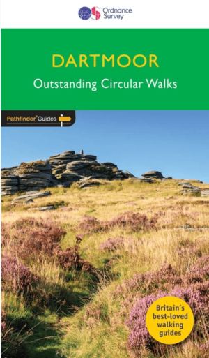
Wandelgids 026 Pathfinder guides Dartmoor National Park - OS • 9780319090305
Wandelgids Dartmoor National Park Devon - OS Productomschrijving: Discover the rugged, iconic landscape of Dartmoor National park, with this selection of 28 walks designed to help you find the best it has to offer. While largely uninhabited wilderness with few villages, farms and roads, there are still plenty of opportunities for walks of all levels. Some of the most significant featu…
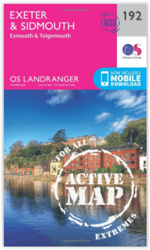
Wandelkaart 192 Exeter- Sidmouth & Exmouth - OSI • 9780319475157
Wandelkaart Exeter- Sidmouth & Exmouth - Devon England Productbeschrijving: Kaart nummer 192 in de OS Landranger kaarten, is de ideale kaart voor de planning van uw daguitstapjes en vakanties naar Exeter en Sidmouth. Verken het oosten van Devon, met inbegrip van de stad van Exeter en de steden van Honiton en badplaats steden zoals Exmouth, Sidmouth, Teignmouth, Seaton en Budleigh Salterton…