

HOOFDCATEGORIEËN
Activiteiten
Fietsen
VTT / MTB
Klimmen
Auteur:
Land
Regio
Reeks/Serie:
Taal
Schaal
Lange afstand wandelroutes
Nationale parken
TOPO's & Stafkaarten
Toepasselijke bergketen
Waterafstotende kaart
Eurovélo-Routes
Iconische Wandelroutes
De Nationale Parken
Uitgever

 Wandelen in Ierland
Wandelen in Ierland, deze landmassa van het eiland Ierland is in 2 delen opgedeeld. Enerzijds is er de regio Noord-Ierland, die ongeveer 1/5 van het eiland beslaat en deel uitmaakt van het Verenigd Koninkrijk, en anderzijds Ierland zelf. Wij hebben het hier echter over het land Ierland, een republiek die de overige 4/5 van het eiland bestrijkt.
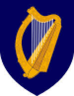
De republiek Ierland heeft als nationaal symbool een Keltische harp. Maar evengoed wordt ook vaak de klaver (shamrock) gebruikt als nationaal symbool. Als u bijvoorbeeld in Ierland een wandelclub bezoekt, is de kans groot dat u wedstrijdbekers uitgestald ziet staan met daarop de shamrock (klaverblad) afgebeeld. De Ierse westkust bestaat grotendeels uit klippen, heuvels en laaggebergte. Het hoogste punt is de berg Carrauntoohil met zijn piek op 1.038 meter, gelegen in het zuidwesten van het land. De republiek Ierland omvat ook enkele kleinere eilanden en eilandgroepjes. Het grootste daarvan is Achill Island. Kleinere eilandjes zijn de Araneilanden, de Blasket-eilanden, Cleareiland, Inishbofin, de Skellig-eilanden en Valentia. De reeksen Wandelkaarten Ierland & Wandelgidsen Ierland zijn bij BIBLIOTREK samen goed voor meer dan 100 artikelen.
Er bestaan in Ierland een dikke 44 National Trails, waarvan de Wicklow Way er één van is. Met zijn 128 Km, is deze een boom van een route door de Wicklow Mountains. VOor deze route zijn de Topografische wandelkaarten van de Ordnance Survey reeks Discovery Series Sheets 50, 56, 61 van Toepassing. Dan izijn er nog vele routes die u zeker graag zult doen, maar dat laten we aan u over. Om er een paar in huis te halen kunt u zeker eens vissen bij de Reisgidsen Ierland, daar vindt je alle informatie van het land in 1 gids.

Stadsplattegrond Belfast pocket map - Harper Collins • 9780008716530
Stadskaart Belfast pocket map - Harper Collins Productomschrijving: Handy little full color Collins map of central Belfast with a high level of detail. Clear mapping from Cliftonville in the north to Botanics in the south, and Shankill in the west to City Airport in the east. Map at a scale of 1:10,000 (6 inches to 1 mile). Clear, detailed, full color Collins mapping is presented in a han…
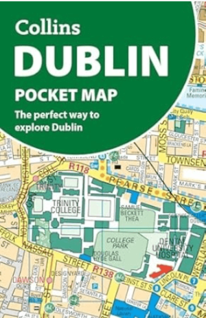
Stadsplattegrond Dublin pocket map - Harper Collins • 9780008716547
Stadskaart Dublin pocket map - Harper Collins Productomschrijving: Handy little full color Collins map of central Dublin with a high level of detail. Map at a scale of 1:7,800 (8 inches to 1 mile). Clear, detailed, full color Collins mapping is presented in a handy format ideal for the pocket or handbag. It is excellent value and covers the most visited area of central Dublin. It is an es…

Landkaart Wegenkaart Wild Atlantic Way - Harper Collins • 9780008580001
WegenkaartThe Wild Atlantic Way - Harper Collins Productomschrijving: Handy full colour map of Ireland’s Wild Atlantic Way with a high level of detail. Clear mapping of the full 2500 km (over 1500 miles), showing the road network and places of interest.Ideal for tourists, locals, hikers and adventurers. Places of interest marked including famous film locations.Excellent value and very det…
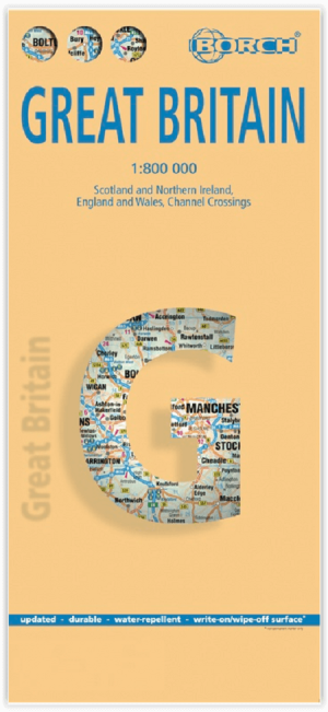
Landkaart Groot-Brittannië - Borch • 9783866093157
Wandelkaart Landkaart Groot-Brittannië - Borch Productomschrijving: Our soft-laminated folded map of Great Britain in the 13th edition shows: Scotland and Northern Ireland 1:800 000, England and Wales 1:800 000, Channel Crossings 1:800 000, Great Britain and Ireland administrative, Europe time zones. Borch Maps are easy to fold, durable and water-repellent with a wipeable surface. Borch Ma…
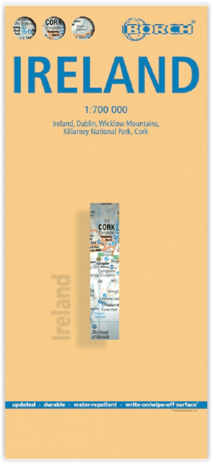
Landkaart Ierland - Borch • 9783866093232
Wandelkaart Landkaart Ierland - Borch Productomschrijving: Our soft-laminated folded map of Ireland in the 18th edition shows: Ireland 1:700 000, Dublin 1:15 000, Cork 1:8 000, Killarney National Park 1:100 000, Wicklow Mountains 1:350 000 and Ireland administrative. Borch maps are easy to fold, durable and water-repellent with a wipeable surface. Borch Maps show hotels, museums, monuments…
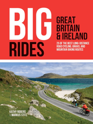
Fietsgids Big Rides- Great Britain & Ireland - Vertebrate Publ. • 9781839810725
Big Rides- Great Britain & Ireland - Vertebrate Productomschrijving: 25 of the best long-distance road cycling, gravel and mountain biking routes Big Rides: Great Britain & Ireland features twenty-five long-distance cycling trails in England, Scotland, Wales, Northern Ireland and Ireland, and includes a general overview of the trails, specific technical information, overview mapping, …
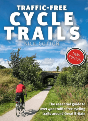
Traffic-Free Cycle Trails around Great Britain - Vertebrate Publ. • 9781912560769
Traffic-Free Cycle Trails around Great Britain - Vertebrate Productomschrijving: The essential guide to over 400 traffic-free cycling trails around Great Britain Traffic-Free Cycle Trails by Nick Cotton contains over 400 cycle routes in Great Britain. This book includes a great variety of routes on former railway paths, canal towpaths and forest trails in England, Scotland and Wales, w…

Fietsgids Great British Bike Rides - Vertebrate Publ. • 9781906148553
Great British Bike Rides - Vertebrate Productomschrijving: 40 classic routes for road cyclists Great British Bike Rides by Dave Barter brings together 40 of the best road rides in England, Scotland and Wales, searching out the country's most celebrated routes, toughest climbs and scenic roads. Features detailed route information, bespoke mapping and a statistical breakdown of every det…
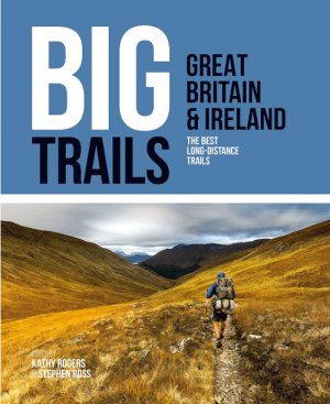
Wandelgids Big Trails DEEL 1 Great Britain & Ireland - Vertebrate • 9781839810008
Big Trails, Great Britain & Ireland - Vertebrate Productomschrijving: The best long-distance trails Big Trails: Great Britain & Ireland features 25 long-distance trails in England, Scotland, Wales, Northern Ireland and Ireland, and includes a general overview of the trails, specific technical information, overview mapping, key information and stunning photography. Big Trails: Great…

Wandelgids Big Trails DEEL 2 Great Britain & Ireland - Vertebrate • 9781839810459
Big Trails DEEL 2 Great Britain & Ireland - Vertebrate Publ. Productomschrijving: More of the best long-distance trails Big Trails: Great Britain & Ireland Volume 2 features twenty-five long-distance trails in England, Scotland, Wales, Northern Ireland and Ireland, and includes a general overview of the trails, specific technical information, overview mapping, key information and stun…
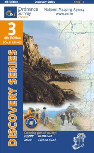
Wandelkaart 3 County Donegal North East & Derry - OSI Ireland • 9781912140008
Wandelkaart Donegal North East & Derry - OSI Ireland Productomschrijving: Ontdek Ierland met de Discovery Series Wandelkaarten van Ordnance Survey Ireland. De Discovery Series wandelkaarten van Ordnance Survey Ireland (OSi) zijn dé keuze voor wandelaars, fietsers en avonturiers die Ierland echt willen verkennen. Deze hoogwaardige topografische kaarten bieden een gedetailleerd en nauwke…
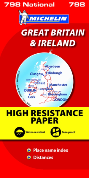
Landkaart Wegenkaart 798 Groot-Brittannië & Ierland - Michelin • 9782067137998
Wegenkaart Groot-Brittannië & Ierland - Michelin Productomschrijving: Deze Nationale kaart van Groot-Brittannië & Ierland, biedt een gedetailleerd overzicht van alle plaatsen. het wegennet wordt verfijnd aangeduid met allerhande symbolen, en voorziet in alle behoeftes, of u op zoek bent naar specifieke wegen, of zich snel uit de voeten wil maken, de plaatsnamenindex, en toeristische inform…
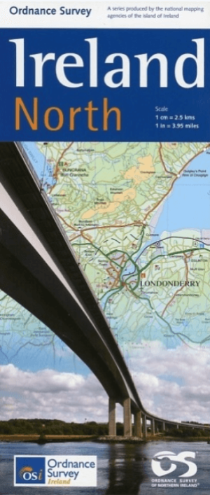
Landkaart Wegenkaart H1 Ierland Noord - OSI • 9781905306619
Wegenkaart Noord Ierland - OSI Productomschrijving: Ordnance Survey Ireland North Road map at 1:250,000 approx 4 miles to the Inch This map shows detailed road classification, altitude colouring and tourist information, published by OSI, the Ordnance Survey of Ireland. Topography of the island is shown by altitude colouring, with additional spot heights and names of mountain or hi…
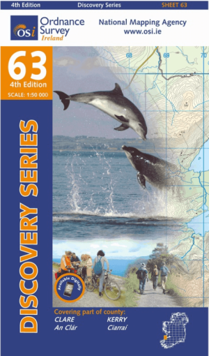
Wandelkaart 63 County Clare & Kerry - OSI • 9781907122927
Wandelkaart Counties Clare & Kerry - OSI Productomschrijving: Ontdek Ierland met de Discovery Series Wandelkaarten van Ordnance Survey Ireland. Omvat de Counties: Clare & Kerry. De Discovery Series wandelkaarten van Ordnance Survey Ireland (OSi) zijn dé keuze voor wandelaars, fietsers en avonturiers die Ierland echt willen verkennen. Deze hoogwaardige topografische kaarten bieden …

Stadsplattegrond Discovery Series Cork city Ireland - OSI • 9781908852748
Stadsplattegrond Cork city Ireland - OSI Productomschrijving: Een gedetailleerde stadskaart van Cork City & omgeving. Compleet met street index, places of interest & City Centre details.

Stadsplattegrond Discovery Series Galway city Ireland - OSI • 9781908852731
Stadskaart Galway city Ireland - OSI Productomschrijving: Galway on an indexed street plan at 1:12,000 from Ordnance Survey of Ireland with an enlargement showing the city centre in greater detail. Street index, placed under the main map, which lists streets with their names in both Irish and English. OSI street plans highlight main traffic arteries in each town, national primary and …
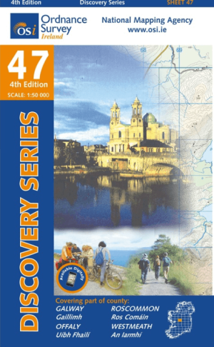
Wandelkaart 47 County Galway, Offaly, Roscommon & Westmeath - OSI • 9781908852663
Wandelkaart County Galway, Offaly, Roscommon & Westmeath - OSI Productomschrijving: Ontdek Ierland met de Discovery Series Wandelkaarten van Ordnance Survey Ireland. De Discovery Series wandelkaarten van Ordnance Survey Ireland (OSi) zijn dé keuze voor wandelaars, fietsers en avonturiers die Ierland echt willen verkennen. Deze hoogwaardige topografische kaarten bieden een gedetailleer…

Stadsplattegrond Discovery Series Kilkenny city - OSI • 9781908852779
Stadskaart Kilkenny city - OSI Productomschrijving: Kilkenny Street Map at a scale of 1:7,000. Detailed overvieuw of City center, street index and more. Large fold out street map with street name index

Wandelkaart 32 County Mayo, Roscommon & Sligo - OSI Ireland • 9781908852700
Wandelkaart County Mayo, Roscommon & Sligo - OSI Productomschrijving: Ontdek Ierland met de Discovery Series Wandelkaarten van Ordnance Survey Ireland De Discovery Series wandelkaarten van Ordnance Survey Ireland (OSi) zijn dé keuze voor wandelaars, fietsers en avonturiers die Ierland echt willen verkennen. Deze hoogwaardige topografische kaarten bieden een gedetailleerd en nauwkeurig …

Wandelkaart 35 County Cavan, Louth, Meath, Monaghan - OSI • 9781908852724
Wandelkaart Countys Cavan, Louth, Meath, Monaghan - OSI Productomschrijving: Ontdek Ierland met de Discovery Series Wandelkaarten van Ordnance Survey Ireland. De Discovery Series wandelkaarten van Ordnance Survey Ireland (OSi) zijn dé keuze voor wandelaars, fietsers en avonturiers die Ierland echt willen verkennen. Deze hoogwaardige topografische kaarten bieden een gedetailleerd en nau…

Stadsplattegrond Discovery Series Limerick city Ireland - OSI • 9781908852823
Stadskaart Limerick city Ireland - OSI Productomschrijving: Limerick Street Map at a scale of 1:13,000 Large Fold Out Street map including street names and index.

Wandelkaart 74 County Cork, Limerick, Tipperary & Waterford - OSI • 9781908852908
Wandelkaart County Cork, Limerick, Tipperary & Waterford - OSI Productomschrijving: Ontdek Ierland met de Discovery Series Wandelkaarten van Ordnance Survey Ireland. Omvat de Counties: Cork, Limerick, Tipperary & Waterford De Discovery Series wandelkaarten van Ordnance Survey Ireland (OSi) zijn dé keuze voor wandelaars, fietsers en avonturiers die Ierland echt willen verkennen. De…
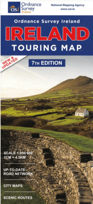
Landkaart Wegenkaart Discovery Ierland touring map - OSI • 9781908852892
Wegenkaart Discovery Ierland touring map - OSI Productomschrijving: A folded map covering the whole of the island of Ireland published by Ordnance Survey Ireland. - Clear easy to read mapping, with tourist information symbols for a variety of attractions - Up to Date Road Network and includes a placename Index. - Includes a Distance Chart in Kms. - Distances in Kms marked across…

Wandelgids 100 outstanding British Walks - Ordnance Survey • 9780319090862
100 outstanding British Walks - OS Productomschrijving: Deze gloednieuwe wandelgids van Ordnance Survey, brengt u een hoop prachtige wandelingen over het ganse Britse landschap verdeeld. Onderaan vindt u de lijst, opgedeeld in de verschillende regio's van de Britse eilanden. Engelse omschrijving: This magnificent compendium of outstanding British walks brings together the finest sele…

Landkaart Wegenkaart Ierland driving map - Ordnance Survey • 9781908852885
Wegenkaart Ierland driving map - OSI Productomschrijving: A folded map covering the whole of the island of Ireland published by Ordnance Survey Ireland. Clear easy to read mapping. Up to Date Road Network and includes a placename Index. Includes a Distance Chart in Kms. Distances in Km marked across the map.
Toesristisch Ierland
Toesristisch Ierland is bij velen bekend voor zijn vele historische overblijfselen uit het Keltische tijdperk, voor de typische kliffen langs de kusten en ook voor zijn gist zwarte Guinness bier. Een toeristische trekpleister zijn bijvoorbeeld de kliffen van Moher. Ierland is als wandelland een absolute aanrader. Vooral de kuststreek van Ierland is voor wandelaars ronduit spectaculair en vergelijkbaar met de kustregio’s van de Schotse westkust. UIteraard kunt u Ierland leren kennen met een degelijke Europese Reisgids in handen van Bibliotrek.
In Ierland zijn er ook Historische fiets- en wandelroutes te vinden, een Dikke 44 National trails zijn hier van toepassing. Specifieke plaatsen waar deze routes langskomen behoren toe aan de lijst van meest bezochte toeristische locaties. De stad Belfast, de Giant’s Causeway aan de kust, filmlocaties van Game of Thrones, de touwbrug van Carrick-a-Rede, de Cliffs of Moher, de stad Cork, de Wicklow Mountains, Killarney National Park, de Ring of Kerry, Skellig Michael & Galway. Dit zijn enkele van de meest bezocht toeristische locatie op het eiland van Ierland. Ierland is onderverdeeld in 26 graafschappen, Counties genoemd. Je bezoekt ze allemaal, en zo krijgt een zicht op het Ierse leven, of Irish life zeg maar.
Wandelroutes in Ierland
Wandelroutes in Ierland met de provincies Leinster, Munster, Connacht en Ulster. De republiek Ierland is onderverdeeld in 26 graafschappen, Counties genoemd. Ook in de regio Noord-Ierland zijn er nog eens 6 graafschappen. Het verschil tussen Ierland en Noord-Ierland is eigenlijk niet echt groot, ondanks het feit dat Noord-Ierland dus volledig tot het Verenigd Koninkrijk behoort.
Dublin is de hoofdstad van de republiek Ierland. Belfast is de grootste stad van Noord-Ierland. De republiek Ierland heeft enkele bezienswaardigheden die echt de moeite lonen. Zo zijn er de Araneilanden, de Cliffs of Moher, het voormalige klooster Glendalough en de Kylemore Abbey. Uniek zijn ook de neolithische vondsten van Brú na Bóinne gelegen aan de rivier de Boyne en de zogenaamde Skellig-eilanden. Beiden staan op de UNESCO werelderfgoedlijst. Mis deze bij een bezoek aan Ierland dus zeker niet. Wandelroutes kunt u afleggen met de Wandelkaarten Ierland, of met de Wandelgidsen Ierland, en toeristische informatie vindt u op de pagina Reisgidsen Ierland.