

Fietsgids South West Mountain Biking - Vertebrate Publ.
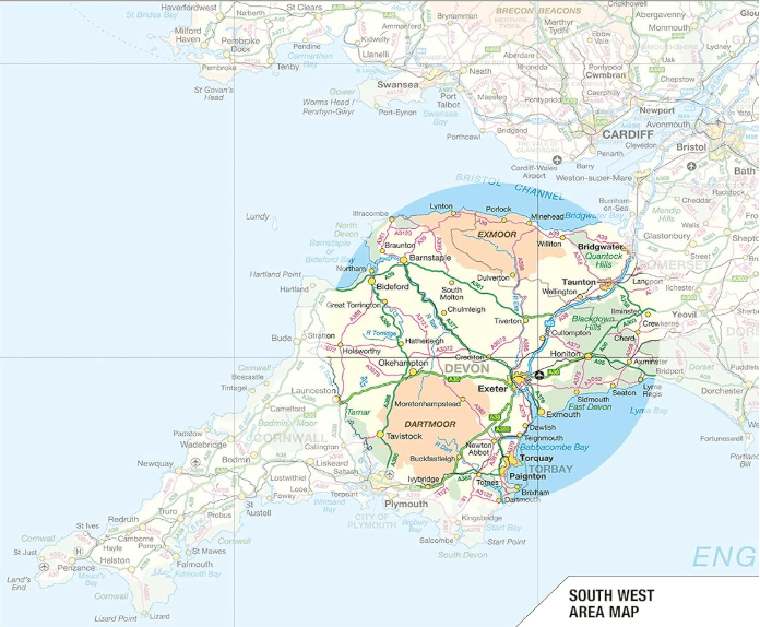
Quantocks AONB - Exmoor NP & Dartmoor NP
Korte omschrijving
Fietsgidsen South West England van Vertebrate Publishing. Ideaal voor tochten in England.
South West Mountain Biking - Vertebrate Productomschrijving: A guide to the mountain biking in the south west of England. It features 26 of the best mountain bike rides in Dartmoor, Exmoor ...

Specificaties
- Uitgever: Vertebrate Publishing
- ISBN-13: 9781906148263
- HOOFDCATEGORIEËN: Fietsgids
- Activiteiten: Fietsen / VTT / MTB
- Auteur: Nick Cotton, Tom Fenton
- Regio: South West England
- Land: England
- Nationale parken: Dartmoor NP, Devon England, Exmoor NP, Devon England
- AONB - Area of Outstanding Beauty: Quantock Hills AONB
- Taal: Engels
- VTT / MTB: Mountainbike
Volledige omschrijving
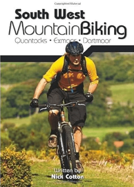
South West Mountain Biking - Vertebrate
Productomschrijving: A guide to the mountain biking in the south west of England. It features 26 of the best mountain bike rides in Dartmoor, Exmoor and the Quantock Hills, between 10km and 30km in length, suitable for different levels of mountain bikers. It also features industry-standard Ordnance Survey mapping.
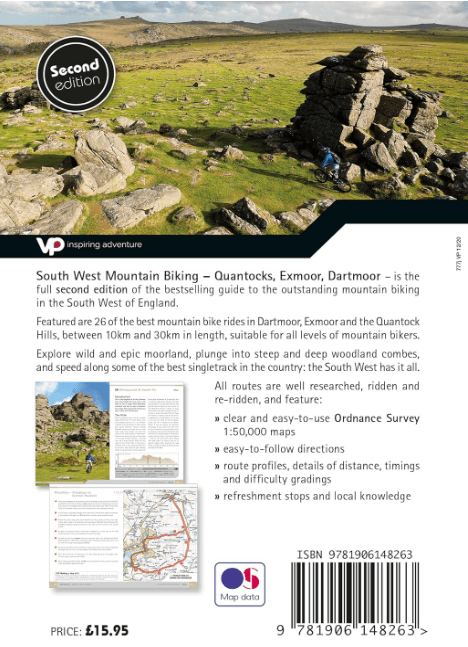
South West Mountain Biking – Quantocks, Exmoor, Dartmoor is the full, revised second edition of the bestselling guide to the outstanding mountain bike riding in the South West of England. Featured are 26 of the best mountain bike rides in Dartmoor, Exmoor and the Quantock Hills, between 10 and 30 kilometres in length, suitable for all levels of mountain bikers.
All route information has been thoroughly checked for this new edition to give the most up to date and – currently – the only comprehensive guidebook to this great area. Explore wild and epic moorland, plunge into steep and deep woodland combes, and speed along some of the best singletrack in the country: the South West has it all.
As with most Vertebrate MTB guidebooks, this new edition features industry standard Ordnance Survey mapping, and is illustrated with stunning, all new action photography. This new addition also features route altitude profiles. Researched, ridden and written by experienced authors Nick Cotton (Dartmoor and Exmoor) and Tom Fenton (Quantocks) each route features clear and easy to use Ordnance Survey 1:50,000 maps, easy to follow directions, details of distance, timings and difficulty gradings, route profiles, and refreshment stops and local knowledge. A detailed Appendix provides essential information on where to eat, drink and sleep.
Artikelen uit dezelfde regio

Reisgids Go Slow Cotswolds (AONB) - Bradt travel guides • 9781804691717
Reisgids Cotswolds - Bradt Productomschrijving: In deze nieuwe, grondig bijgewerkte 3e editie van Bradt's The Cotswolds, onderdeel van Bradt's kenmerkende 'Slow travel' serie van gidsen over Britse regio's, deelt lokale inwoner en ervaren reisschrijfster Caroline Mills haar favoriete plekken in een regio die onverminderd populair is. Op basis van meer dan 50 jaar wonen in de Cotswolds, en …

Reisgids Bath- Bristol & Somerset - Rough Guides • 9781839059841
Bath- Bristol & Somerset - Rough Guides Productomschrijving: De regio van somerset in Zuid west Engeland, biedt u in deze gids de uitlopers van Exmoor nationaal park, Bath, Bristol en de volledige regio Somerset. Engelse omschrijving: From the genteel Georgian terraces of Bath to the wilderness expanses of Exmoor NP, the fully updated The Rough Guide to Bath, Bristol & Somerset provide…

Wandelgids Part 3 SWCP Map Booklet PLymouth to pool - Cicerone • 9781786312006
Map booklet South West Coast Path - Cicerone Productomschrijving: Kaart van een deel van het zuidelijke deel van het 630 mijl (1014 km) lange South West Coast Path National Trail. Omvat het pad van Plymouth naar Poole langs de kustlijn van Devon en Dorset. Dit handige en compacte boekje met Ordnance Survey 1:25.000 kaarten toont de route en biedt alle kaarten die je nodig hebt om het pad i…
Wandelgids Great Walks on the England Coast Path - Cicerone • 9781852849894
Great Walks on the England Coast Path - Cicerone Engelse omschrijving: At around 4500 km (2800 miles), the England Coast Path is the longest coastal trail in the world. This inspirational large-format guide presents a handpicked selection of 30 highlight sections, offering a taste of England's stunning and diverse shoreline. Routes range from 9 to 45km, spanning between 3 hours and 2 days,…
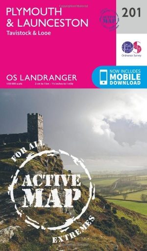
Wandelkaart 201 Plymouth & Launceston England - OSI • 9780319475249
Wandelkaart Plymouth & Launceston - South West England Productbeschrijving: Kaart nummer 201 in de OS Landranger kaarten reeks, is de ideale kaart om te gebruiken bij het plannen van excursies naar Plymouth, Launceston, Tavistock en Looe. Plymouth houdt vele attracties met zijn rijke maritieme geschiedenis en het aantrekkelijke landschap eromheen. Hoogtepunten van het gebied zijn onder and…