

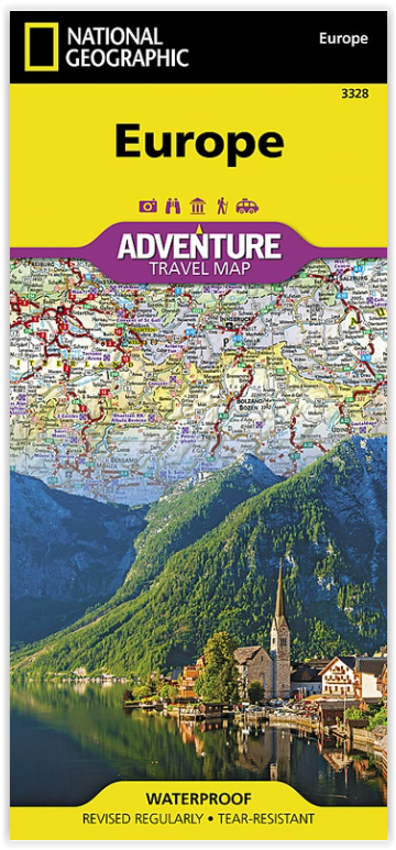
Landkaart Wegenkaart 3328 Europa - Nat Geo
All european roads and sites

Korte omschrijving
Wegen- & stadskaarten Europa van National Geographic. Ideaal voor tochten in Europa.
Wegenkaart Europa - Nat Geo Productomschrijving: National Geographic's Europe Adventure Map provides global travelers with the perfect combination of function and perspective. Designed to me...

Specificaties
- Uitgever: National Geographic
- ISBN-13: 9781566957342
- HOOFDCATEGORIEËN: Wegenkaart - Landkaart
- Activiteiten: Street/Road maps & city plans
- Auteur: National Geographic
- Regio: Europa
- Land: Europa
- Waterafstotende kaart: Nat Geo waterproof series
- TOPO's & Stafkaarten: Topografisch wandelen
- Schaal: 1:3600000
- Taal: Engels
- Reeks/Serie: NAT GEO Adventure travel maps
Volledige omschrijving
Wegenkaart Europa - Nat Geo
Productomschrijving: National Geographic's Europe Adventure Map provides global travelers with the perfect combination of function and perspective. Designed to meet the needs of adventure travelers with its detailed, accurate information, this map includes the location of cities and towns with a user-friendly index and a clearly marked road network complete with distances and designations for roads/motorways, plus secondary routes for those seeking to explore off the beaten path.
Europe is home to hundreds of UNESCO World Heritage Sites with both cultural and natural significance. Each of these sites is shown on the map and also listed in a handy index to help you quickly find your next voyage into the historic past. The north side of the printed map includes the northern extents of Europe including Scandinavia, Finland and Iceland. The southern side of the printed map includes the majority of mainland Europe and the countries of the Mediterranean with each country highlighed in its own color. Major roads and ferry routs help you navigate this densely populated continent with thousands of towns from mega-cities such as London and Paris to small towns in the hinterlands of Bulgaria.
Every Adventure Map is printed on durable synthetic paper, making them waterproof, tear-resistant and tough — capable of withstanding the rigors of international travel.
Overzichtskaarten

NAT GEO Adventure maps EUROPE 3302 - 3328
NAT GEO Adventure maps EUROPE 3302 - 3328
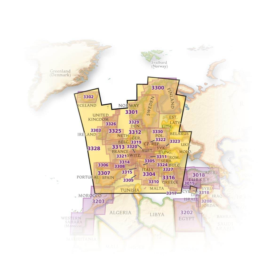
Producten op de overzichtskaart
Klik op een product om naar de detailpagina te gaan.
- Landkaart Wegenkaart 3301 Zweden Zuid & Noorwegen - Nat Geo
- Landkaart Wegenkaart 3302 Ijsland - Nat Geo
- Landkaart Wegenkaart 3303 Ierland - Nat Geo
- Landkaart Wegenkaart 3304 Italië - Nat Geo
- Landkaart Wegenkaart 3305 Toscane - Nat Geo
- Landkaart Wegenkaart 3306 Spanje Noord - Nat Geo
- Landkaart Wegenkaart 3307 Spanje & Portugal - Nat Geo
- Landkaart Wegenkaart 3308 Pyreneeën & Andorra - Nat Geo
- Landkaart Wegenkaart 3309 Sardinië - Nat Geo
- Landkaart Wegenkaart 3312 Adventure map Duitsland - Nat Geo
- Landkaart Wegenkaart 3313 Adventure map Frankrijk - Nat Geo
- Landkaart Wegenkaart 3314 Adventure map Zuid-Frankrijk - Nat Geo
- Landkaart Wegenkaart 3315 Adventure map Corsica - Nat Geo
- Landkaart Wegenkaart 3316 Adventure map Griekenland - Nat Geo
- Landkaart Wegenkaart 3317 Adventure map Kreta - Nat Geo
- Landkaart Wegenkaart 3318 Adventure map Cyprus - Nat Geo
- Landkaart Wegenkaart 3319 Adventure map Oostenrijk - Nat Geo
- Landkaart Wegenkaart 3320 Adventure map Zwitserland - Nat Geo
- Landkaart Wegenkaart 3321 De Alpen - Nat Geo
- Landkaart Wegenkaart 3322 Adventure map Tsjechië - Nat Geo
- Landkaart Wegenkaart 3323 Adventure map Slowakije - Nat Geo
- Landkaart Wegenkaart 3324 Adventure map Kroatië - Nat Geo
- Landkaart Wegenkaart 3325 Adventue map Groot-Brittannië - Nat Geo
- Landkaart Wegenkaart 3326 Adventure map Schotland - Nat Geo
- Landkaart Wegenkaart 3327 Westelijke Balkan - Nat Geo
- Landkaart Wegenkaart 3328 Europa - Nat Geo
Artikelen uit dezelfde regio

Fietsgids De mooiste fietsroutes van Europa - Debo Prod. • 9789036644136
De mooiste fietsroutes van Europa - Debo Productomschrijving: Dit boek bevat een overzicht van de meest fascinerende, imponerende en bekendste fietsroutes van Europa. Voor elke fietser – super afgetraind of recreatierijder. Langs de Loire, door de Alpen of van de Noordkaap naar Malta: dit boek bevat internationale routes van het netwerk EuroVelo, maar ook korte tochten in één land. Wat…

Fietskaart France & Europe - Voies vertes & véloroutes - Chamina • 9782844667243
Fietskaart France & Europe - Voies vertes & véloroutes. Productomschrijving: Descriptif Préparez vos aventures à vélo avec un outil clair et complet. Cette carte regroupe les 19 grandes EuroVéloroutes, mais aussi les incontournables circuits et traces nationales, pour des escapades sur mesure où que vous soyez en Europe. Parfaite pour planifier votre voyage en toute sérénité : choisiss…

Plano Politieke Wandkaart Europe 140 x 100 - Lovell Johns • 9781903030806
Wandkaart Europe 136 x 100 - Lovell Johns Productomschrijving: Duidelijke politieke kaart van Europa. Elk land heeft een verschillende kleur waardoor het gemakkelijk is om de internationale grenzen te zien. Schaduweffecten worden gebruikt om de bergen en diepten in de zeeën en oceanen aan te duiden. Alle grote Europese steden zijn op de kaart te vinden en de hoofdsteden van de landen z…
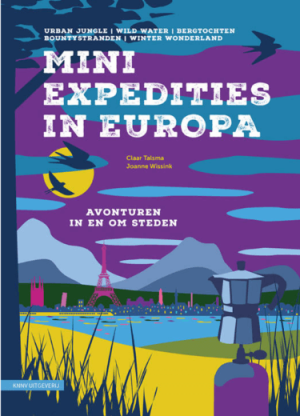
Wandelgids Mini expedities in Europa - KNNV Uitgeverij • 9789050119504
Mini expedities in Europa - KNNV Productomschrijving: Een inspiratieboek voor stedentrips, natuur en treinreizen in Europa. Een stedentrip combineren met een avontuurlijke tocht door de natuur. Het lijkt misschien ongebruikelijk, maar als je met de trein reist is het juist logisch. Op de treinreis van huis naar de bergen moet je ongetwijfeld overstappen in een stad. Tijdens je citytrip is…
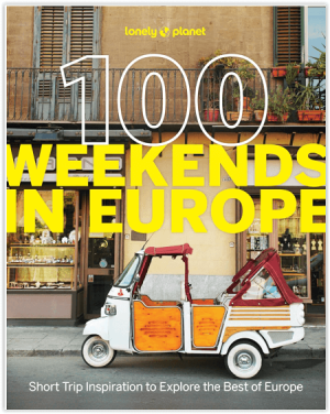
Reisgids Europe - Lonely Planet • 9781837583102
100 Weekens in Europe - Lonely Planet Productomschrijving: Discover the best of Europe - one weekend at a time - with this collection of 100 short trip itineraries with maps to feed your wanderlust and inspire your next getaway. Explore Vienna’s vines, Umbria’s hilltop towns, and Oxford’s literary legends with 100 carefully plotted and mapped travel itineraries featuring epic escapes to di…