

Landkaart Wegenkaart 670 Western Australia State & Suburban - UBD
Ridgewood- Halls Head- North Dandalup- Karragullen and Gleneagle


Korte omschrijving
Wegenkaart Western Australia State & Suburban - Gregory's Productomschrijving: The latest edition of the Western Australia State and Suburban map has been fully revised and updated and incl...

Specificaties
- Uitgever: UBD Gregory's Universal Publishers
- ISBN-13: 9780731933297
- HOOFDCATEGORIEËN: Wegenkaart - Landkaart
- Activiteiten: Street/Road maps & city plans
- Regio: Western Australia
- Land: Australië
- Schaal: 1:2900000
- Editie: 17
- Taal: Engels
- De Australische Regio's: Western Australia
Volledige omschrijving
Wegenkaart Western Australia State & Suburban - Gregory's
Productomschrijving: The latest edition of the Western Australia State and Suburban map has been fully revised and updated and includes:
- Suburban map coverage of Perth and surrounds, north to Ridgewood, south to Halls Head and North Dandalup, and east to the Lakes, Karragullen and Gleneagle (including insets of Yanchep and Pinjarra) with an index to the suburbs and localities included on this map
- State map and index to towns, localities and homesteads with a section on South West Western Australia at a scale of 1: 870 000.
- With the quality and clarity you have come to expect from a UBD Gregorys map this is an essential tool for navigating your way around Western Australia, Perth, Rockingham and Mandurah.
Artikelen uit dezelfde regio

Landkaart Wegenkaart West & Midden-Westen Australië NP's - Hema • 9321438002109
Landkaart West & Midden-Westen Australië - Hema Produductomschrijving: A regional map of Mid West Western Australia that covers from Cape Range National Park south to Mandurah and as far as Kalgoorlie at a scale of 1:1,250,000 that has camping areas, national parks, fuel supplies and facility symbols marked on the map. On the reverse is region-specific touring information for Wildflower c…
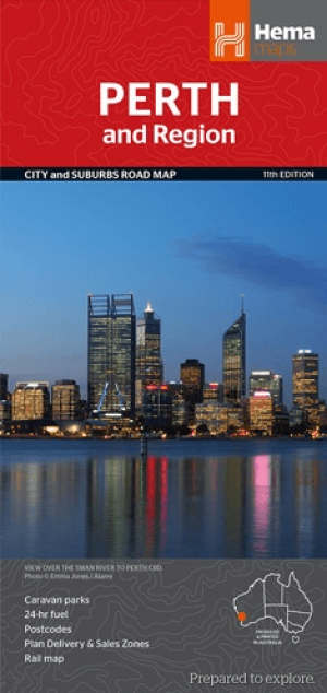
Stadskaart plattegrond Perth & omgeving - Hema Maps • 9781925195163
Stadskaart Perth & omgeving - Hema Productomschrijving: Perth CBD, City & Suburbs Map A map that has the Perth suburbs (1:80,000) and Perth city (1:15,000) maps on one side and the Perth region (1:750,000) and Fremantle (1:20,000) maps on the other. Included is a rail network map of Perth as well as points of interest and accommodation for both Fremantle and Perth. Perth is one of …

Landkaart Wegenkaart Western Australia state handy map - Hema • 9321438001560
Wegenkaart Western Australia state handy map - Hema Productomschrijving: A compact map of Western Australia (WA) for touring throughout the state with a distance grid and index for planning and reference. Marked on the mapping are highways, major and minor roads, camping and rest areas, 24-hour fuel, information centres, picnic areas, caravan parks and lookouts.
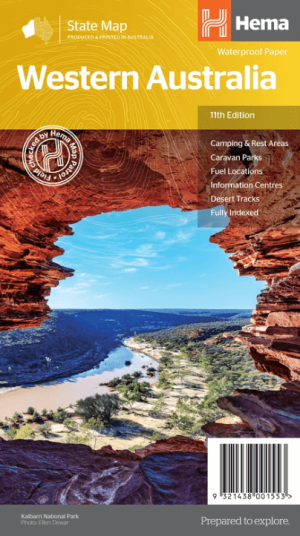
Landkaart Wegenkaart West-Australië state map - Hema Maps • 9321438001553
Wegenkaart West-Australië state map - Hema Productomschrijving: A map of Western Australia (WA) for touring throughout the state that has camping and rest areas, 24-hour fuel and points of interest marked on the mapping. On the reverse are CBD and through road maps of Perth in addition to inset maps of Leeuwin-Naturaliste National Park, Cape Range National Park, Nambung National Park, …

Kampinggids Perth & The South West 4WD + Camping escapes - Hema • 9781865006215
Wegenatlas Kampinggids Perth & The South West Productomschrijving: 4WD + Camping Escapes – Perth & the South West is a guide to the best four-wheel driving and camping locations in South West Western Australia. Each regional section outlines the area’s 4WD Tracks and Featured Camping Areas, with a Camping Directory at the end to provide comprehensive coverage of other camping areas. T…