

Landkaart Wegenkaart West-Australië state map - Hema Maps
Leeuwin-Naturaliste NP - Cape Range NP - Nambung NP

Korte omschrijving
Wegenkaart West-Australië state map - Hema Productomschrijving: A map of Western Australia (WA) for touring throughout the state that has camping and rest areas, 24-hour fuel and points of i...

Specificaties
- Uitgever: Hema Maps
- ISBN-13: 9321438001553
- HOOFDCATEGORIEËN: Wegenkaart - Landkaart
- Activiteiten: Street/Road maps & city plans
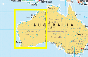
- Regio: West Australië, Western Australia
- Land: Australië
- Schaal: 1:2500000
- Editie: 11
- Taal: Engels
- Reeks/Serie: State maps, Hema
- De Australische Regio's: Western Australia
Volledige omschrijving
Wegenkaart West-Australië state map - Hema
Productomschrijving: A map of Western Australia (WA) for touring throughout the state that has camping and rest areas, 24-hour fuel and points of interest marked on the mapping.
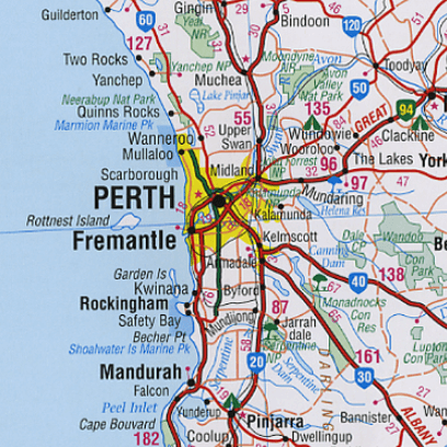
On the reverse are CBD and through road maps of Perth in addition to inset maps of Leeuwin-Naturaliste National Park, Cape Range National Park, Nambung National Park, Francois Peron National Park, Purnululu National Park, Walpole-Nornalup National Park and Karijini National Park.
Also included are listed national parks and information centres within Western Australia.
Artikelen uit dezelfde regio
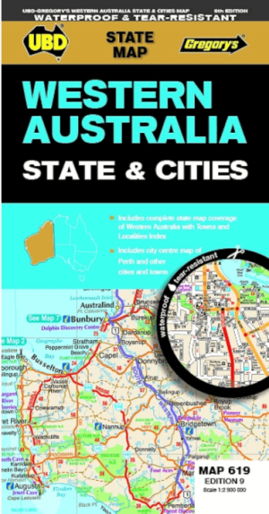

Landkaart Wegenkaart 619 Western Australia State & Cities - UBD • 9780731933198
Wegenkaart Western Australia State & Cities - Gregory's Productomschrijving: The latest edition of the Western Australia State and Cities map has been fully revised and updated. It includes a comprehensive state map with an index to the towns and localities at a scale of 1: 2.900.000 plus more detailed coverage of South West Western Australia at a scale of 1 : 1.870.000 on one side. …

Landkaart Wegenkaart 670 Western Australia State & Suburban - UBD • 9780731933297
Wegenkaart Western Australia State & Suburban - Gregory's Productomschrijving: The latest edition of the Western Australia State and Suburban map has been fully revised and updated and includes: - Suburban map coverage of Perth and surrounds, north to Ridgewood, south to Halls Head and North Dandalup, and east to the Lakes, Karragullen and Gleneagle (including insets of Yanchep and Pi…

Landkaart Wegenkaart Australië Indigenous Journeys Map - Hema Map • 9781922668936
Wegenkaart Australië Indigenous Journeys Map - Hema Maps Productomschrijving: Australië Indigenous Journeys Map hema 1:5.5M Ontdek de zanglijnen van de oudste levende cultuur ter wereld Al meer dan 65.000 jaar bewandelen Aboriginals en Torres Strait Islanders - de traditionele eigenaars van Australië - het land, smeden handelsroutes, delen kennis en zorgen voor het land. De Indigenou…
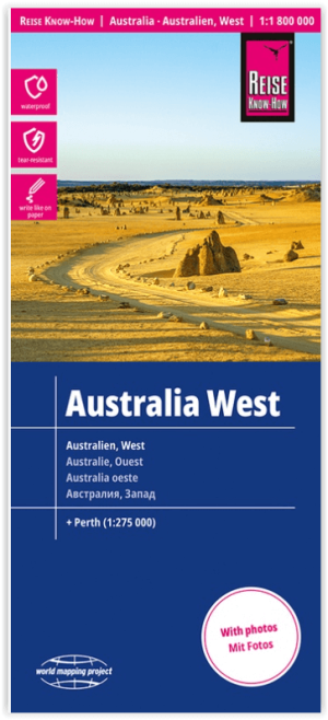
Landkaart Wegenkaart Australië West - Reise Know How • 9783831774739
Wegenkaart West Australië - Reise Know How Productomschrijving: Reis Know-How-kaarten (wereldkaart-projectreeks) zijn gemakkelijk te lezen, waterdichte en zeer duurzame reiskaarten die speciaal zijn ontworpen voor dagelijks gebruik op de weg. Omvat: The Northern Territories, Western Australia & Southern Australia. Onze kaarten combineren state-of-the-art, GPS-compatibele cartograf…

Stadsplattegrond 662 Perth City Streets & Suburbs - UBD GRegory's • 9780731933433
Stadskaart Perth City Streets & Suburbs - UBD GRegory's Productomschrijving: The latest edition of the Perth City Streets and Suburbs city map has been fully revised and updated and includes detailed street level mapping of Perth and surrounding suburbs at a scale of 1: 25 000 with coverage from Westminster in the north, Coolbellup in the south, Maylands in the east and along the coast fro…