

Moutainbike Cotswold Gravel & Mountain AONB - Goldeneye
18 Gravel & Mountain Bike Routes

Korte omschrijving
Fietskaarten Somerset South West England, Warwickshire, West Midlands, Wiltshire, West England, Oxfordshire west England, Worcestershire, West England en Gloucestershire, Egland van Goldeneye. Ideaal voor tochten in England.
Moutainbike map Cotswold - Goldeneye Productomschrijving: Cotswold Gravel & Mountain Bike Routes: The Ultimate Off-Road Experience - Gravel & Mountain Bike Routes 18 (Paperback) When mo...

Specificaties
- Uitgever: Goldeneye
- ISBN-13: 9781859653135
- HOOFDCATEGORIEËN: Fietskaart
- Activiteiten: Fietsen / VTT / MTB
- Regio: Gloucestershire, Egland, Oxfordshire west England, Somerset South West England, Warwickshire, West Midlands, Wiltshire, West England, Worcestershire, West England
- Land: England
- AONB - Area of Outstanding Beauty: Cotswolds AONB
- Schaal: 1:47700
- Editie: 6
- Taal: Engels
- De Engelse Graafschappen: Gloucestershire, Oxfordshire, Somerset, Warwickshire, Wiltshire, Worcestershire
- VTT / MTB: Mountainbike
Volledige omschrijving
Moutainbike map Cotswold - Goldeneye
Productomschrijving: Cotswold Gravel & Mountain Bike Routes: The Ultimate Off-Road Experience - Gravel & Mountain Bike Routes 18 (Paperback)
When mountainbiking in the Cotswolds, in an Area of Outstanding Natural Beauty of AONB area, a lot of sportsfanatics & MTB fanatics are very interested, and cannot go wrong with this new Goldeneye mountainbikie map.
Artikelen uit dezelfde regio

Wandelkaart 191 Banbury- Bicester & Chipping Norton- OSI • 9780319243848
Wandelkaart Banbury- Bicester & Chipping Norton - Oxfordshire Omvat ook: Brackley Productomschrijving: Kaart nummer 191 in de OS Explorer kaarten reeks heeft betrekking op een gedeelte van de Cotswolds AONB, de Macmillan Way en Wychwood way recreative path. Hoogtepunten van het gebied zijn de steden van Banbury, Chipping Norton, Brackley Bicester, en het Oxford Canal Walk. De OS Explor…

Wandelkaart 184 Salisbury & The Plain- Wiltshire England - OSI • 9780319262825
Wandelkaart Salisbury & The Plain - Wiltshire England Productbeschrijving: Kaart nummer 184 in de OS Landranger kaarten reeks, is ideaal voor het plannen van uitstapjes in- en rond het gebied van Salisbury. Grote open ruimten zijn in overvloed in dit gebied, zodat bezoekers van het gebied zullen genieten van spectaculaire uitzichten. Hoogtepunten van het gebied zijn onder andere: Stoneheng…
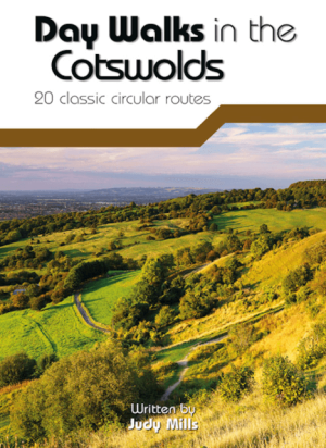
Wandelgids Day Walks in the Cotswolds AONB - Vertebrate Publ. • 9781910240991
Day Walks in the Cotswolds AONB - Vertebrate Productomschrijving: Day Walks in the Cotswolds by Judy Mills features 20 circular routes suitable for hillwalkers of all abilities. Together with stunning photography, each route features Ordnance Survey 1:25,000 maps, easy-to-follow directions, distance and navigation information, refreshment stops and local information. Split across thre…

Wandelkaart 170 Abingdon & Wantage - Oxfordshire - OSI • 9780319243633
Wandelkaart Abingdon & Wantage - Oxfordshire England Productbeschrijving: 170 - Kaart van Abingdon, Wantage & Vale of White Horse - Kaart nummer 170 in de OS Explorer reeks heeft betrekking op het Vale of White Horse en Uffington, North Wessex Downs AONB, het Gemeenschappelijke grote Westelijk bos en een klein deel van de Chiltern Hills AONB. Ook zijn de nederzettingen van Lechlade on…

Wandelgids The Ridgeway National Trail - Trailblazer Publ. • 9781912716524
The Ridgeway National Trail - Trailblazer Publications Productomschrijving: The Ridgeway: Avebury to Ivinghoe Beacon - 53 maps - 46 colour photos, - 4pp colour flower & butterfly guide An 87-mile (139km) National Trail, the Ridgeway runs from Overton Hill near Avebury in Wiltshire to Ivinghoe Beacon in Buckinghamshire. Part of this route follows Britain’s oldest road, dating b…