
Wandelgids Loch Lomond & the Trossachs walking - Cicerone
70 graded low-level, mid-level and mountain walks


Korte omschrijving
Wandelgidsen Argyll & Bute, Schotland, Stirling, Schotland, Dunbartonshire, Schotland en Loch Lomond, Schotland van CICERONE Press. Ideaal voor tochten in Schotland.
Loch Lomond & the Trossachs walking - Cicerone Productomschrijving: A guide to walking and scrambling routes in the beautiful Loch Lomond and the Trossachs National Park. Over 70 graded low-...


Specificaties
- Uitgever: CICERONE Press
- ISBN-13: 9781786312402
- HOOFDCATEGORIEËN: Wandelgids
- Activiteiten: Wandelen, Hiking & Trekking
- Regio: Argyll & Bute, Schotland, Dunbartonshire, Schotland, Loch Lomond, Schotland, Stirling, Schotland
- Land: Schotland
- Nationale parken: Trossachs NP, Schotland
- Editie: 3
- Taal: Engels
Volledige omschrijving
Loch Lomond & the Trossachs walking - Cicerone
Productomschrijving: A guide to walking and scrambling routes in the beautiful Loch Lomond and the Trossachs National Park. Over 70 graded low-level, mid-level and mountain walks taking in hills, glens and picturesque woodland, as well as all of the region's Munro summits. Highlights include Ben Lui, Ben Lomond, the Cobbler and the Arrochar Alps.
Seasons:
Year round. Spring and early summer are the very best time for high and low level routes. Mountain routes under snow require winter hillwalking experience, clothing and equipment.
Centres:
Aberfoyle, Callander, Lochearnhead, Killin, Tyndrum, Crianlarich, Loch Lomond side, Arrochar, Lochgoilhead. Daywalks can be reached by car from Glasgow, Stirling and Edinburgh.
Difficulty:
Routes (which are graded 1-5 for difficulty) for all abilities, from woodland and lochside routes, to long mountain days, some of which are on rocky ground. The summit of the Cobbler is an exposed scramble.
Must See:
Ben Lomond. Arrochar Alps and The Cobbler. Oakwoods of the Trossachs. Ben Lui. The Cowal peninsular, and the Fairy Knowe at Aberfoyle.
Artikelen uit dezelfde regio
Wandelgids 031 Pathfinder guides Oban, Mull & Kintyre - OS • 9780319091036
Wandelgids Oban, Mull & Kintyre - OS Productomschrijving: This Pathfinder walking route guidebook for Oban, Mull and Kintyre has 28 circular, graded walks created by experienced seasoned walkers. The routes range from extended strolls of two miles (3.2km) to exhilarating hikes of 13 miles (21km), so there is something for people of all abilities. Key routes in this book include Campbel…
Wandelkaart XT25 Arrochar Alps - Harvey maps • 9781851376063
Wandelkaart - XT25 Arrochar Alps - Harvey maps Productomschrijving: De Arrochar Alps zijn een bergketen gelokalliseerd rond de "Loch Long", "Loch Fine" & "Loch Goil" in de Argyl & Bute regio in de schotse Highlands, in het Trossachs nationale park. Gelegen dicht bij de dorpen van Arrochar en Lochgoilhead, op de Cowal Peninsula in de Argyll and Bute regio in Schotland. Deze bergketen is een…
Wandelkaart 14 Tarbert & Loch Seaforth- Argyl & Bute - OSI • 9780319473375
Wandelkaart Tarbert & Loch Seaforth - Argyl & Bute Schotland Productbeschrijving: De OS Landranger-kaart 14 van Tarbert & Loch Seaforth bevat ook Maraig, Scalpay, Loch Langabhat, Grabhair, Caolas Stocinis, alsmede Tioga Moraym. Het ruige terrein rond de loch biedt prachtige landschap en de natuur fotografie kansen evenals wandel- en wandelroutes De OS Landranger kaarten reeks heeft betrekk…
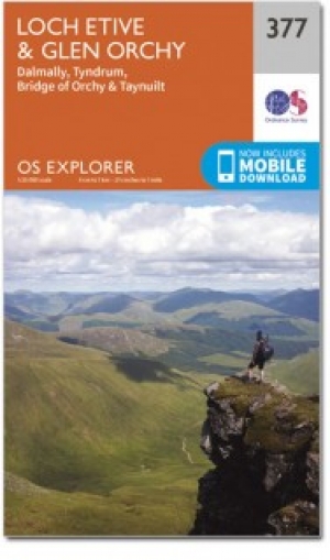
Wandelkaart 377 Loch Etive & Glen Orchy- Schotland- OSI • 9780319246245
Wandelkaart Loch Etive & Glen Orchy - Argyl & Bute Schotland Productbeschrijving: Dubbel zijdige OS Explorer kaart 377 toont Loch Etive aan de Loch Lomond en Trossarchs National Park. Naast een substantieel deel van de West Highland way zijn er 21 Munro's 'om in te nemen' en een deel van de Ben Nevis en Glen Coe National Scenic Area. De OS Explorer kaart voor Loch Etive & Glen Orchy is bes…
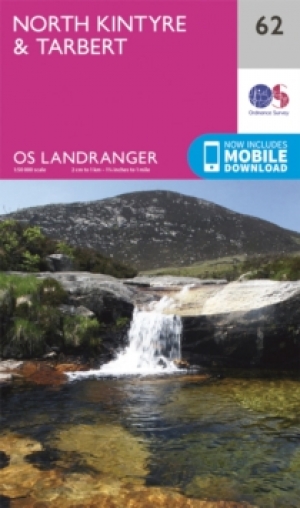
Wandelkaart 62 North Kintyre & Tarbert - Schotland - OSI • 9780319261606
Wandelkaart North Kintyre & Tarbert - Schotland Productbeschrijving: OS Landranger kaart 62 heeft betrekking op Noord Kintyre en de stad van Tarbert, samen met kleinere nederzettingen zoals Ormsary, Ardminish en Grogport. Loch Fyne staat bekend om oesters en Hengelsport, terwijl u wandelt het Kintyre way om te ontdekken van een landschap dat in honderden jaren niet is aanzienlijk veranderd…