

Wandelgids 031 Pathfinder guides Oban, Mull & Kintyre - OS
Campbeltown Loch- the Wishing Tree- Isle of Kerrera- Isle of Ulva


Korte omschrijving
Wandelgidsen Argyll & Bute, Schotland van Ordnance Survey. Ideaal voor tochten in Schotland.
Wandelgids Oban, Mull & Kintyre - OS Productomschrijving: This Pathfinder walking route guidebook for Oban, Mull and Kintyre has 28 circular, graded walks created by experienced seasoned wal...

Specificaties
- Uitgever: Ordnance Survey
- ISBN-13: 9780319091036
- HOOFDCATEGORIEËN: Wandelgids
- Activiteiten: Wandelen, Hiking & Trekking
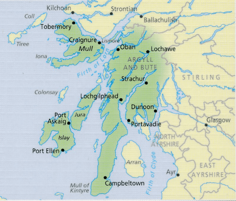
- Regio: Argyll & Bute, Schotland
- Land: Schotland
- Taal: Engels
- Reeks/Serie: Outstanding Circular Walks, Pathfinder Series, OS
Volledige omschrijving
Wandelgids Oban, Mull & Kintyre - OS
Productomschrijving: This Pathfinder walking route guidebook for Oban, Mull and Kintyre has 28 circular, graded walks created by experienced seasoned walkers. The routes range from extended strolls of two miles (3.2km) to exhilarating hikes of 13 miles (21km), so there is something for people of all abilities.
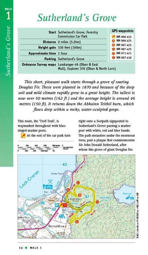
Key routes in this book include Campbeltown Loch, the Wishing Tree, Isle of Kerrera, Isle of Ulva and Ben More. Each route includes the path shown on an extract of the OS Explorer map for the area, route notes, waypoints and keey features to look out for. It's ideal for both visitors and locals alike. Pathfinder Guides are Britain’s best-loved walking guides. Printed with weather-resistant covers featuring durable rounded corners, they are the perfect companion for country walking throughout Britain.
Overzichtskaarten

Overzicht Pathfinder guides - OS
Overzicht Pathfinder guides - OS

Producten op de overzichtskaart
Klik op een product om naar de detailpagina te gaan.
- Wandelgids 001 Pathfinder guides South Devon & Dartmoor NP - OS
- Wandelgids 003 Pathfinder guides Isle of Skye - OS
- Wandelgids 004 Pathfinder guides Cairngorms NP - OS
- Wandelgids 005 Pathfinder guides Cornwall England - OS
- Wandelgids 006 Pathfinder guides Cotswolds AONB - OS
- Wandelgids 007 Pathfinder guides Fort William & Glen Coe - OS
- Wandelgids 008 Pathfinder guides Kent - OS
- Wandelgids 009 Pathfinder guides Exmoor NP & the Quantocks - OS
- Wandelgids 010 Pathfinder guides Snowdonia NP Wales - OS
- Wandelgids 011 Pathfinder guides Dorset England - OS
- Wandelgids 012 Pathfinder New Forest & South Downs NP Hampshire
- Wandelgids 015 Pathfinder guides Yorkshire Dales NP - OS
- Wandelgids 018 Pathfinder guides Brecon Beacons Wales - OS
- Wandelgids 019 Pathfinder guides Dumfries & Galloway - OS
- Wandelgids 020 Pathfinder guides Sherwood Forest - OS
- Wandelgids 022 Pathfinder guides More Lake District - OS
- Wandelgids 023 Pathfinder guides Loch Lomond, Trossachs NP - OS
- Wandelgids 025 Pathfinder guides Thames Valley & Chilterns - OS
- Wandelgids 026 Pathfinder guides Dartmoor National Park - OS
- Wandelgids 027 Pathfinder Perthshire "big county" Angus & Five OS
- Wandelgids 028 Pathfinder guides North York Moors NP - OS
- Wandelgids 029 Pathfinder guides Wye Valley AONB & Forrest of Dean
- Wandelgids 030 Pathfinder guides Loch Ness & Iverness - OS
- Wandelgids 031 Pathfinder guides Oban, Mull & Kintyre - OS
- Wandelgids 034 Pathfinder guides Pembrokeshire Wales - OS
- Wandelgids 035 Pathfinder guides Northumberland- Scottish Borders
- Wandelgids 039 Pathfinder Durham, North Pennines & Tyne & Wear OS
- Wandelgids 041 Pathfinder guides Central Wales - OS
- Wandelgids 042 Pathfinder guides Cheshire England - OS
- Wandelgids 044 Pathfinder guides Essex England - OS
- Wandelgids 045 Pathfinder guides Norfolk - OS
- Wandelgids 046 Pathfinder guides Aberdeen & Royal Deeside - OS
- Wandelgids 047 Pathfinder Edinburgh, Pentlands & Lothians - OS
- Wandelgids 048 Pathfinder guides Suffolk East England - OS
- Wandelgids 049 Pathfinder guides Vale of York East England - OS
- Wandelgids 050 Pathfinder guides Lincolnshire & the Wolds - OS
- Wandelgids 051 Pathfinder guides Cambridgeshire & The Fens - OS
- Wandelgids 053 Pathfinder guides Lancashire NW En England - OS
- Wandelgids 054 Pathfinder guides Hertfordshire & Bedfordshire- OS
- Wandelgids 055 Pathfinder guides Gower, Swansea & Cardiff - OS
- Wandelgids 060 Pathfinder guides Lake District NP - OS
- Wandelgids 063 Pathfinder guides Peak District England - OS
- Wandelgids 064 Pathfinder guides South Pennines - OS
- Wandelgids 065 Pathfinder guides Surrey England - OS
- Wandelgids 066 Pathfinder guides West Sussex & South Downs - OS
- Wandelgids 067 Pathfinder guides South Downs NP & East Sussex- OS
- Wandelgids 068 Pathfinder guides Devon North & Mid - OS
- Wandelgids 069 Pathfinder guides South West England Coastal walks
- Wandelgids 071 Pathfinder guides High Fells of Lakeland - OS
- Wandelgids 073 Pathfinder guides More Peak District - OS
Artikelen uit dezelfde regio

Wandelkaart OL37 Cowal East- Dunoon & Iverary - OSI • 9780319469552
Wandelkaart Cowal East- Dunoon & Iverary - Argyl & Bute Omvat ook: Dunoon & Inveraray Productbeschrijving: Kaart nummer OL 37 omvat Cowal East, Dunoon & Inveraray. Hoogtepunten Loch Lomond en de Trossachs National Park, Argyll Forest Park en Kyles of Bute. Ook Loch Fyne, Holy Loch en West Island way. Deze kaart vervangt de vorige OS Explorer kaart 363 voor dit gebied. De OS Explorer ka…

Wandelkaart 55 Lochgilphead & Loch Awe - OSI • 9780319473788
Wandelkaart Lochgilphead & Loch Awe - Schotland Productbeschrijving: Lochgilphead ligt op een uitbreiding van het prachtige Loch Fyne en is gastheer voor culturele evenementen zoals de beroemde Highland Games en de Schotse serie Yacht Race. Als alternatief kunt OS Landranger kaart 55 reis van Noord naar Loch Awe nemen voor een paar mooie bergwandelingen. Deze kaart van Lochgilphead & Loch …
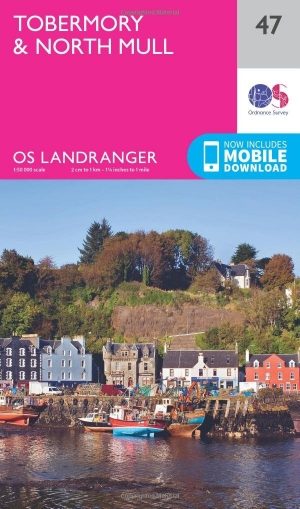
Wandelkaart 47 Tobermory & North Mull - Schotland - OSI • 9780319261453
Wandelkaart Tobermory & North Mull - Schotland Productbeschrijving: OS Landranger kaart 47 heeft betrekking op het eiland Mull, met deel van Coll. Omvat ook Tobermory en Ardnamurchan. Tobermoray is een kleurrijke vissen poort, en bekend als de locatie van toen acht Bells tol door Alistair MacLean. U kunt ook een bezoek brengen aan de Tobermory distilleerderij, De OS Landranger kaarten …
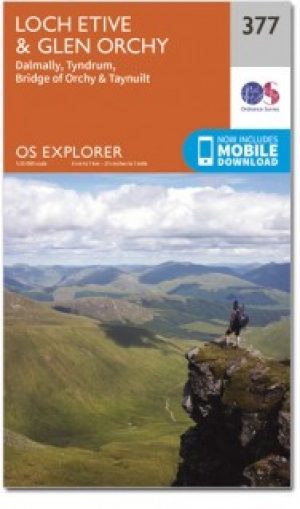
Wandelkaart 377 Loch Etive & Glen Orchy- Schotland- OSI • 9780319246245
Wandelkaart Loch Etive & Glen Orchy - Argyl & Bute Schotland Productbeschrijving: Dubbel zijdige OS Explorer kaart 377 toont Loch Etive aan de Loch Lomond en Trossarchs National Park. Naast een substantieel deel van de West Highland way zijn er 21 Munro's 'om in te nemen' en een deel van de Ben Nevis en Glen Coe National Scenic Area. De OS Explorer kaart voor Loch Etive & Glen Orchy is bes…


Wandelkaart 50 Glen Orchy & Loch Etive- Argyl & Bute - OSI • 9780319473733
Wandelkaart Glen Orchy & Loch Etive - Argyl & Bute Schotland Productbeschrijving: OS Landranger 50 van de kaart serie is de ideale kaart moet worden gebruikt bij het verkennen van het noorden van Loch Fyne tot Black Mount. Deze kaart dekt een deel van Loch Lomond and The Trossachs National Park en een deel van de West highland way door Glen Orchy en Loch Etvie naar het westen De OS Lan…