

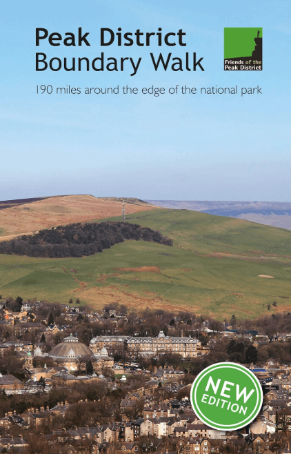
Wandelgids Peak District Boundary Walk - Vertebrate Publ.
190 miles around the edge of the National Park
Korte omschrijving
Wandelgidsen Derbyshire & Peak District, England van Vertebrate Publishing. Ideaal voor tochten in England.
Peak District Boundary Walk - Vertebrate Productomschrijving: 190 miles around the edge of the National Park To celebrate Britain's first national park, supporters of Friends of the Pea...

Specificaties
- Uitgever: Vertebrate Publishing
- ISBN-13: 9781909461536
- HOOFDCATEGORIEËN: Wandelgids
- Activiteiten: Wandelen, Hiking & Trekking
- Auteur: Andrew McCloy
- Regio: Derbyshire & Peak District, England
- Land: England
- Nationale parken: Peak District NP, Derbyshire UK
- Taal: Engels
- De Engelse Graafschappen: Derbyshire, South Yorkshire
- De Nationale Parken: Peak District Nationaal Park, England
Volledige omschrijving
Peak District Boundary Walk - Vertebrate
Productomschrijving: 190 miles around the edge of the National Park
To celebrate Britain's first national park, supporters of Friends of the Peak District have devised a 190-mile walking route around its boundary – the Peak District Boundary Walk. Peak District Boundary Walk includes a detailed route description, Ordnance Survey 1:25,000-scale maps and information about places of interest and local facilities.
Stretching from the moorland tops of the South Pennines to the gentle limestone scenery of the Derbyshire Dales, the route embraces the urban edges of Sheffield and Oldham, as well as Staffordshire's rugged moorland and the undulating slopes of Cheshire. Follow the route along existing footpaths, tracks, quiet lanes, former railway lines and a canal towpath.
Enjoy some quiet and little-known corners of the national park. Walk it in day stages or tackle it all in one go. Peak District Boundary Walk includes a detailed route description, Ordnance Survey 1:25,000-scale maps and information about places of interest and local facilities. Separate features examine some of the key national park issues and how the Friends of the Peak District have campaigned for over 90 years to safeguard our most precious landscapes.
Artikelen uit dezelfde regio

Reisgids Go Slow Peak District National Park - Bradt travel guides • 9781804692509
Reisgids Peak District National Park - Bradt Productomschrijving: This new, thoroughly updated edition of Bradt's Slow Travel Peak District brings a fresh perspective to this much-loved area. Slow down and let expert local author Helen Moat guide you to not just all the well-known places, but away from the crowds to uncover the hidden corners of the Peak District. The author's love of int…
Mountainbike kaart Peak District National Park - Goldeneye • 9781859653012
MTB-kaart Peak District National Park - Goldeneye Productomschrijving: The Peak District National Park is a remarkable place - from the north, the upturned horseshoe of high, gritstone moors and crags of the Dark Peak extend southwards to the east and west of the contrasting limestone plateau of the softer pastoral landscape of the White Peak itself incised by the valleys of the Derbyshir…

Wandelgids Classic Day Walks in the Peak District - Vertebrate • 9781906148492
Classic Day Walks in the Peak District - Vertebrate Productomschrijving: Day Walks in the Peak District – 20 classic circular routes features 20 circular walks, between 8.1 and 12.1 miles (13km and 19.5km), suitable for hillwalkers of all abilities. Local authors Norman Taylor and Barry Pope share walks in their favourite areas of the Peak District National Park including Chatsworth, Chee …

Wandelgids Malvern Hills Short walks - Cicerone • 9781786311399
Wandelgids Malvern Hills Short walks - Cicerone Productomschrijving: Julia Goodfellow-Smith heeft 15 van de beste korte wandelingen in de Malvern Hills AONB gekozen, waaronder Worcestershire Beacon. Elke wandeling is voorzien van goed leesbare Ordnance Survey-kaarten, een duidelijke routebeschrijving en veel afbeeldingen, plus informatie over mooie plekjes en rustplaatsen. Geen moeilijk te…

Wandelgids Peak District-Bakewell & The White Peak - Cicerone • 9781786312570
Wandelgids Peak District-Bakewell & The White Peak - Cicerone Productomschrijving: Would you like to explore the best of Bakewell and the White Peak? This guidebook covers 15 of the best short walks in the Peak District (between 4 and 10km, all under three hours), including Taddington, Chatsworth Park, Sheldon and Magpie Mine, Elton and Robin Hood's Stride, and the Monsal Trail. Why c…