

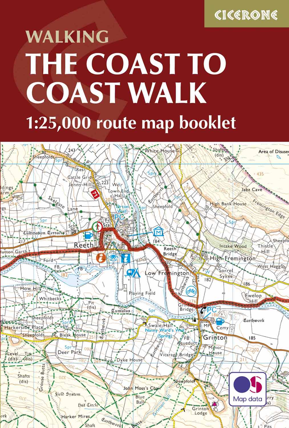
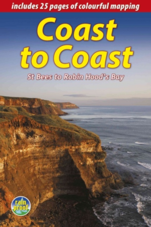
Wandelgids The Coast to Coast Map Booklet - Cicerone
St Bees Head naar Robin Hood's Bay aan de kust van Yorkshire
Korte omschrijving
Wandelgidsen North & North East England en Noord Engeland van CICERONE Press. Ideaal voor tochten in England.
Wandelgids - The Coast to Coast Map Booklet - Cicerone Productomschrijving: Deze wandelgids toont u de 300km lange Coast to Coast Walk, een populaire interlokale trail in Noord-Engeland, die...

Specificaties
- Uitgever: CICERONE Press
- ISBN-13: 9781852849269
- HOOFDCATEGORIEËN: Wandelgids
- Activiteiten: Wandelen, Hiking & Trekking
- Regio: Noord Engeland, North & North East England
- Land: England
- Lange afstand wandelroutes: Coast to Coast- St-Bees to Robinhood's bay England (370 km)
- Schaal: 1:25000
- Editie: 1
- Taal: Engels
- Reeks/Serie: Map Booklet, Cicerone
- Iconische Wandelroutes: Coast to coast path, UK
- National Trails UK, England & Wales: Coast to Coast Walk, England
Volledige omschrijving
Wandelgids - The Coast to Coast Map Booklet - Cicerone
Productomschrijving: Deze wandelgids toont u de 300km lange Coast to Coast Walk, een populaire interlokale trail in Noord-Engeland, die vertrekt uit St Bees Head in Cumbria naar Robin Hood's Bay aan de kust van Yorkshire.
Product description: This map booklet shows the 190 mile (300km) Coast to Coast Walk, a popular long distance trail across northern England from St Bees Head in Cumbria to Robin Hood's Bay on the Yorkshire coast, devised by Alfred Wainwright. This booklet of Ordnance Survey 1:25,000 Explorer maps has been designed for convenient use on the Coast to Coast Walk and shows the full line of the trail along with the relevant extract from the OS Explorer map legend. It can be used when walking the route west–east or east–west. Conveniently sized for slipping into a jacket pocket or top of a rucksack, it comes in a clear PVC sleeve.
Seasons:
Accommodation along the Coast to Coast walk may be busy in summer and higher, more remote, parts difficult in winter. Spring or autumn is ideal.
Centres:
St Bees, Grasmere, Shap, Kirkby Stephen, Richmond, Ingleby Arncliffe, Grosmont, Whitby, Robin Hood's Bay.
Difficulty:
The C2C is a two-week route with total ascent of 6995m (22,825ft). Some remote stretches, especially walking on the North York Moors.
Must See:
The Lakeland fells, Swaledale, Vale of Mowbray, North York Moors, cliff-top walks at Robin Hood's Bay.
Locatie op kaart
Gekoppelde artikelen

Wandelgids Northern England Coast to Coast walk - Cicerone • 9781852847593
standaard versieWandelgids - Northern England Coast to Coast walk - Cicerone Productomschrijving: Een wandelgids, uitgebreid in zijn genre, die u van kust naar kust brengt in de noordelijke regio's van Engeland. Deze streek is gekenmerkt door zijn geschiedenis met resten van zelf nog de Romeinse tijd. De regio is ook bekend om zijn Hadrian's Wall path. Product description: First devised by Alfred Wain…
Wandelgids Trekking the Coast to Coast Path - Knife Edge • 9781912933143
standaard versieTrekking the Coast to Coast Path - Knife Edge Productomschrijving: Deze beroemde wandelroute van om en bij de 290 km, loopt door 3 nationale parken, 3 wereldbekende nationale parken die elk appart hun eigen specifieke voordelen bieden. Route: St-Beest to Robin Hood's Bay Engelse omschrijving: The definitive two-way guide to the Coast to Coast Path: both eastbound and westbound rou…
Artikelen uit dezelfde regio
Landkaart Wegenkaart 4 Engeland Noord - OSI • 9780319263761
Wegenkaart Noord Engeland - OSI Productomschrijving: Plan your journey with this series of road maps from OS. Showing all major road, rail and ferry links as well as settlements and selected features in 1: 250 000 scale, this is the ideal map for planning trips and holidays by car or cycle. OS Road 4 covers: Northern England, including the Lake District, North York Moors Liverpool and…
Wandelgids Reivers Way through historic Northumberland- Cicerone • 9781852844981
Wandelgids- Reivers Way through historic Northumberland- Cicerone Productomschrijving: Een handige zakformaat handleiding voor iedereen die van plan is om de Reivers Way af te lopen. Volg in de voetstappen van de border reivers op deze 150 mijl lange route, die loopt van Corbridge naar Alnmouth. De reivers route dwaalt door wilde en schilderachtige delen van Northumberland, en kan worden g…
Wandelgids Dales Country Yorkshire England - Cicerone • 9781852843236
Wandelgids - Dales Country Yorkshire England - Cicerone Productomschrijving: Een gids over 30 familiewandelingen in de Yorkshire Dales, Engeland. De 30 circulaire wandelingen nemen de bekende Dales plekken in zoals Malham en Ingleborough. Routes nemen tussen een halve tot een volledige dag in beslag. Ook minder bezochte, bijna geheime routes, ingedeeld van gemakkelijk tot inspannend. P…
Wandelgids The Wainwright route - Rucksack readers • 9781898481829
Wandelgids - The Wainwright route- coast tot coast walking Productomschrijving: This challenging walk of 184 miles (296 km) crosses the north of England from St Bees on the Cumbria coast to Robin Hood’s Bay on the North Sea. It passes through three National Parks – the Lake District, Yorkshire Dales and North York Moors – with splendidly varied scenery. Many walkers complete it within 12 t…
Wandelgids The Dales Way 135 km - Cicerone • 9781786310934
The Dales Way 135 km - Cicerone Productomschrijving: Gids voor het afleggen van de Dales Way. Deze schilderachtige route van 79 mijl (135 km) door de Yorkshire Dales tussen Ilkley en Bowness-on-Windermere, en is een van de rustigste lange-afstandswandelingen in Groot-Brittannië. De route wordt in beide richtingen beschreven en gaat door Wharfedale, Dentdale en de oostelijke rand van het La…