

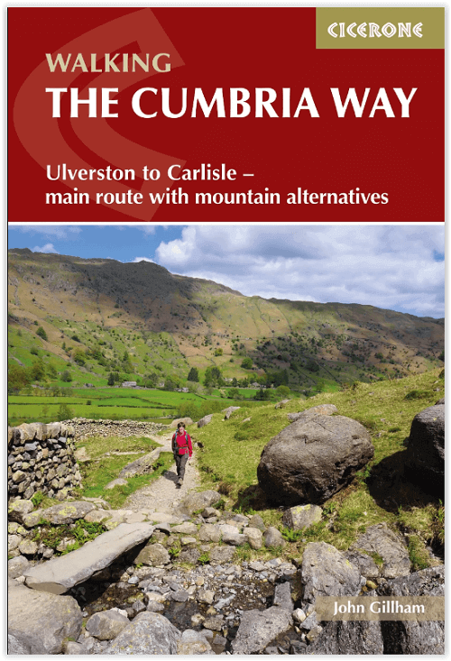
Wandelgids The Cumbria Way walking guide - Cicerone
Van Ulverston in het zuiden tot Carlisle in het noorden
Korte omschrijving
Wandelgidsen Cumbria & Lake District, England van CICERONE Press. Ideaal voor tochten in England.
The Cumbria Way walking guide - Cicerone Productomschrijving: Een wandelgids die de zeer bekende 112 km lange Cumbria Way omvat, een gemakkelijke langeafstandswandeling door het hart van het...

Specificaties
- Uitgever: CICERONE Press
- ISBN-13: 9781786311337
- HOOFDCATEGORIEËN: Wandelgids
- Activiteiten: Wandelen, Hiking & Trekking
- Regio: Cumbria & Lake District, England
- Land: England
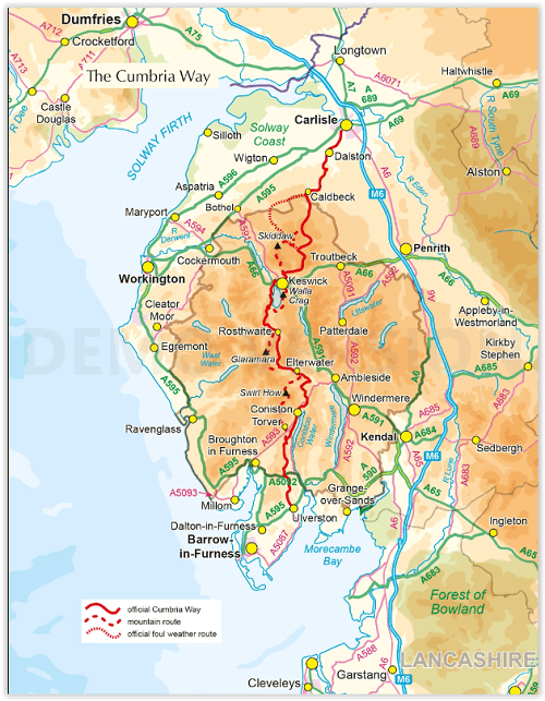
- Lange afstand wandelroutes: Cumbria Way, England (112km)
- Nationale parken: Lake District NP, Cumbria England
- Editie: 2
- Taal: Engels
Volledige omschrijving
The Cumbria Way walking guide - Cicerone
Productomschrijving: Een wandelgids die de zeer bekende 112 km lange Cumbria Way omvat, een gemakkelijke langeafstandswandeling door het hart van het Lake District National Park, van Ulverston in het zuiden tot Carlisle in het noorden, met goede transportverbindingen naar beide uiteinden. De route is grotendeels op laag niveau maar deze gids biedt alternatieve bergdagen om onderweg enkele van de beroemde fells te beklimmen.
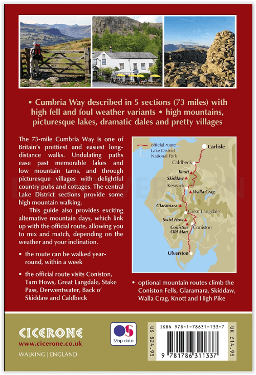
Engelse omschrijving: A guidebook to the 73 mile Cumbria Way, an easy long-distance walk though the heart of the Lake District National Park, from Ulverston in the south to Carlisle in the north, with good transport links to either end. The route is largely low-level but this guide offers alternative mountain days to climb some of the famous fells en route.
Seasons:
Official way can be done year-round using B&Bs or Easter to October using campsites. The mountain route is best saved for spring, summer and autumn.
Centres:
Ulverston, Torver, Coniston, Elterwater, Great Langdale, Rosthwaite, Keswick, Bassenthwaite, Caldbeck, Dalston and Carlisle.
Difficulty:
Official Cumbria Way is easy with only two places where the inexperienced walker can go wrong (in mist) - Stake Pass and High Pike. The mountain routes require mountain experience and the knowledge of how to use a map and compass.
Must See:
Official route visits Coniston, Tarn Hows, Great Langdale, Stake Pass, Derwentwater, Back o' Skiddaw and Caldbeck, while the mountain route adds the Coniston Fells, Glaramara, Skiddaw and Knott.

Locatie op kaart
Artikelen uit dezelfde regio
Wandelgids The Lake District Fells Wasdale - Cicerone • 9781786310316
The Lake District Fells Wasdale - Cicerone Productomschrijving: Deze gids beschrijft beklimmingen van 25 Lake District fells die beklommen kunnen worden vanuit de valleien van Wasdale, Eskdale en Ennerdale. Rustiger en wilder dan de oostkant van het nationale park - maar zeker even mooi - is dit gebied de thuisbasis van veel van de meest gevierde toppen van de regio, met als hoogtepunten o…

Wandelkaart 90 Penrith & Keswick - Lake District NP - OSI • 9780319263372
Penrith & Keswick - Lake District NP - OSI Productomschrijving: Kaart nummer 90 in de OS Landranger kaartenserie is de perfecte kaart voor het plannen van vakanties en dagtochten naar het Penrith en Keswick gebied van het Lake District. Het gebied is ideaal voor vakantiegangers die willen deelnemen aan wandelingen, tochten of watersporten, want er zijn fantastische paden, activiteiten en l…
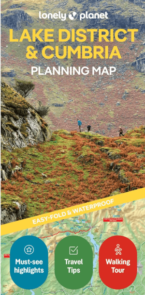
Landkaart Wegenkaart Planning map Lake District & Cumbria • 9781788688376
Wegenkaart Planning map Lake District & Cumbria Productomschrijving: From Lonely Planet, the world's leading travel guide publisher Durable and waterproof, with a handy slipcase and an easy-fold format, Lonely Planet's Lake District & Cumbria Planning Map helps you get around with ease. Get more from your map and your trip with images and information about top attractions, itinerary sugges…
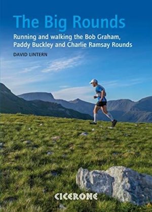
Wandelgids The Big Rounds - Cicerone • 9781852847722
Wandelgids - The Big Rounds - Cicerone Productomschrijving: Deze inspirerende gids kijkt naar elk van de 19 nationale routes in het Verenigd Koninkrijk, met informatie die vergelijkings- en contrastgemak mogelijk maakt, waardoor u wordt geïnspireerd om meer te weten te komen en een uitdaging op lange afstand aan te gaan. Sommige paden zijn kort en gemakkelijk, anderen veel langer, en veel …

Wandelgids Lake District Low level & lake walks - Cicerone • 9781786312273
Lake District NP Low level & lake walks - Cicerone Productomschrijving: This guidebook describes 30 of the best low-level walks in the Lake District. From delightful wooded glades and sparkling tarns, to waterfalls and glacier-carved valleys towered over by craggy mountains. The walks described aim to seek out the best walking that the lower areas of the Lake District have to offer. Se…