

Wandelgids Wales coast path - Cicerone Press
From Chester to Chepstow- including Anglesey Island - 57 stages


Korte omschrijving
Wandelgidsen Wales van CICERONE Press. Ideaal voor tochten in Wales.
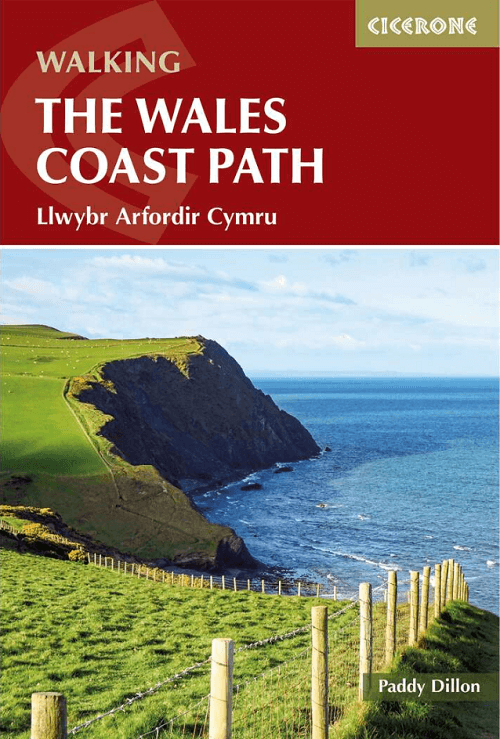
Wandelgids Wales coast path - Cicerone Productomschrijving: A single guidebook to walking the whole Wales Coast Path - 1400km (870 miles) the length of Wales from Chester to Chepstow, includ...

Specificaties
- Uitgever: CICERONE Press
- ISBN-13: 9781786312464
- HOOFDCATEGORIEËN: Wandelgids
- Activiteiten: Wandelen, Hiking & Trekking
- Auteur: Paddy Dylan
- Regio: Wales
- Land: Wales
- Editie: 3
- Taal: Engels
Volledige omschrijving
Wandelgids Wales coast path - Cicerone
Productomschrijving: A single guidebook to walking the whole Wales Coast Path - 1400km (870 miles) the length of Wales from Chester to Chepstow, including Anglesey Island, described in 57 stages. The route passes through the Eryri (Snowdonia) and Pembrokeshire National Parks and many National Landscapes and can be linked with the Offa's Dyke Path for a complete circuit of Wales.
Seasons:
In summer you'll get the best weather, and all services will be open. The route is feasible in spring and autumn but expect cooler and wetter weather, and some places will be closed. Not recommended in winter.
Centres:
Chester, Llandudno, Bangor, Holyhead, Caernarfon, Pwllheli, Barmouth, Machynlleth, Aberystwyth, Cardigan, Fishguard, St David's, Pembroke, Tenby, Carmarthen, Swansea, Cardiff, Newport, Chepstow.
Difficulty:.
Walkers need to be careful to cover comfortable distances, and not over-extend themselves. There are occasional rugged sections, sometimes featuring short steep ascents and descents, and some remote stretches with few facilities. It is necessary to be aware of the weather forecast, tides and the availability of accommodation and public transport.
Must See:
The historic 'Iron Ring' castles; holiday resort towns including Llandudno, Barmouth and Tenby; wild cliffs, rocky coves, sandy beaches; parts of the Eryri (Snowdonia) and Pembrokeshire National Parks; numerous AONBs, Heritage Coasts and nature reserves; museums and visitor centres.

Artikelen uit dezelfde regio

Fietsgids Great British Bike Rides - Vertebrate Publ. • 9781906148553
Great British Bike Rides - Vertebrate Productomschrijving: 40 classic routes for road cyclists Great British Bike Rides by Dave Barter brings together 40 of the best road rides in England, Scotland and Wales, searching out the country's most celebrated routes, toughest climbs and scenic roads. Features detailed route information, bespoke mapping and a statistical breakdown of every det…

Wandelgids Glyndwr's Way walking - Cicerone • 9781786311290
Glyndwr's Way walking - Cicerone Productomschrijving: Gids over de hystorische wandelroute van de Glyndwr's Way, een langeafstandspad door midden-Wales. De 217 Km lange route van Knighton via Machynlleth naar Welshpool duurt 9 dagen om te lopen, en 2 dagen (29 mijl) om de lus langs het Offa's Dyke Path af te maken zodat er een rondwandeling ontstaat. Een prachtige route door rustige heuvel…

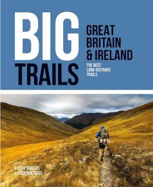
Wandelgids Big Trails DEEL 2 Great Britain & Ireland - Vertebrate • 9781839810459
Big Trails DEEL 2 Great Britain & Ireland - Vertebrate Publ. Productomschrijving: More of the best long-distance trails Big Trails: Great Britain & Ireland Volume 2 features twenty-five long-distance trails in England, Scotland, Wales, Northern Ireland and Ireland, and includes a general overview of the trails, specific technical information, overview mapping, key information and stun…

Wandelkaart 262 Anglesey West- Wales AONB - OSI • 9780319244593
Wandelkaart Anglesey West - Wales AONB Productbeschrijving: Holyhead 262 - Anglesey West, Wales AONB - Kaart nummer 262 in de OS Explorer reeks heeft betrekking op het westen van het eiland van Anglesey AONB (Ynys Mon) met inbegrip van Holyhead (Caergbyi). Hoogtepunten van het gebied zijn onder andere: Holy Island (Ynys Gybi), Holyhead bay, Llyn Alaw, Wylfa Head en Carmel hoofd. De OS…
Wandelgids Big Trails DEEL 1 Great Britain & Ireland - Vertebrate • 9781839810008
Big Trails, Great Britain & Ireland - Vertebrate Productomschrijving: The best long-distance trails Big Trails: Great Britain & Ireland features 25 long-distance trails in England, Scotland, Wales, Northern Ireland and Ireland, and includes a general overview of the trails, specific technical information, overview mapping, key information and stunning photography. Big Trails: Great…