

Wandelgids Walking in the Forest of Dean - Cicerone
25 wandelingen in de Forest of Dean- met Offa's Dyke Path


Korte omschrijving
Wandelgidsen West England en Gloucestershire, Egland van CICERONE Press. Ideaal voor tochten in England en Wales.
Wandelgids - Walking in the Forest of Dean - Cicerone Productomschrijving: Een gids over 25 wandelingen in de Forest of Dean, met alle informatie die nodig is om te genieten van een scala aa...

Specificaties
- Uitgever: CICERONE Press
- ISBN-13: 9781852846893
- HOOFDCATEGORIEËN: Wandelgids
- Activiteiten: Wandelen, Hiking & Trekking
- Auteur: Mike Dunn
- Regio: Gloucestershire, Egland, West England
- Land: England, Wales
- Historische wandelroutes: Offa's Dyke Path (283 km)
- Lange afstand wandelroutes: Offa's Dyke Path (285 km)
- Regionale parken: Forest of Dean, England
- Editie: 1
- Taal: Engels
Volledige omschrijving
Wandelgids - Walking in the Forest of Dean - Cicerone
Productomschrijving: Een gids over 25 wandelingen in de Forest of Dean, met alle informatie die nodig is om te genieten van een scala aan wandelingen in de dallen en de open ruimtes van dit oude gebied. Van korte 4-mijl lange wandelingen tot volle dagsecties van interlokale paden zoals de Offa's Dyke Path en Gloucestershire Way, is deze gids een ideaal hulpmiddel voor het verkennen van het bos en zijn geschiedenis.
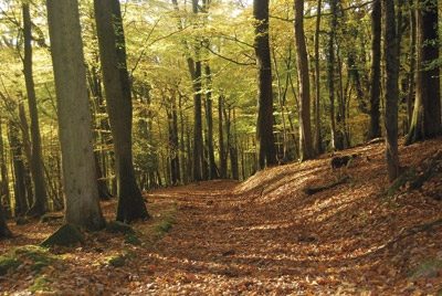
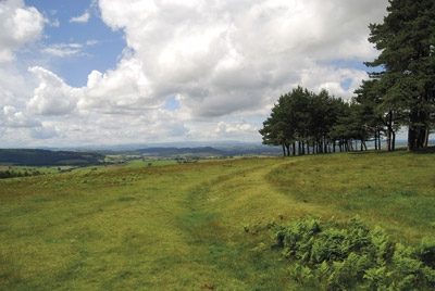
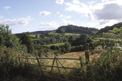
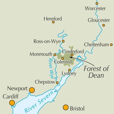
Detail: Ingesloten door twee belangrijke rivieren, de Severn en de Wye, is de Forest of Dean echt een spectaculair land, met een kenmerkend landschap en een uniek culturele identiteit. Citadel ruggen en de bosrijke hellingen geven de centrale Forest een geheimzinnige kwaliteit, terwijl de bergkammen boven de Wye-kloof en de Severn Vale sensationeel uitzicht bezorgen en gemakkelijke wandelingen bieden.
Product description: Guidebook to 25 walks in the Forest of Dean, between the Severn and Wye, from 4-mile routes to all-day sections of long-distance trails such as the Offa's Dyke Path and Gloucestershire Way, this guide is ideal for exploring the forest and its history and includes the information needed for walkers of all abilities to explore this ancient area.
Seasons:
Seasonswalks can be enjoyed in every season, with the central forest providing shelter on windy days.
Centres:
Accessible from Gloucester, Lydney and Chepstow, while the key centres within the Forest of Dean itself are Coleford and Cinderford.
Difficulty:
None of the routes should present any technical difficulties, although all of them require basic route-finding skills and the walks following part of long-distance trails are challenging full-day expeditions; many follow clear forest tracks and paths across farmland.
Must See:
Iconic hills (such as May Hill), forested slopes, coal and iron-making sites with furnaces and ponds, sensational views, picturesque landscapes and a rich cultural and social history.

Locatie op kaart
Overzichtskaarten
Hystorische wandel- en fietsroutes
Hystorische wandel- en fietsroutes

Producten op de overzichtskaart
Klik op een product om naar de detailpagina te gaan.
- Wandelkaart South Downs Way - Harvey maps
- Wandelgids North Yorkshire historic walks - Cicerone
- Wandelkaart OL13 - Brecon Beacons NP - Eastern area - OSI
- Wandelgids Pilgrim Pathways walking guide - Trailblazer
- Wandelgids The Great Glen Way - Trailblazer
- Wandelgids Hadrian's wall Path - Knife Edge
- Wandelgids Hadrian's Wall Path - Trailblazer
- Wandelkaart XT40 Offa's Dyke Path - Harvey Maps
- Wandelkaart OL43 Hadrian's Wall - OSI
- Wandelkaart 351 Dunbar & North Berwick- Schotland - OSI
- Wandelgids Walking in the Forest of Dean - Cicerone
- Wandelkaart 130 Salisburry & Stonehenge- Wiltshire - OSI
- Wandelkaart 256 Wrexham- Wrecsam & Llangollen - OSI
- Wandelkaart 130 Salisbury & Stonehenge- Wiltshire - OSI
- Wandelgids John Muir Trail - Cicerone
- Wandelkaart Rob Roy Way National trail - Harvey maps
- Wandelkaart Hadrian's Wall Path - Harvey maps
- Wandelkaart Offa's Dyke Path- Route Map Booklet - Cicerone
Artikelen uit dezelfde regio
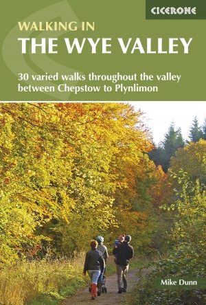
Wandelgids Walking in the Wye Valley - Cicerone • 9781852847241
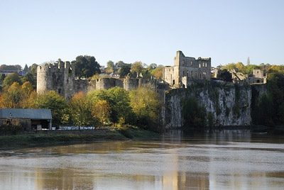
Wandelgids - Walking in the Wye Valley - Cicerone Productomschrijving: Een gids met 30 gevarieerde wandelingen van 3 tot 10 mijl, in de vallei van de Wye, en de mooiste rivier in Engeland en Wales, tussen Chepstow in het zuiden en Plynlimon. Het landschap varieert van open heidevelden naar beboste kloven en is bezaaid met de sites van de IJzertijd met heuvelforten en kastelen. Centra omvat…
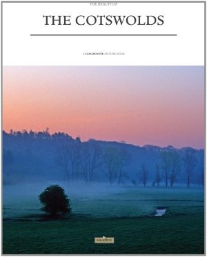
Fotoboek The beauty of The Cotswolds AONB • 9781859652183
Fotoboek Cotswolds - The beauty of The Cotswolds AONB Productomschrijving: De eerste van een nieuwe serie van massamarkt souvenirboeken. Een Memento, een aandenken voor de duizenden toeristen die de Cotswolds, Cornwall, Lake District en Noord-Devon bezoeken. Dit fotoboek is een bewijs van William Fricker zijn lange geschiedenis met de Cotswoldheuvels. Deze beelden zijn vergaard geweest uit…
Wandelkaart 168 Stroud- Tetbury & Malmesbury - OSI • 9780319470404
Wandelkaart Stroud- Tetbury & Malmesbury - England Productbeschrijving: Kaart nummer 168 in de OS Explorer kaarten reeks omvat Stroud, Tetbury, Malmesbury en Nailsworth. Hoogtepunten van het gebied zijn onder meer: Cotswolds AONB, Cotswold Way, Monarch Way en de Thames Path. De OS Explorer kaart voor Stroud, Tetbury & Malmesbury is beschikbaar in zowel de standaard papieren versie als de w…
Wandelgids Walking the Thames Path National Trail - Cicerone • 9781786311481
Thames Path National Trail - Cicerone Productomschrijving: Een gloednieuwe wandelgids vover het Theemspad, een National Trail van 180 mijl tussen de Thames Barrier in Londen en de bron van de rivier in Gloucestershire, door Windsor, Oxford en het platteland. Biedt volledige informatie over deze gemakkelijke route langs de rivier die ongeveer twee weken in beslag neemt. Inclusief een 1:25K …

Wandelgids 029 Pathfinder guides Wye Valley AONB & Forrest of Dean • 9780319090442
Wandelgids Wye Valley AONB & Forrest of Dean -OS Productomschrijving: The Wye Valley and Forest of Dean Pathfinder guidebook contains 28 circular walks for all abilities. Walks are from 4km to 17km long, and each route includes a difficulty rating, route directions, an extract of the Ordnance Survey map and notes and photos of key features to look for. All of them have been created and te…