
Wandelkaart Offa's Dyke Path- Route Map Booklet - Cicerone
283 km tussen Sedbury (bij Chepstow) en Prestatyn
Korte omschrijving
Wandelkaart boekje - Offa's Dyke Path - Cicerone Productomschrijving: Kaartboekje van het 177 mijl (283 km) lange Offa's Dyke Path National Trail, tussen Sedbury (bij Chepstow) en Prestatyn...

Specificaties
- Uitgever: CICERONE Press
- ISBN-13: 9781852848941
- HOOFDCATEGORIEËN: Wandelkaart
- Activiteiten: Wandelen, Hiking & Trekking
- Regio: Gloucestershire, Egland, Herefordshire, England, Shropshire West Midlands
- Land: England, United Kingdom, Great Britain, Wales
- Historische wandelroutes: Offa's Dyke Path (283 km)
- Blz.: 80
- Schaal: 1:25000
- Afmeting: 12x17
- Editie: 1
- Taal: Engels
Volledige omschrijving
Wandelkaart boekje - Offa's Dyke Path - Cicerone
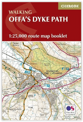
Productomschrijving: Kaartboekje van het 177 mijl (283 km) lange Offa's Dyke Path National Trail, tussen Sedbury (bij Chepstow) en Prestatyn. Het pad is in 2 weken te lopen en is geschikt voor wandelaars van alle ervaringsniveaus. Dit compacte boekje met OS 1:25,000 kaarten toont de volledige route en biedt alle kaarten die u nodig heeft, en wordt bij de gids geleverd.
Omvat: Chepstow, Hay-on-Wye, Kington, Bishops Castle, Montgomery, Welshpool, Oswestry, Llangollen, Denbigh & Prestatyn.
Engelse omschrijving: Map of the 177 mile (283km) Offa's Dyke Path National Trail, between Sedbury (near Chepstow) and Prestatyn. The trail takes 2 weeks to walk, and is suitable for walkers at all levels of experience. This compact booklet of OS 1:25,000 maps shows the full route, providing all of the mapping you need, and is included with the guidebook.
Seasons:
This walk is exceptional in all seasons, though the Black Mountains and Clwydian range deserve respect in winter conditions, and especially in mist, since there are few landmarks on the Black Mountain ridge.
Difficulty:
The trail includes a couple of unavoidably long stages and there are some mountain and moorland stages, but the route poses no special difficulties and caters for walkers of all levels of ability provided that sensible advance planning is undertaken
Must See:
Geology - limestone gorge of the lower Wye, igneous intrusions around Hergest ridge, Breidden Hills dolerite, limestone escarpments north of Llangollen Uplands - Black Mountain moorlands, remote Clun Forest, Clwydian ridge Lowlands - orchards and meadows, Montgomery canal, broad Severn valley Historical attractions - Tintern abbey and Llanthony priory, border castles, Pontcysyllte aqueduct
Gekoppelde artikelen

Wandelgids The Offa's Dyke Path - England & Wales - Cicerone • 9781852847760
standaard versieWandelgids The Offa's Dyke Path - Wales - Cicerone Productomschrijving: Deze gids beschrijft het Offa's Dyke Path National Trail, een langeafstandswandeling van 283 km langs de Engels-Welshe grens tussen Sedbury (bij Chepstow) en Prestatyn. De gids is opgedeeld in 12 etappes met suggesties voor het plannen van alternatieve routes. Met 1:25K OSI (Ordnance Servey) kaart boekje. Engelse o…
Overzichtskaarten

Hystorische wandel- en fietsroutes
Hystorische wandel- en fietsroutes

Producten op de overzichtskaart
Klik op een product om naar de detailpagina te gaan.
- Wandelkaart - South Downs Way - Harvey maps
- Wandelgids - North Yorkshire historic walks - Cicerone
- Wandelkaart OL13 - Brecon Beacons NP - Eastern area - OSI
- Wandelgids - Pilgrim Pathways walking guide - Trailblazer
- Wandelgids - The Great Glen Way - Trailblazer
- Wandelgids - Hadrian's wall Path - Knife Edge
- Wandelgids - Hadrian's Wall Path - Trailblazer
- Wandelkaart XT40 - Offa's Dyke Path - Harvey Maps
- Wandelkaart OL43 - Hadrian's Wall - OSI
- Wandelgids - Cleveland Way - Trailblazer
- Wandelkaart 351 - Dunbar & North Berwick- Schotland - OSI
- Wandelgids - Walking in the Forest of Dean - Cicerone
- Wandelkaart 130 - Salisburry & Stonehenge- Wiltshire - OSI
- Wandelkaart 256 - Wrexham- Wrecsam & Llangollen - OSI
- Wandelkaart 130 - Salisbury & Stonehenge- Wiltshire - OSI
- Wandelgids - John Muir Trail - Cicerone
- Wandelkaart - Rob Roy Way National trail - Harvey maps
- Wandelkaart - Hadrian's Wall Path - Harvey maps
- Wandelkaart - Offa's Dyke Path- Route Map Booklet - Cicerone
Artikelen uit dezelfde regio

Wandelkaart 149 Hereford & Leominster- England - OSI • 9780319474723
Wandelkaart Hereford & Leominster - Herefordshire England Productbeschrijving: OS Landranger kaart 149 helpt u bij het verkennen van de gotische kathedraal van Hereford, of ga voor een wandeling maken of paard rijden rond de omgeving van Herefordshire. U kunt de nabijgelegen historische markt stad Leominster, Ledbury en Bromyard ook verkennen. De OS Landranger kaarten reeks heeft betrekkin…

Wandelgids The Cotswold Way - Cicerone • 9781786312105
The Cotswold Way - Cicerone Productomschrijving: Wandelgids over de Cotswold Way Nationale route. Tussen Chipping Campden en Bath verkent de 164 km lange route door de Cotswolds AONB (Area of Outstanding Natural Beauty). Beschreven in beide richtingen over 13 etappes. De Cotswold Way kan het hele jaar door belopen worden, en is geschikt voor beginnende wandelaars. Inclusief apart OS 1:25.0…

Wandelkaart 149 Hereford & Leominster England - OSI • 9780319262474
Wandelkaart Hereford & Leominster England Productbeschrijving: OS Landranger kaart 149 helpt u bij het verkennen van de gotische kathedraal van Hereford of een wandeling, of paard rijden rond de omgeving van Herefordshire. U kunt ook de nabijgelegen historische markt steden Leominster, Ledbury en Bromyard verkennen. De OS Landranger kaarten reeks heeft betrekking op Groot-Brittannië met 20…

Reisgids Cotswolds AONB - Rough Guides • 9781839059728
The Cotswolds AONB - Rough Guides Productomschrijving: Deze omvat het Cotswolds gebied in zuid-oost Engeland. Een gebied van uitmuntend natuurschoon, of in andere meer lokalere woorden, een AONB area, of Area of Outstanding Natural Beauty. Bij ons is dat bijvoorbeeld de westhoek, het Zwin, enz... Deze reisgids biedt u deze regio inclusief de locaties van Stratford-Uppon-Avon & Oxford die a…

Wandelkaart 240 Oswestry & Croesoswallt- Shropshir - OSI • 9780319244333
Wandelkaart Oswestry & Croesoswallt - Shropshire England Omvat ook: Chirk, Ellesmere & Pant. Productomschrijving: Explorer map 240 is gericht op Oswestry (Croesoswallt) en heeft een deel van de "Severn Way" en de "Offa's Dyke Path" (Llwybr Clawdd Offa) die de grens van Engeland & Wales volgen. Er zijn een aantal kleinere steden en dorpen in het gebied, waaronder Chirk (Y Waun), broek, …