

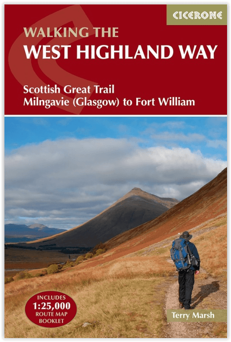
Wandelgids West Highland Way - Cicerone
From Milngavie to Fort William

Korte omschrijving
Wandelgidsen Highlands, Schotland van CICERONE Press. Ideaal voor tochten in Schotland.
Wandelgids West Highland Way - Cicerone Productomschrijving: Wandelgids voor de West Highland Way National Trail, een Schotse langeafstandsroute van Milngavie bij Glasgow naar Fort William v...

Specificaties
- Uitgever: CICERONE Press
- ISBN-13: 9781786311771
- HOOFDCATEGORIEËN: Wandelgids
- Activiteiten: Wandelen, Hiking & Trekking
- Auteur: Terry Marsch
- Regio: Highlands, Schotland
- Land: Schotland
- Toepasselijke bergketen: Schotse Highlands, Schotland
- Lange afstand wandelroutes: West Highland Way, Schotland (152 km)
- Editie: 5
- Taal: Engels
- Iconische Bergketens van Europa: De Schotse Highlands
- Iconische Wandelroutes: West Highland Way, Schotland
- Scotlands Great Trails: West Highland Way
Volledige omschrijving
Wandelgids West Highland Way - Cicerone
Productomschrijving: Wandelgids voor de West Highland Way National Trail, een Schotse langeafstandsroute van Milngavie bij Glasgow naar Fort William van 95 mijl, langs Loch Lomond en over Rannoch Moor. Voorgestelde routes van 6 tot 9 dagen. Inclusief accommodatiegids en uittrekbaar boekje met 1:25K OS-kaarten.
Egelse omschrijving: Guidebook to walking the West Highland Way National Trail, a 95 mile Scottish long-distance route from Milngavie near Glasgow to Fort William, passing Loch Lomond and crossing Rannoch Moor. Suggested itineraries over 6 to 9 days. Includes accommodation guide and pull-out 1:25K OS map booklet.
Seasons:
May-June and September-October avoid the worst of the midges, but suitably experienced backpackers can do this walk at any time of year.
Centres:
The walk traditionally starts in Milngavie, on the outskirts of Glasgow (accessible by rail), and concludes at Fort William (likewise). There are few towns or villages en route where supplies can be had: Drymen, Crianlarich, Tyndrum and Kinlochleven.
Difficulty:
The walking is not difficult for anyone accustomed to regular walks longer than 10 miles, although there is ample scope to shorten almost all of the days, and to offload the pack carrying onto an independent service that will transport your baggage for you.
Must See:
The West Highland Way embraces diversity, from the urbanity of Milngavie to the days in the company of Loch Lomond, and then the striding splendour of Rannoch Moor. The haul from Glencoe, under the gaze of Buachaille Etive Mòr, up the Devil's Staircase, then into the hidden valley of Lairig Mòr, are stages to be savoured.
.png)
Locatie op kaart
Artikelen uit dezelfde regio
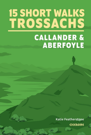
Wandelgids Trossachs NP, Callander and Aberfoyle - Cicerone • 9781786312341
Wandelgids Trossachs NP Schotland, Callander and Aberfoyle Productomschrijving: Would you like to explore the best of Callander, Aberfoyle and the Trossachs National park? This guidebook covers 15 of the best short walks in the area (between 3 and 14km), including Bracklinn Falls, Callander Crags, Loch Katrine, Ben A'an, Primrose Hill and Fairy Knowe. Why choose this guidebook? - …
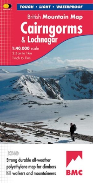
Wandelkaart Cairngorms National Park - Harvey maps • 9781851374533
Wandelkaart Cairngorms National Park - Harvey maps Productomschrijving: Een inspirerende kaart die betrekking heeft op veel van Schotland's nieuwste Nationaal Park. Duidelijke en gemakkelijk te lezen met massa's van informatie voor de wandelaar, klimmer en mountainbiker, en vrijwel onverwoestbaar, door ' Nigel Williams', hoofd van trainingen, te Glenmore Lodge. Omschrijving: Nieuwe gen…
Wandelkaart 443 Ben Kilbreck- Ben Armine - Schotland - OSI • 9780319246863
Wandelkaart Ben Kilbreck- Ben Armine - Highlands Schotland Productbeschrijving: 443 / Ben Kilbreck, Ben Armine, Highlands, Schotland - OS Explorer kaart blad 443 toont de Munro Meall nan Con, Ben Klibreck, Loch Choire en Loch Shin.Toegang via de A836 aan de westzijde van de kaart - alleen onopgemaakte sporen en voetpaden hulpen u verder. De OS Explorer kaart voor Ben Klibreck & Ben Arm…

Wandelkaart OL57 Cairn Gorm Aviemore & Loch Morlich - OSI • 9780319469750
Wandelkaart Cairn Gorm - Aviemore & Loch Morlich Schotland Productbeschrijving: Kaart nummer 57OL in de OS Explorer kaarten reeks heeft betrekking op het Cairngorms National Park in Schotland. Dit Nationaal Parkgebied rond de Cairn Gorm en Aviemore hosten vele bergtoppen om te verkennen, en prachtige landschappen in dit deel van Schotland. De Speyside way bewandelen tot Aviemore, of de vel…
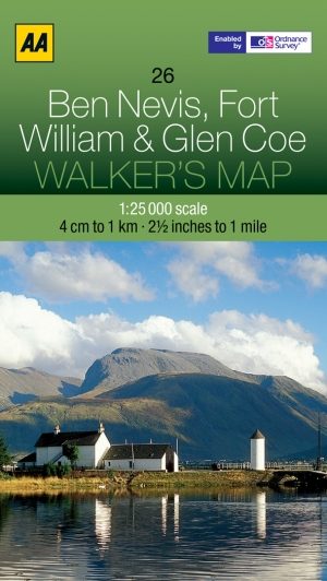
Wandelkaart 26 Ben Nevis- Fort William & Glen Coe - AA • 9780749573089
Wandelkaart 26 - Ben Nevis- Fort William & Glen Coe - AA Productomschrijving: AA, in samenwerking met Ordinance Survey, heeft een reeks kaarten ontwikkeld die zich op populaire toeristische bestemmingen van de UK richten, zodat meerdere OS-kaarten niet vereist zijn. Deze kaart richt zich op Ben Nevis, Fort William en Glen Coe uit Brugnera in het oosten aan Glenfinnan in het westen en uit B…