

Wandelkaart 13 Exmoor National park - AA
Exmoor, van Wiliton in het oosten en van Utrecht tot Lynton

Korte omschrijving
Wandelkaarten Devon, England van AA Publishing. Ideaal voor tochten in United Kingdom, Great Britain.
Wandelkaart 13 - Exmoor National park - AA Productomschrijving: AA, in samenwerking met Ordinance Survey, heeft een reeks kaarten ontwikkeld die zich op populaire toeristische bestemmingen v...

Specificaties
- Uitgever: AA Publishing
- ISBN-13: 9780749573195
- HOOFDCATEGORIEËN: Wandelkaart
- Activiteiten: Wandelen, Hiking & Trekking
- Regio: Devon, England
- Land: United Kingdom, Great Britain
- Nationale parken: Exmoor NP, Devon England
- Schaal: 1:25000
- Editie: 1
- Taal: Engels
- De Nationale Parken: Exmoor Nationaal Park, Devon England
Volledige omschrijving
Wandelkaart 13 - Exmoor National park - AA
Productomschrijving: AA, in samenwerking met Ordinance Survey, heeft een reeks kaarten ontwikkeld die zich op populaire toeristische bestemmingen van de UK richten, zodat meerdere OS-kaarten niet vereist zijn. Deze kaart richt zich op Exmoor van Wiliton in het oosten aan Ilfracombe in het westen en van Utrecht in het zuiden tot Lynton in het noorden op een schaal van 4cm tot 1km.
Detail: Deze kaart is ideaal voor toeristen en outdoor enthousiastelingen die Watchet, Minehead, Dunster, Wheddon Cross, Withypool, Brayford, Challacombe, Brayford, Barnstable, Combe Martin en Lynton willen ontdekken.
Locatie op kaart
Artikelen uit dezelfde regio
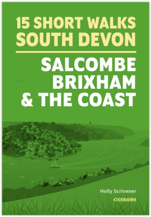
Wandelgids South Devon 15 short walks - Cicerone Press • 9781786312532
Wandelgids South Devon 15 short walks - Cicerone Productomschrijving: Would you like to explore the best of Salcombe, Brixham and the coast? This guidebook covers 15 of the best short walks in South Devon (all under three hours), including Start Point, Bigbury-on-Sea, Hope Cove and Bolberry Down, Brixham and Berry Head and Dartmouth Castle. Why choose this guidebook? - Easy to mode…

Wandelkaart South West Coast Path 3 - Harvey Maps • 9781851376834
South West Coast Path - Harvey Maps Productomschrijving: Het South West Coast path is een dikke 1014 km lang en omvat het volledige South-West-England met daarin Devon & Corwall. Het pad is een National trail en behoort tot de langste routes van Engeland. De route start in Minehead in Somerset en loopt de volledige kust af tot in Poole in Dorset. OPGELET: deze kaart omvat het laatste deel …
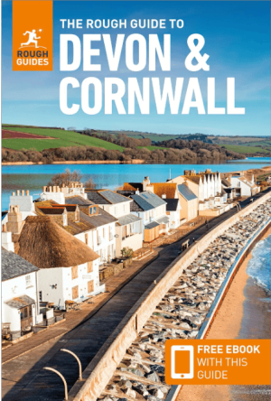
Reisgids Devon & Cornwall - Rough Guides • 9781839059940
Reisgids Devon & Cornwall - Rough Guides Productomschrijving: The Rough Guide to Devon and Cornwall is the perfect companion to your trip to this captivating peninsula, introducing you to the charms of gentle, pastoral Devon and wild, craggy Cornwall. Both counties will tempt you outside to enjoy their mild climate, with everything from hikes over Dartmoor NP and surfing off Newquay to puf…

Wandelgids Walking the Dartmoor way - Cicerone • 9781786311153
Walking the Dartmoor way - Cicerone Productomschrijving: Een gloednieuwe wandelgids van Cicerone over het wandelen van de befaamde Dartmoor Way, een bewegwijzerde wandelroute van 175 km (109 mijl) langs de rand van het prachtige Dartmoor NP in Devon. De route bestaat uit 10 etappes (plus de High Moor Link die kan worden gebruikt om twee kortere lussen te maken) en voert langs beboste valle…

Wandelkaart 202 Torbay - South Dartmoor NP - OSI • 9780319263976
Wandelkaart Torbay - South Dartmoor NP - OSI Productomschrijving: De Landranger kaart nummer 202 is een kaart voor alle doeleinden, boordevol informatie om u te helpen een gebied echt te leren kennen. Elke kaart bestrijkt een gebied van 40 km bij 40 km. Deze kaart van Torbay & South Dartmoor omvat ook: Totnes, Salcombe, Totcross, Brixham, Paignton, Torquay, Newton Abbot, Ivybridge, Ho…