
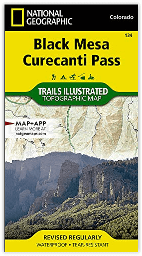
Wandelkaart 134 Black Mesa - Curecanti Pass Colorado - Nat Geo
Gunnison national Forest- West Elk Mountains- West Elk Peak
Korte omschrijving
Wandelkaart Black Mesa - Curecanti Pass Colorado - Nat Geo Productomschrijving: Outdoor enthousiastelingen die de afgelegen en ongetemde bergen van westelijk Colorado willen verkennen zullen...

Specificaties
- Uitgever: National Geographic
- ISBN-13: 9781566954303
- HOOFDCATEGORIEËN: Wandelkaart
- Activiteiten: Wandelen, Hiking & Trekking
- Regio: Colorado, USA
- Land: Verenigde Staten van Amerika (USA)
- Schaal: 1:40000
- Afmeting: 10x19
- Taal: Engels
Volledige omschrijving
Wandelkaart Black Mesa - Curecanti Pass Colorado - Nat Geo
Productomschrijving: Outdoor enthousiastelingen die de afgelegen en ongetemde bergen van westelijk Colorado willen verkennen zullen zich verbazen over National Geographic's Trails Illustrated kaart van Black Mesa en Curecanti Pass. Gemaakt in samenwerking met de U.S. Forest Service, dekt deze deskundig onderzochte kaart, het recreatiegebied in het gebied met ongeëvenaarde detail. Onder de belangrijkste punten van belang zijn Gunnison National Forest, West Elk Mountains en Wilderness, Sapinero, Centennial en Gunnison State Wildlife Areas, Curecanti National Recreation Area en Rainbow Lake.
Andere kenmerken op deze kaart zijn: Gunnison National Forest, West Elk Mountains, West Elk Peak, West Elk Wilderness.
Engelse omschrijving: Outdoor enthusiasts seeking to explore the remote and untamed mountains of western Colorado will marvel at National Geographic's Trails Illustrated map of Black Mesa and Curecanti Pass. Created in cooperation with the U.S. Forest Service, this expertly researched map covers the recreational land in the area with unparalleled detailed. Among the main points of interest are Gunnison National Forest, West Elk Mountains and Wilderness, Sapinero, Centennial and Gunnison State Wildlife Areas, Curecanti National Recreation Area and Rainbow Lake.
Other features found on this map include: Gunnison National Forest, West Elk Mountains, West Elk Peak, West Elk Wilderness.
Get off the beaten path and back on again by following the map along hiking and motorized trails; hard surface and mountain bike routes; and snowmobile and winter use trails. To aid in your navigation of the area, the map also includes contour lines, elevations, labeled peaks, summits and passes, water features and selected waypoints as well as a complete road network of the area, including numbered Forest Service roads and BLM routes. Some of the other recreation features pinpointed are areas for camping, cross-country and alpine skiing, climbing, fishing and picnicking. Additionally, wilderness regulations, survival tips, Leave No Trace guidelines and essential contact information is provided.
Every Trails Illustrated map is printed on "Backcountry Tough" waterproof, tear-resistant paper. A full UTM grid is printed on the map to aid with GPS navigation.
Locatie op kaart
Artikelen uit dezelfde regio

Wandelkaart 131 Crested Butte- Pearl Pass - Nat geo • 9781566952477
TOPO Wandelkaart 131 - Crested Butte- Pearl Pass Colorado, USA - National geographic Productomschrijving: Crested Butte is een rustige wandel- en MTB uitvalsbasis in Gunnison County, Colorado, United States. Omvat de oude kool industrie, en noemt nu "the last great Colorado ski town". Crested Butte is aeveneens een locatie voor skiërs & mountainbiking, als ook een verzameling van andere ou…

Wandelkaart 101 Cache La Poudre- Big Thompson Colorado - Nat Geo • 9781566953900
Cache La Poudre, Big Thompson Colorado - Nat Geo Productomschrijving: Canyon Lakes Ranger District, dat is het bezienswaardige bosgebied, of zeg maar wildernis gebied dat naast Fort Collins Colorado ligt. Outdoor enthousiastelingen die willen genieten van de recreatieve mogelijkheden net ten oosten van Rocky Mountain National Park zullen National Geographic's Trails Illustrated kaart van C…

Wandelkaart 127 Aspen - Independence Pass - Colorado USA • 9781566953580
TOPO Wandelkaart 127 - Aspen - Independence Pass - Colorado USA Productomschrijving: Independence Pass in Aspen Colorado is een uitmuntende wandellocatie. Deze omvat een topografische wandelkaart die echt tot de verbeelding spreekt. Een subliem exemplaar als het over wandelen gaat. Engelse omschrijving: Independence Pass, originally known as Hunter Pass, is a high mountain pass in cen…

Wandelkaart 601 Aspen Local Trails - Nat Geo • 9781566957526
Wandelkaart Aspen Local Trails - Nat Geo Productomschrijving: Met meer dan 320 km aan wandelpaden op korte afstand van de stad hebben bezoekers van Aspen een benijdenswaardig probleem: met al deze paden om uit te kiezen, waar moeten ze beginnen? De Aspen Local Trails-kaart helpt bij het beantwoorden van deze vraag - waar gaan de plaatselijke bewoners heen als ze een korte wandeling met het…

Reisgids USA Southwest & National Parks - DK Eyewitness • 9780241365519
USA Southwest & National Parks Omvat: Arizona, Las Vegas, Southern Utah, the Four Corners & New Mexico. Productomschrijving: Staar naar de diepten van de Grand Canyon, ervaar de glitter en glamour van de Las Vegas strip, beklim de rotsachtige overspanningen van Arches National Park of wandel door het historische Santa Fe: alles wat u moet weten is overzichtelijk weergegeven in kleurgec…