

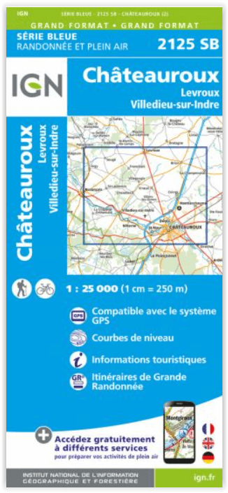
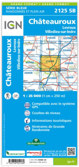
Wandelkaart 2125 SB Châteauroux & Levroux - IGN
Villedieu-sur-Indre- La Champenoise- Coings- Montierchaume
Korte omschrijving
Wandelkaarten Centre Val de Loire, Frankrijk van Institut Géographique National. Ideaal voor tochten in Frankrijk.
Wandelkaart Châteauroux & Levroux - IGN Productomschrijving: Châteauroux & Levroux zijn gemeentes in het Franse departement Indre, in de regio Centre-Val de Loire. De plaats maakt deel uit v...

Specificaties
- Uitgever: Institut Géographique National
- ISBN-13: 9782758554189
- HOOFDCATEGORIEËN: Wandelkaart
- Activiteiten: Wandelen, Hiking & Trekking
- Regio: Centre Val de Loire, Frankrijk
- Land: Frankrijk
- Departement: Indre (36)
- Schaal: 1:25000
- Editie: 2
- Taal: Frans
- Reeks/Serie: IGN Cartes Série Bleue
- De Franse Regio's: Centre-val-de-Loire
Volledige omschrijving
Wandelkaart Châteauroux & Levroux - IGN
Productomschrijving: Châteauroux & Levroux zijn gemeentes in het Franse departement Indre, in de regio Centre-Val de Loire. De plaats maakt deel uit van het arrondissement Châteauroux.
Omvat: Châteauroux, Levroux, Villedieu-sur-Indre, La Champenoise, Coings, Montierchaume, Étrechet, Brion, Francillon, Vineuil, Déols, Villegongis, Niherne, Chezelles, Saint-Maur, La Chapelle-Orthemale, Saint-Lactencin, Argy.
Te ontdekken: Parc Naturel de la Brenne, Forêt de Lancosme,Écoparc des Chênevières.
Afmeting: 96 cm x 121 cm

Locatie op kaart
Overzichtskaarten
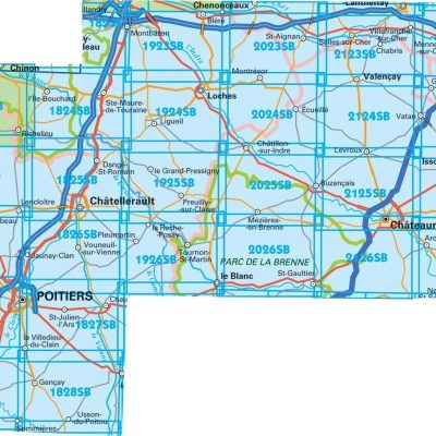
IGN TOP25 Wandelkaarten Loire Centre - Zuidelijk DEEL - Bourges - Poitiers
IGN TOP25 Wandelkaarten Loire Centre - Zuidelijk DEEL - Bourges - Poitiers
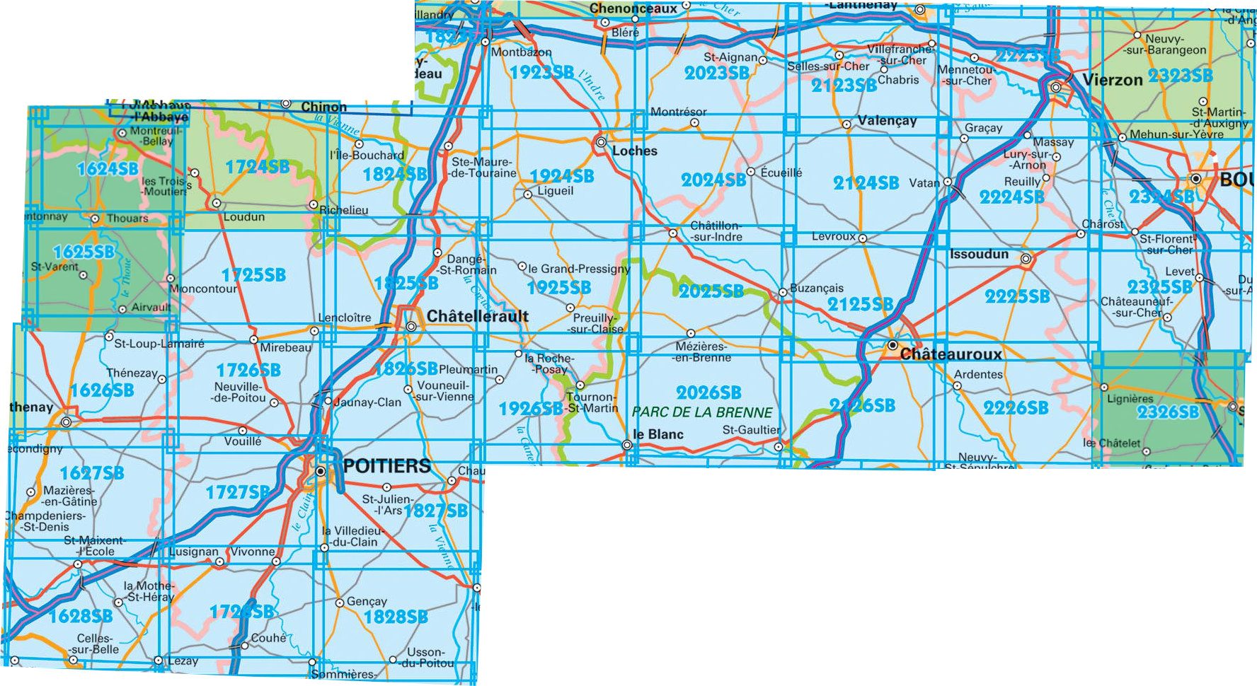
Producten op de overzichtskaart
Klik op een product om naar de detailpagina te gaan.
- Wandelkaart 1627 SB Mazières-en-Gâtine & Vasles - IGN
- Wandelkaart 1724 SB Loudun & Richelieu - IGN
- Wandelkaart 1725 SB Lencloître & St-Jean-de-Sauves - IGN
- Wandelkaart 1727 SB Poitiers & Coulombiers - IGN
- Wandelkaart 1728 SB Vivonne & Lusignan - IGN
- Wandelkaart 1824 SB Ste-Maure-de-Touraine & L'Ile-Bouchard IGN
- Wandelkaart 1825 SB Châtellerault & Descartes - IGN
- Wandelkaart 1827 SB Poitiers & Chauvigny - IGN
- Wandelkaart 1923 SB Bléré- Chenonceaux & Veigné - IGN
- Wandelkaart 1924 SB Loches & Ligueil - IGN
- Wandelkaart 1925 SB Preuilly-sur-Claise & le Grand-Pressigny
- Wandelkaart 1926 SB Le Blanc- Pleumartin & La Roche-Posay - IGN
- Wandelkaart 2024 SB Châtillon-sur-Indre - Ecueillé - IGN
- Wandelkaart 2025 SB Buzançais & Mézières-en-Brenne - IGN
- Wandelkaart 2026 SB Saint-Gaultier & Rosney - IGN
- Wandelkaart 2123 SB Selles-sur-Cher & Chabris - IGN
- Wandelkaart 2124 SB Luçay-le-Mâle & Poulaines - IGN
- Wandelkaart 2125 SB Châteauroux & Levroux - IGN
- Wandelkaart 2126 SB Le Poinçonnet- Velles & Luant - IGN
- Wandelkaart 2223 SB Vierzon & Mennetou-sur-Cher - IGN
- Wandelkaart 2224 SB Vatan & Chârost - IGN
- Wandelkaart 2225 SB Issoudun & Neuvy-Paillouxt - IGN
- Wandelkaart 2226 SB Ardentes & La Berthenoux - IGN
- Wandelkaart 2323 SB St-Martin-D'Auxigny & Foëcy - IGN
- Wandelkaart 2324 SB Bourges & Mehun-sur-Yèvre - IGN
Artikelen uit dezelfde regio

Wandelkaart 2024 SB Châtillon-sur-Indre - Ecueillé - IGN • 9782758554080
Wandelkaart Châtillon-sur-Indre - Ecueillé - IGN Productomschrijving: Châtillon-sur-Indre & Ecueillé zijn gemeentes in het Franse departement Indre, in de regio Centre-Val de Loire. De plaats maakt deel uit van het arrondissement Châteauroux. Omvat: Chemillé-sur-Indrois, Saint-Cyran-du-Jambot, Fléré-la-Rivière, Écueillé, Châtillon-sur-Indre, Bridoré, Saint-Hippolyte, Sennevières, Préau…

Wandelkaart 2326 SB St-Amand-Montrond & Lignières - IGN • 9782758537199
Wandelkaart 2326 SB - St-Amand-Montrond & Lignières Productomschrijving: St-Amand-Montrond & Lignières zijn gemeentes in het zuiden van het departement Cher in de regio Centre. ze zijn gelegen langs de A71 en de Cher in het geografische centrum van Frankrijk. Ze is tevens hoofdstad van de Boischaut. Tussen 2014 en 2018, worden alle SERIE BLUE kaarten in de collectie vernieuwd. Een nieuwe k…

Wandelkaart 2519 SB Courtenay & Château-Renard - IGN • 9782758548676
Wandelkaart - Courtenay & Château-Renard Productomschrijving: Courtenay & Château-Renard zijn gemeentes in het Franse departement Loiret in de regio Centre-Val de Loire. De plaats maakt deel uit van het arrondissement Montargis. Tussen 2014 en 2018 vernieuwt IGN haar volledige collectie serie blauw. Een nieuwe toewijzing voor optimale leesbaarheid, met een grotere mate van geometrische…

Wandelkaart 2119 SB Patay & Ouzouer-le-Marché - IGN • 9782758548386
Wandelkaart 2119 SB - Patay & Ouzouer-le-Marché Productomschrijving: Patay & Ouzouer-le-Marché zijn gemeentes in het Franse departement Loir-et-Cher in de regio Centre-Val de Loire. De plaats maakt deel uit van het arrondissement Blois. Tussen 2014 en 2020 vernieuwt IGN haar volledige collectie serie blauw. Een nieuwe toewijzing voor optimale leesbaarheid, met een grotere mate van geom…

Wandelkaart 2127 SB Argenton-sur-Creuse & Cluis - IGN • 9782758556244
Wandelkaart Argenton-sur-Creuse & Cluis - IGN Productomschrijving: Argenton-sur-Creuse & Cluis zijn beide te vinden in het Franse departement Indre, gelegen in de regio van Centre-vla-de-Loire. Franse omschrijving van de uitgever: L'indispensable carte de randonnée IGN 2127SB. D'une très grande précision elle contient tous les détails existants sur le terrain : voies de communication j…