

Wandelkaart 217 Mount Rainier NP- Washington - Nat Geo
Gelegen in het zuidoosten van Pierce County

Korte omschrijving
Wandelkaarten ##REGIO## van National Geographic. Ideaal voor tochten in Verenigde Staten van Amerika (USA).
TOPO Wandelkaart 217 - Mount Rainier National Park - Nat Geo Productomschrijving: Mount Rainier National Park is een Amerikaans national park gelegen in het zuidoosten van Pierce County en t...

Specificaties
- Uitgever: National Geographic
- ISBN-13: 9781566953450
- HOOFDCATEGORIEËN: Wandelkaart
- Activiteiten: Wandelen, Hiking & Trekking
- Auteur: National Geographic
- Land: Verenigde Staten van Amerika (USA)
- Nationale parken: Mount Rainier NP, Washington USA
- TOPO's & Stafkaarten: Topografisch wandelen
- Schaal: 1:55000
- Taal: Engels
Volledige omschrijving
TOPO Wandelkaart 217 - Mount Rainier National Park - Nat Geo
Productomschrijving: Mount Rainier National Park is een Amerikaans national park gelegen in het zuidoosten van Pierce County en ten noordoosten van Lewis County in Washington state.
Engelse omschrijving: The highest point in the Cascade Range, Mount Ranier is an icon of Washington state. It is an active volcano and the largest single-peak glacial system in the lower forty-eight states, spawning 6 major rivers. National Geographic's Trails Illustrated map of Mount Ranier National Park is designed to meet the needs of outdoor enthusiasts by combining valuable information with unmatched detail of this spectacular landscape of glaciers, old-growth forests, subalpine meadows, and valleys. Created in partnership with local land management agencies, this expertly researched map features key areas of interest including Paradise, Longmire, White River, Mowich Lake, Ohanapecosh, Chinook Scenic Byway, Crystal Mountain, and Glacier View Wilderness.
With extensive detail of Mount Ranier and its glaciers, and miles of clearly marked trails including the Pacific Crest and Wonderland trails, this map will prove invaluable in your exploration of the park. Mileages between intersections are shown and the map base includes contour lines and elevations for summits, passes and many lakes. Recreation features noted include ski areas, campgrounds, trailheads, lodging, horse camps, scenic overlooks, and more. Every Trails Illustrated map is printed on "Backcountry Tough" waterproof, tear-resistant paper. A full UTM grid is printed on the map to aid with GPS navigation.
Other features found on this map include: Cascade Range, Chinook Pass, Comet Falls, Fairy Falls, Gifford Pinchot National Forest, Mount Rainier, Mount Rainier National Park, Norse Peak Wilderness, Sluiskin Falls, Snoqualmie National Forest, Tatoosh Range, Tatoosh Wilderness, William O. Douglas Wilderness.
Locatie op kaart
Overzichtskaarten

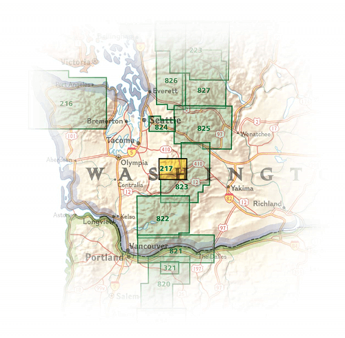
NAT GEO Washington trail maps
NAT GEO Washington trail maps

Producten op de overzichtskaart
Klik op een product om naar de detailpagina te gaan.
- Wandelkaart 216 Olympic NP- Washington - Nat Geo
- Wandelkaart 217 Mount Rainier NP- Washington - Nat Geo
- Wandelkaart 821 Columbia River Gorge - Nat Geo
- Wandelkaart 822 Mount St. Helens- Washington - Nat Geo
- Wandelkaart 223 North Cascades NP- Washington - Nat Geo
- Wandelkaart 825 Alpine Lakes Wilderness Washington - Nat Geo
- Wandelkaart 826 Mount Baker & Boulder River Wilderness