
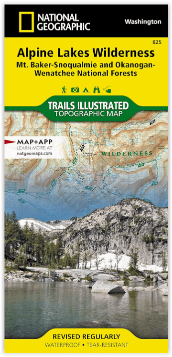
Wandelkaart 825 Alpine Lakes Wilderness Washington - Nat Geo
Mt. Baker-Snoqualmie - Okanogan-Wenatchee National Forests
Korte omschrijving
Alpine Lakes Wilderness Washington - Nat Geo Productomschrijving: Buitenmensen die de Central Cascades willen verkennen, vinden de Trails Illustrated-kaart van National Geographic van de Alp...

Specificaties
- Uitgever: National Geographic
- ISBN-13: 9781566955072
- Activiteiten: Wandelen, Hiking & Trekking
- Land: Verenigde Staten van Amerika (USA)
- Waterafstotende kaart: Nat Geo waterproof series
- Regionale parken: Alpine Lakes Wilderness, Washington State USA
- Schaal: 1:75000
- Afmeting: 10x19
- Taal: Engels
- Reeks: National Geographic Trails Illustrated
Volledige omschrijving
Alpine Lakes Wilderness Washington - Nat Geo
Productomschrijving: Buitenmensen die de Central Cascades willen verkennen, vinden de Trails Illustrated-kaart van National Geographic van de Alpine Lakes Wilderness een onmisbaar hulpmiddel. De kaart is deskundig onderzocht en gemaakt in samenwerking met de U.S. Forest Service en anderen. De kaart beslaat de wildernis en de omliggende delen van de Mt. Baker-Snoqualmie en Okanogan-Wenatchee National Forests. Terwijl het ruige, door gletsjers uitgesleten terrein van het gebied wordt gedomineerd door tientallen pieken en honderden meren, zijn andere belangrijke punten de Skykomish en Wenatchee River, Lake Eaton State Park en Stevens Pass.
Alle paden zijn duidelijk gemarkeerd en voorzien van een kleurcode op basis van hun gebruik, of je nu te voet, te paard, op een mountainbike of met een gemotoriseerd voertuig onderweg bent. De Pacific Crest en Pacific Northwest Trails, die door het gebied slingeren, zijn gemarkeerd. Voor degenen die liever met een gemotoriseerd voertuig op verkenning gaan, zijn de Mountains to Sound en Stevens Pass Greenways aangegeven, evenals OHV-routes en wegen met een hoge doorrijhoogte. De kaart bevat hoogtelijnen en hoogtes voor toppen, bergtoppen, passen en de honderden meren. Waardevolle wildernis regelgeving en veiligheidstips zijn ook opgenomen op de kaart, samen met nuttige contactinformatie.
Omvat: Alpine Lakes Wilderness, Cashmere Mountain, Chiwaukum Mountains, Cle Elum Lake, Entiat Mountains, Goat Mountain, Icicle Ridge, Kachess Lake, Lake Sawyer, Mount Daniel, Mount Stuart, Snoqualmie National Forest, Snoqualmie Pass, Teanaway Ridge, Wenatchee Mountains, Wenatchee National Forest, Wild Sky Wilderness.
Engelse omschrijving: Outdoor enthusiasts looking to explore of the Central Cascades will find National Geographic's Trails Illustrated map of Alpine Lakes Wilderness an indispensable tool. Expertly researched and created in partnership with the U.S. Forest Service and others, the map covers the wilderness and the surrounding parts of the Mt. Baker-Snoqualmie and Okanogan-Wenatchee National Forests. While the area's rugged, glacier-carved terrain is dominated by tens of peaks and hundreds of lakes, other key points of interest include Skykomish and Wenatchee River, Lake Eaton State Park and Stevens Pass.
All trails are clearly marked and color coded according to their designated usage, whether you're traveling by foot, horse, mountain bike, or motorized vehicle. The Pacific Crest and Pacific Northwest Trails, which snake through the area, are highlighted. For those who prefer exploring in a motorized vehicle the Mountains to Sound and Stevens Pass Greenways are both indicated, as well as OHV routes and high clearance roads. The map base includes contour lines and elevations for peaks, summits, passes and the hundreds of lakes. Valuable wilderness regulation and safety tips are also included on the map, along with useful contact information.
Many recreation and adventure features are noted as well, including campgrounds and primitive campsites, horse camps and corrals, downhill and cross-country ski areas, snowmobile trails, boat launches and fishing areas. Every Trails Illustrated map is printed on "Backcountry Tough" waterproof, tear-resistant paper. A full UTM grid is printed on the map to aid with GPS navigation.
Other features found on this map include: Alpine Lakes Wilderness, Cashmere Mountain, Chiwaukum Mountains, Cle Elum Lake, Entiat Mountains, Goat Mountain, Icicle Ridge, Kachess Lake, Lake Sawyer, Mount Daniel, Mount Stuart, Snoqualmie National Forest, Snoqualmie Pass, Teanaway Ridge, Wenatchee Mountains, Wenatchee National Forest, Wild Sky Wilderness.
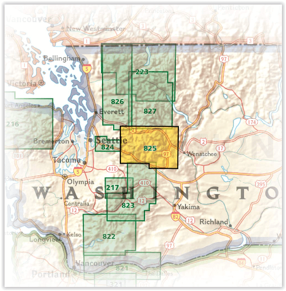
Overzichtskaarten

NAT GEO Washington trail maps
NAT GEO Washington trail maps

Producten op de overzichtskaart
Klik op een product om naar de detailpagina te gaan.