
Wandelkaart 266 Wirral- Chester & Caer- Merseyside - OSI
Omvat de Mersey community Forest en recreatieve paden

Korte omschrijving
Wandelkaart Wirral- Chester & Caer - Merseyside England Productbeschrijving: Kaart nummer 266 in de OS Explorer reeks heeft betrekking op het Wirral, in het noordwesten van Engeland in de bu...

Specificaties
- Uitgever: Ordnance Survey
- ISBN-13: 9780319244630
- HOOFDCATEGORIEËN: Wandelkaart
- Activiteiten: Wandelen, Hiking & Trekking
- Regio: Merseyside, England
- Land: England
- Regionale parken: Mersey Community Forest
- Schaal: 1:25000
- Afmeting: 13x23
- Taal: Engels
- Reeks: Explorer Series
Volledige omschrijving
Wandelkaart Wirral- Chester & Caer - Merseyside England
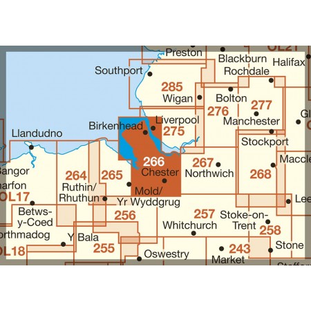
Productbeschrijving: Kaart nummer 266 in de OS Explorer reeks heeft betrekking op het Wirral, in het noordwesten van Engeland in de buurt van Liverpool. De Mersey community Forest en recreatieve paden de North Cheshire Way, Canalside Trail en Wirral way worden getoont, samen met hoogtepunten zoals de steden Chester, Liverpool, samen met de steden Birkenhead, Bootle, Connah's Quay en Buckley. De OS Explorer kaart voor Wirral & Chester is beschikbaar in zowel de standaard papieren versie als de weerbestendige 'Actief' versie.
Productdiscription: Map sheet number 266 in the OS Explorer series covers The Wirral in the North West of England near Liverpool. The Mersey Community Forest and recreational paths the North Cheshire Way, Canalside Trail and Wirral Way are covered, along with highlights such as the cities of Chester and Liverpool, along with the towns of Birkenhead, Bootle, Connah's Quay and Buckley. The OS Explorer map for Wirral & Chester is available in both the standard paper version and weatherproof 'Active' version.
Locatie op kaart
Gekoppelde artikelen

Wandelkaart 266 Wirral- Chester & Caer- Merseyside - OSI • 9780319244630
standaard versieWandelkaart Wirral- Chester & Caer - Merseyside England Productbeschrijving: Kaart nummer 266 in de OS Explorer reeks heeft betrekking op het Wirral, in het noordwesten van Engeland in de buurt van Liverpool. De Mersey community Forest en recreatieve paden de North Cheshire Way, Canalside Trail en Wirral way worden getoont, samen met hoogtepunten zoals de steden Chester, Liverpool, samen m…

Wandelkaart 266 Wirral Chester & Caer Merseyside - OSI • 9780319471388
weatherproof versieWandelkaart Wirral- Chester & Caer - Merseyside England Productbeschrijving: Kaart nummer 266 in de OS Explorer kaarten reeks heeft betrekking op Wirral, in het noordwesten van Engeland in de buurt van Liverpool. De Mersey community Forest en recreatieve paden de North Cheshire Way, stijlkamers Trail en Wirral Way, vallen samen met hoogtepunten zoals de steden Chester, Liverpool, samen met…
Overzichtskaarten

OSI Explorer & Explorer Active - Wales
OSI Explorer & Explorer Active - Wales

Producten op de overzichtskaart
Klik op een product om naar de detailpagina te gaan.
- Wandelkaart 151 Cardiff & Bridgend- Wales - OSI
- Wandelkaart 152 Newport & Pontypool- South Wales - OSI
- Wandelkaart 164 Gower AONB & Gwyr- South Wales - OSI
- Wandelkaart 165 Swansea & Abertawe- South Wales - OSI
- Wandelkaart 166 Rhondda & Merthyr Tydfil - OSI
- Wandelkaart 177 Carmarthen & Kidwelly- Wales - OSI
- Wandelkaart 178 Llanelli- Ammanford & Rhydaman - OSI
- Wandelkaart 185 Newcastle & Emly- Northumberland - OSI
- Wandelkaart 186 Llandeilo- Brechfa Forest- Wales - OSI
- Wandelkaart 187 Llandovery- South Wales - OSI
- Wandelkaart 188 Builth Wells & Llanfair-ym-Muallt - OSI
- Wandelkaart 189 Hereford & Ross-on-Wye- England - OSI
- Wandelkaart 198 Cardigan & New Quay- Wales - OSI
- Wandelkaart 199 Lampeter- Wales - OSI
- Wandelkaart 200 Llandrindod Wells & Elan Valley - OSI
- Wandelkaart 201 Knighton & Presteigne- Wales - OSI
- Wandelkaart 202 Leominster & Bromyard Hererfordshire - OSI
- Wandelkaart 203 Ludlow & Shropshire Hills AONB - OSI
- Wandelkaart 213 Aberystwyth & Cwm Rheidol - Wales - OSI
- Wandelkaart 214 Llanidloes- Newtown & Y Drenewydd - OSI
- Wandelkaart 215 Newtown & Machynlleth- Powys Wales - OSI
- Wandelkaart 216 Welshpool & Montgomery- Powys - OSI
- Wandelkaart 217 Long Mynd & Wenlock Edge - OSI
- Wandelkaart 239 Lake Vyrnwy & Efyrnwy- North Wales - OSI
- Wandelkaart 240 Oswestry & Croesoswallt- Shropshir - OSI
- Wandelkaart 241 Shrewsbury- shropshire England - OSI
- Wandelkaart 253 Lleyn Peninsula West Wales - OSI
- Wandelkaart 254 Lleyn Peninsula East- Wales - OSI
- Wandelkaart 255 Llangollen & Berwyn- West Wales - OSI
- Wandelkaart 256 Wrexham- Wrecsam & Llangollen - OSI
- Wandelkaart 257 Crewe & Nantwich & Cheshire East - OSI
- Wandelkaart 262 Anglesey West- Wales AONB - OSI
- Wandelkaart 263 Anglesey East AONB- Wales - OSI
- Wandelkaart 264 Vale of Clwyd & Dyffryn Clwyd - OSI
- Wandelkaart 265 Clwydian Range & Bryniau Clwyd - OSI
- Wandelkaart 266 Wirral- Chester & Caer- Merseyside - OSI
- Wandelkaart 267 Northwich & Delamere Forest - OSI
- Wandelkaart 275 Liverpool- South West England - OSI
- Wandelkaart OL12 Brecon Beacons NP- West & Central - OSI
- Wandelkaart OL13 Brecon Beacons NP - Eastern area - OSI
- Wandelkaart OL17 Snowdon & Conwy Valley area - OSI
- Wandelkaart OL35 North Pembrokeshire Wales - OSI
- Wandelkaart OL36 South Pembrokeshire- Wales - OSI
Artikelen uit dezelfde regio

Reisgids Liverpool Secret - Jonglez Publishing • 9782361953249
Travelguide Liverpool Secret - Jonglez Publishing Productinformation: Let Secret Liverpool guide you around the unusual and unfamiliar. Step off the beaten track with this fascinating Liverpool guide book and let our local experts show you the well-hidden treasures of an amazing city. Ideal for local inhabitants and curious travellers alike. The places included in our guides are unusual an…

Wandelkaart 285 Southport & Chorley- Merseyside - OSI • 9780319471579
Wandelkaart Southport & Chorley - Merseyside England Omvat ook: Wigan, Formby & Ormskirk. Productbeschrijving: Kaart nummer 285 in de OS Explorer kaarten reeks is ideaal voor het ontdekken van het noordwesten van Engeland rond Southport en Chorley. Met het Red Rose Forest en de Mersey Forest opgenomen in het gebied van deze kaart, is er geen tekort aan plaatsen om te gaan verkennen. An…

Wandelkaart 285 Southport & Chorley Merseyside - OSI • 9780319244821
Wandelkaart Southport & Chorley - Merseyside England Omvat ook: Wigan, Formby & Ormskirk. Productbeschrijving: Kaart nummer 285 in de OS Explorer kaarten reeks is ideaal voor het ontdekken van het noordwesten van Engeland rond Southport en Chorley. Met het Red Rose Forest en de Mersey Forest opgenomen in het verdragsgebied van deze kaart, zijn er geen plaatsen te kort om uitstappen te …

Wandelkaart 108 Liverpool Merseyside England - OSI • 9780319262061
Wandelkaart Liverpool- Merseyside England - OSI Productbeschrijving: De OS Landranger kaart 108 omvat Liverpool alsook Southport, Wigan, Chorley, Standish, Formby, Crosby, Rainford, Kirkby, St Helens, Prescot, Widness, Birkenhead en Runcorn. De OS Landranger kaarten reeks heeft betrekking op Groot-Brittannië met 204 gedetailleerde kaarten, perfect voor dagtochten en korte pauzes. Elke kaar…

Wandelkaart 275 Liverpool St Helens Widnes & Runcorn - OSI • 9780319471470
Wandelkaart Liverpool- St Helens - Widnes & Runcorn Omvat ook: St Helens, Widnes & Runcorn. Productbeschrijving: OS Explorer kaart 275 omvat Liverpool, St Helens, Widnes Runcorn, alsmede de rivier de Mersey. Hoogtepunten zijn onder andere de Trans Pennine Trail, Mersey Wayen de Liverpool run Line. De OS Explorer kaart voor Liverpool is beschikbaar in zowel de standaard papieren versie …