

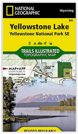
Wandelkaart 305 Yellowstone Lake - Yellowstone NP - Nat Geo
Big Game Ridge- Colter Peak- Eagle Peak- Heart Lake & Lewis Lake

Korte omschrijving
Wandelkaarten Wyoming, USA, Montana, USA en Idaho, USA van National Geographic. Ideaal voor tochten in Noord-Amerika (USA & Canada).
Yellowstone Lake - Yellowstone NP - Nat Geo Omvat: Big Game Ridge, Colter Peak, Eagle Peak, Heart Lake, Lewis Lake, Mount Hancock, Mount Sheridan, North Absaroka Wilderness, Red Mountains, S...

Specificaties
- Uitgever: National Geographic
- ISBN-13: 9781566954365
- HOOFDCATEGORIEËN: Wandelkaart
- Activiteiten: Wandelen, Hiking & Trekking
- Auteur: National Geographic
- Regio: Idaho, USA, Montana, USA, Wyoming, USA
- Land: Noord-Amerika (USA & Canada)
- Waterafstotende kaart: Nat Geo waterproof series
- Nationale parken: Yellowstone NP, Wyoming USA
- Schaal: 1:70000
- Editie: 7
- Taal: Engels
Volledige omschrijving
Yellowstone Lake - Yellowstone NP - Nat Geo
Omvat: Big Game Ridge, Colter Peak, Eagle Peak, Heart Lake, Lewis Lake, Mount Hancock, Mount Sheridan, North Absaroka Wilderness, Red Mountains, Shoshone National Forest, Teton National Forest, Teton Wilderness, Thorofare Plateau, Washakie Wilderness, Yellowstone Lake, Yellowstone National Park.
Engelse omschrijving: National Geographic's Trails Illustrated map of the Yellowstone Lake area of Yellowstone National Park is designed to meet the needs of outdoor enthusiasts with unmatched detail of the south-east section of the national park. Expertly researched and created in partnership with local land management agencies, this map features key points of interest including Yellowstone lake shown with contours and bathe metric shading, Lake Village, Grant Village, East Entrance Station, Heart Lake, Bridger-Teton National Forest, Shoshone National Forest, Teton Wilderness, and North Absaroka Wilderness.
With many miles of mapped trails and marked Bear Management Zones the Yellowstone Lake map can guide you off the beaten path and back again. The clearly marked trails include mileages between intersections. The map base includes contour lines and elevations for summits, passes and many lakes. Some of the many recreation features include: visitor centers, campgrounds, boat ramps, trailheads, and interpretive trails.
Every Trails Illustrated map is printed on "Backcountry Tough" waterproof, tear-resistant paper. A full UTM grid is printed on the map to aid with GPS navigation.
Locatie op kaart
Overzichtskaarten
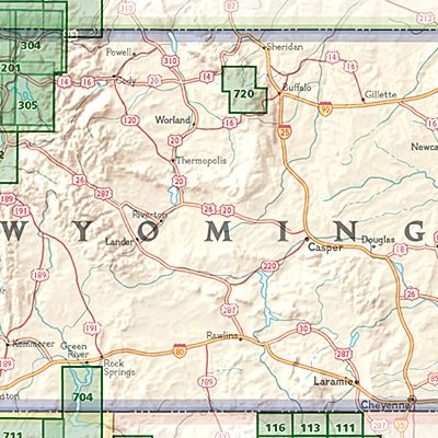
NAT GEO Wyoming trail map
NAT GEO Wyoming trail map

Producten op de overzichtskaart
Klik op een product om naar de detailpagina te gaan.
- Wandelkaart 201 Yellowstone NP- Wyoming - Nat Geo
- Wandelkaart 202 Grand Teton NP- Wyoming - Nat Geo
- Wandelkaart 302 Yellowstone NP & Old Faithful - Nat Geo
- Wandelkaart 303 Mammoth Hot Springs- Yellowstone - Nat Geo
- Wandelkaart 304 Tower & Canyon Yellowstone NP - Nat Geo
- Wandelkaart 305 Yellowstone Lake - Yellowstone NP - Nat Geo
- Wandelkaart 704 Flaming Gorge- Recreational Area - Utah
Artikelen uit dezelfde regio
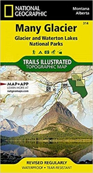
Wandelkaart 314 Many Glacier NP- Waterton lakes - Montana • 9781566954709
TOPO Wandelkaart 314 - Many Glacier NP- Waterton lakes Productomschrijving: Many Glacier is een locatie binnen het Glacier National Park gelegen in de U.S. in de staat van Montana Engelse omschrijving: Created in partnership with local land management agencies, National Geographic's Trails Illustrated map of Many Glacier, Glacier and Waterton Lakes National Parks offers unparalleled de…
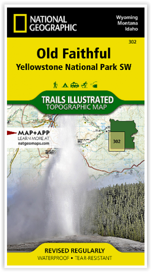

Wandelkaart 302 Yellowstone NP & Old Faithful - Nat Geo • 9781566954334
Yellowstone National Park & Old Faithful - Nat Geo Omvat: Craig Pass, Gallatin National Forest, Grand Teton National Park, Heart Lake, Jedediah Smith Wilderness, John D. Rockefeller, Jr. Memorial Parkway, Lewis Lake, Mount Sheridan, Pitchstone Plateau, Red Mountains, Shoshone Lake, Targhee National Forest, Teton National Forest, Teton Wilderness, Yellowstone National Park. Engelse omsc…
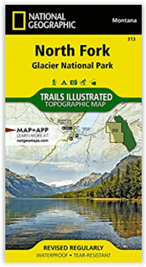
Wandelkaart 313 North Fork- Glacier National Park - Nat Geo • 9781566954693
North Fork river - Glacier National Park - Nat Geo Productomschrijving: National Geographic's Trails Illustrated kaart van North Fork in Glacier National Park zal zelfs de meest ervaren buitensportliefhebber ten goede komen, bij het verkennen van dit ongerepte landschap dat zeer weinig voorzieningen heeft. Twee extra kaarten voor Many Glacier en de Two Medicine regio's van het park, samen…

Wandelkaart 723 Bozeman- Big Sky & Bridger Range - Natgeo • 9781566956802
TOPO Wandelkaart 723 - Bozeman- Big Sky & Bridger Range Productomschrijving: Bozeman Pass is een bergpas gelegen ongeveer 21 km ten oosten van Bozeman, Montana en ongeveer 24 km ten westen van Livingston, Montana. It verdeeld de Bridger & Gallatin bergmassieven. Engelse omschrijving: Located just north of Yellowstone National Park, Absaroka-Beartooth Wilderness is known for it high pea…

Wandelkaart 201 Yellowstone NP- Wyoming - Nat Geo • 9781566952958
TOPO Wandelkaart 201 - Yellowstone NP- Wyoming - Nat geo Productomschrijving: Yellowstone National Park, wat een prachtig concept voor een nationaal park, een par van formaat, en een nationaal park in de Verenigde Staten, hoofdzakelijk in Wyoming, maar met kleine gedeeltes in de aangrenzende staten Montana en Idaho. Engelse omschrijving: National Geographic's Trails Illustrated map of …