

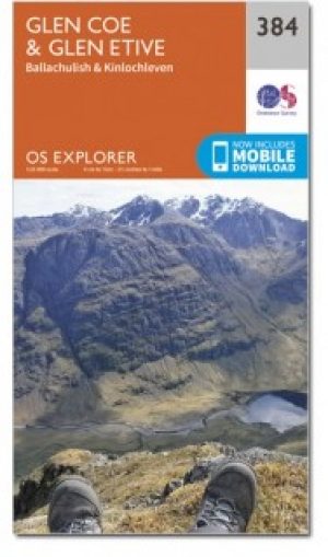
Wandelkaart 384 Glen Coe & Glen Etive- Highlands - OSI
Omvat Glen Coe- Glen Etive en Ballachulish Kinlochleven


Korte omschrijving
Wandelkaarten Highlands, Schotland van Ordnance Survey. Ideaal voor tochten in Schotland.
Wandelkaart Glen Coe & Glen Etive - Highlands Schotland Productbeschrijving: Ballachulish & Kinlochleven. 384 - Glen Coe & Glen Etive, Highlands, Schotland - Kaart nummer 384 in de OS E...

Specificaties
- Uitgever: Ordnance Survey
- ISBN-13: 9780319246306
- HOOFDCATEGORIEËN: Wandelkaart
- Activiteiten: Wandelen, Hiking & Trekking
- Regio: Highlands, Schotland
- Land: Schotland
- TOPO's & Stafkaarten: Topografisch wandelen
- Schaal: 1:25000
- Taal: Engels
- Reeks/Serie: Explorer Series OS
- Iconische Bergketens van Europa: De Schotse Highlands
Volledige omschrijving
Wandelkaart Glen Coe & Glen Etive - Highlands Schotland
Productbeschrijving: Ballachulish & Kinlochleven.
384 - Glen Coe & Glen Etive, Highlands, Schotland - Kaart nummer 384 in de OS Explorer kaart reeks is de ideale kaart voor bezoekers aan de Glen Coe, Glen Etive en Ballachulish Kinlochleven gebieden. Het gebied omvat 17 Munro's die de wandelaars aantrekken. Hoogtepunten van het gebied zijn onder andere: Glen Coe, Loch Leven erfgoed Trail, de West Highland Way, Ballachulish. De OS Explorer kaart voor Glen Coe & Glen Etive is beschikbaar in zowel de standaard papieren versie als de weerbestendige 'Actief' versie.
384 / Glen Coe & Glen Etive, Highlands, Schotland - Map sheet number 384 in the OS Explorer map series is the ideal map for visitors to the Glen Coe, Glen Etive, Ballachulish and Kinlochleven areas. The area is home to 17 Munros which attract walkers whose pastime is ‘Munro bagging’.Highlights of the area include: Glen Coe, Loch Leven Heritage Trail, The West Highland Way, Ballachulish. The OS Explorer map for Glen Coe & Glen Etive is available in both the standard paper version and weatherproof 'Active' version.
Locatie op kaart
Gekoppelde artikelen

Wandelkaart 384 Glen Coe & Glen Etive- Highlands - OSI • 9780319246306
standaard versieWandelkaart Glen Coe & Glen Etive - Highlands Schotland Productbeschrijving: Ballachulish & Kinlochleven. 384 - Glen Coe & Glen Etive, Highlands, Schotland - Kaart nummer 384 in de OS Explorer kaart reeks is de ideale kaart voor bezoekers aan de Glen Coe, Glen Etive en Ballachulish Kinlochleven gebieden. Het gebied omvat 17 Munro's die de wandelaars aantrekken. Hoogtepunten van het ge…
Wandelkaart 384 Glen Coe & Glen Etive- Schotland - OSI • 9780319472507
weatherproof versieWandelkaart Glen Coe & Glen Etive - Highland's Schotland Omvat ook: Ballachulish & Kinlochleven. Productbeschrijving: Kaart nummer 384 in de OS Explorer kaarten reeks is de ideale kaart voor bezoekers aan de Glen Coe, Glen Etive en Ballachulish Kinlochleven gebieden. Het gebied is thuis aan 17 Munro's die wandelaars gebruiken en waarvan ze het favo tijdverdrijf is 'Munro zakken'. Hoogt…
Overzichtskaarten

OSI Explorer & Explorer Active - Ben Nevis - Glen Coe
OSI Explorer & Explorer Active - Ben Nevis - Glen Coe
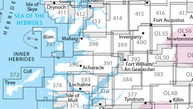
Producten op de overzichtskaart
Klik op een product om naar de detailpagina te gaan.
- Wandelkaart 372 Coll & Tiree- Ayrshire & Lanark - OSI
- Wandelkaart 374 Isle of Mull North & Tobermroy - OSI
- Wandelkaart 376 Oban & North Lorn- Argyl & Bute - OSI
- Wandelkaart 377 Loch Etive & Glen Orchy- Schotland- OSI
- Wandelkaart 383 Morvern & Lochaline- Highland's - OSI
- Wandelkaart 384 Glen Coe & Glen Etive- Highlands - OSI
- Wandelkaart 385 Rannoch Moor & Ben Alder- Highland's - OSI
- Wandelkaart 390 Ardnamurchan- Highlands Schotland - OSI
- Wandelkaart 391 Ardgour & Strontian- Highlands - OSI
- Wandelkaart 392 Ben Nevis & Fort William- Highlands - OSI
- Wandelkaart 397 Rum- Eigg- Muck- Canna & Sanday - OSI
- Wandelkaart 398 Loch Morar & Mallaig- Highland's - OSI
- Wandelkaart 399 Loch Akraig- Lochaber Schotland - OSI
- Wandelkaart 400 Loch Lochy & Glen Roy- Highlands - OSI
- Wandelkaart 413 Knoydart- Loch Hourn & Loch Duich - OSI
- Wandelkaart 414 Glen Shiel & Kintail Forest- Highlands- OSI
- Wandelkaart 415 Glen Affric & Glen Moriston - OSI
- Wandelkaart 416 Inverness & Loch Ness - OSI
- Wandelkaart OL50 Ben Alder, Loch Ericht & Laggan - OS
- Wandelkaart OL55 Loch Laggan, Creag Meagaidh & Corrieyairack - OS
- Wandelkaart OL56 Badenoch, Upper Strathspey & Kingussie - OS
Artikelen uit dezelfde regio
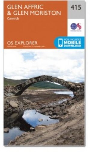

Wandelkaart 415 Glen Affric & Glen Moriston Schotland - OSI • 9780319472705
Wandelkaart Glen Affric & Glen Moriston - Iverness Highland's Omvat ook: Cannich. Productbeschrijving: Kaart nummer 415 in de OS Explorer kaarten reeks is ideaal voor het ontdekken van het gebied rond Glen Affric in de hooglanden van Schotland. Glen Affric is een National Scenic Area, en biedt de mogelijkheid voor vele wandelingen rond prachtige landschappen. Er zijn vele Lochs om te o…
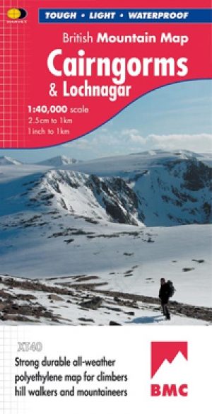
Wandelkaart Cairngorms National Park - Harvey maps • 9781851374533
Wandelkaart Cairngorms National Park - Harvey maps Productomschrijving: Een inspirerende kaart die betrekking heeft op veel van Schotland's nieuwste Nationaal Park. Duidelijke en gemakkelijk te lezen met massa's van informatie voor de wandelaar, klimmer en mountainbiker, en vrijwel onverwoestbaar, door ' Nigel Williams', hoofd van trainingen, te Glenmore Lodge. Omschrijving: Nieuwe gen…
Wandelkaart OL55 Loch Laggan & Creag Meagaidh - OSI • 9780319469736
Wandelkaart Loch Laggan & Creag Meagaidh - Highland's Omvat ook: Corrieyairick Pass Productbeschrijving: OS Explorer kaart OL 55 dekt Loch Laggan, onderdeel van het Cairngorms National Park, Corrieyairick forest en 6 Munros. Deze kaart vervangt de vorige OS Explorer kaart 401 voor dit gebied. De OS Explorer kaart voor Loch Laggan & Creag Meagaidh is beschikbaar in zowel de standaard pa…

Wandelkaart 385 Rannoch Moor & Ben Alder- Highland's - OSI • 9780319246313
Wandelkaart Rannoch Moor & Ben Alder - Highland's Schotland Omvat ook: Loch Rannoch. Productbeschrijving: Kaart nummer 385 omvat Rannoch Moor en Ben Alder. Hoogtepunten van het gebied zijn: Loch Rannoch, Loch Laidon en het Cairngorms National Park & Tay Forest Park. Omvat ook Blackwater Reservoir, Loch Ossian en Loch Eigheach. De OS Explorer kaart voor Rannoch Moor & Ben Alder is besch…
Wandelgids Mountain Walks Ben Nevis - Vertebrate Publ. • 9781839812460
Wandelgids Mountain Walks Ben Nevis - Vertebrate Productomschrijving: 15 routes to enjoy on- and around Ben Nevis. Mountain Walks Ben Nevis by Keri Wallace is a guide to walking routes to the summit of Ben Nevis in Lochaber, Scotland. Alongside the summit routes, there are also lower-level alternatives for mixed weather or shorter days and those new to mountain walking. Among the …