
Wandelkaart 702 Cedar Mountain - Utah USA - Nat Geo
Pine Valley Mountain - Dixie National Forest
Korte omschrijving
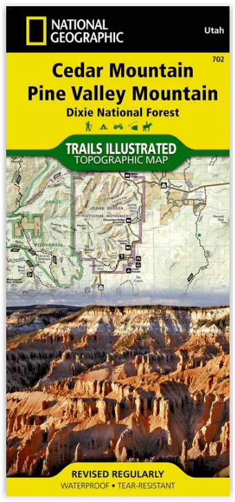
Wandelkaart Cedar Mountain - Utah USA - Nat Geo Omvat: Ashdown Gorge Wilderness, Brian Head, Dixie National Forest, Kolob Terrace, Little Salt Lake, Markagunt Plateau, Panguitch Lake, Parowa...

Specificaties
- Uitgever: National Geographic
- ISBN-13: 9781566953061
- HOOFDCATEGORIEËN: Wandelkaart
- Activiteiten: Wandelen, Hiking & Trekking
- Regio: Utah, USA
- Land: Verenigde Staten van Amerika (USA)
- Waterafstotende kaart: Nat Geo waterproof series
- Schaal: 1:75000
- Afmeting: 10x19
- Taal: Engels
Volledige omschrijving
Wandelkaart Cedar Mountain - Utah USA - Nat Geo
Omvat: Ashdown Gorge Wilderness, Brian Head, Dixie National Forest, Kolob Terrace, Little Salt Lake, Markagunt Plateau, Panguitch Lake, Parowan Valley, Pine Valley Mountain Wilderness, Pine Valley Mountains, Signal Peak.
Engelse omschrijving: Cedar City is the headquarters of the Dixie National Forest which is a two-million-acre, 170-mile stretch of breathtaking wilderness across southern Utah. This map covers the Markagunt OHV Trail System from the stunning Pink Cliffs in the South to the Parowon Valley Northwest to the town of Panguitch in the East, and the spectacular Markagunt Plateau Scenic Drive—a 123-mile trail from Cedar City to Parowan.
Also featured are Cedar Breaks National Monument—with meadows at 10,000 feet and stunning nights for stargazing—as well as the shallow Navajo Lake, ideal for fishing, swimming, and boating, and the red limestone Hurricane Cliffs.
The area offers boundless outdoor recreation opportunities, from hiking, hunting, and horseback riding to skiing, swimming, and scenic driving—for all seasons, and a wide range of visitors. Recreation features are clearly marked, including trailheads, campgrounds, boat launches, mountain bike routes, ATV trails, downhill ski areas, scenic overlooks, and points of interest. The map includes contour lines, shaded relief, and elevations for summits and passes, as well as safety tips, visitor centers and ranger stations, and contact information for local agencies.
The printed map contains an inset showing greater detail of the popular Brian Head Ski Area and Cedar Breaks National Monument.
Every Trails Illustrated map is printed on "Backcountry Tough" waterproof, tear-resistant paper. A full UTM grid is printed on the map to aid with GPS navigation.
Other features found on this map include: Ashdown Gorge Wilderness, Brian Head, Dixie National Forest, Kolob Terrace, Little Salt Lake, Markagunt Plateau, Panguitch Lake, Parowan Valley, Pine Valley Mountain Wilderness, Pine Valley Mountains, Signal Peak.
Locatie op kaart
Overzichtskaarten

NAT GEO Utah trail maps
NAT GEO Utah trail maps

Producten op de overzichtskaart
Klik op een product om naar de detailpagina te gaan.
- Wandelkaart 210 Canyonlands NP - Utah - Natgeo
- Wandelkaart 211 Arches National Park- Utah - Natgeo
- Wandelkaart 214 Zion National Park - Natgeo
- Wandelkaart 219 Bryce Canyon NP Utah - Natgeo
- Wandelkaart 220 Dinosaur National Monument - Natgeo
- Wandelkaart 267 Capitol Reef NP Utah - Natgeo
- Wandelkaart 310 Canyonlands NP - Island in the Sky District
- Wandelkaart 311 Canyonlands NP - Needles District - Natgeo
- Wandelkaart 312 Canyonlands NP - Maze District - Natgeo
- Wandelkaart 702 Cedar Mountain - Utah USA - Nat Geo
- Wandelkaart 703 Manti-La Sal National forest - Natgeo
- Wandelkaart 704 Flaming Gorge- Recreational Area - Utah
- Wandelkaart 705 Mount Dutton & Aquarius Plateau - Nat Geo
- Wandelkaart 213 Glen Canyon & Capitol Reef NP - Nat Geo
Artikelen uit dezelfde regio

Wandelkaart 709 Wasatch Front North Utah - Nat Geo • 9781566953702
Wasatch Front North - Utah - Nat Geo Omvat: Bountiful, Centerville, Cottonwood Heights, Currant Creek Peak, Daniels Canyon, Deer Creek Reservoir, Draper, Highland, Holladay, Lindon, Lone Peak Wilderness, Midvale, Mount Olympus Wilderness, Mount Timpanogos, Mount Timpanogos Wilderness, Murray, North Salt Lake, Orem, Pleasant Grove, Provo, Provo River, Rockport Lake, Salt Lake City, South Sa…

Reisgids Utah - Insight guides ENG • 9781839053252
Reisgids Utah - Insight guides ENG Productomschrijving: Deze Insight Guide is een rijk geïllustreerde inspirerende reisgids voor Utah en een prachtig souvenir van uw reis. Perfect voor reizigers die op zoek zijn naar een diepere duik in de geschiedenis en cultuur van de bestemming en ideaal om u te inspireren en te helpen bij het plannen van uw reis. Met zijn grote selectie van beziens…

Wandelkaart 506 Moab West - Klondike Bluffs & Dead Horse Point • 9781566959018
Wandelkaart Moab West - Klondike Bluffs & Dead Horse Point Productomschrijving: Deze kaart omvat het westelijke gedeelte van het grote Moab recreatie gebied van het befamde National Geographic's Trails Illustrated. De kaart biedt een overzicht genummerd 506 op onderstaande kaart van het gebied. Het gebied omvat 3 kaarten met nummers, 505, 506 & 507. De 505 is de kaart die alles in één keer…

Wandelkaart 700 Ogden- Monte Cristo Range Utah USA - Nat Geo • 9781566956345
Ogden- Monte Cristo Range- Utah USA - Nat Geo Productomschrijving: Outdoor enthousiastelingen die willen genieten van de grenzeloze recreatieve mogelijkheden in het noorden van Utah net ten oosten van Great Salt Lake zullen zich vergapen aan National Geographic's Trails Illustrated kaart van Ogden en de Monte Cristo Range. Ontworpen met een breed scala van bezoekers in het achterhoofd, wer…

Wandelkaart 267 Capitol Reef NP Utah - Natgeo • 9781566956703
Wandelkaart Capitol Reef NP Utah - Nat Geo Productomschrijving: Capitol Reef National Park is een verborgen juweel gelegen in de Waterpocket Fold, een rimpel in de aarde die zich uitstrekt bijna 100 mijl door het zuiden-centrale rode rots land van Utah. National Geographic's Trails Illustrated kaart van Capitol Reef biedt ongeëvenaarde details van het park om tegemoet te komen aan de behoe…