

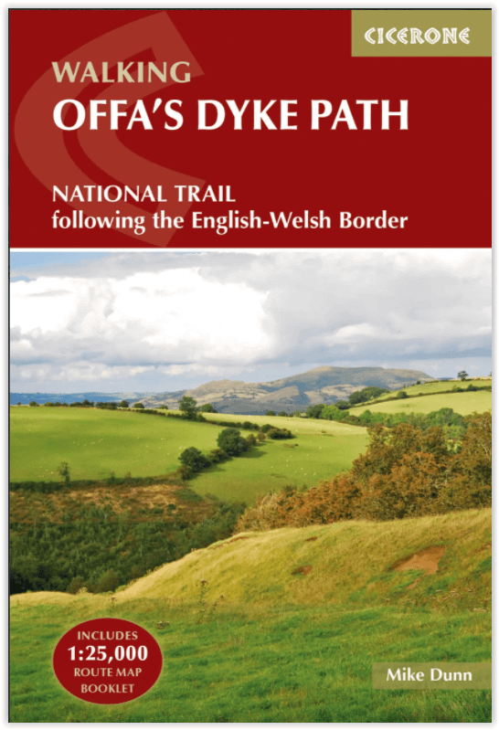
Wandelgids The Offa's Dyke Path - England & Wales - Cicerone
283 km tussen Sedbury (bij Chepstow) en Prestatyn
Korte omschrijving
Wandelgidsen Gloucestershire, Egland, Herefordshire, England en Shropshire West Midlands van CICERONE Press. Ideaal voor tochten in England en Wales.
Wandelgids The Offa's Dyke Path - Wales - Cicerone Productomschrijving: Deze gids beschrijft het Offa's Dyke Path National Trail, een langeafstandswandeling van 283 km langs de Engels-Welshe...

Specificaties
- Uitgever: CICERONE Press
- ISBN-13: 9781852847760
- HOOFDCATEGORIEËN: Wandelgids
- Activiteiten: Wandelen, Hiking & Trekking
- Auteur: Mike Dunn
- Regio: Gloucestershire, Egland, Herefordshire, England, Shropshire West Midlands
- Land: England, Wales
- Lange afstand wandelroutes: Offa's Dyke Path (285 km)
- Schaal: 1:25000
- Editie: 1
- Taal: Engels
Volledige omschrijving
Wandelgids The Offa's Dyke Path - Wales - Cicerone
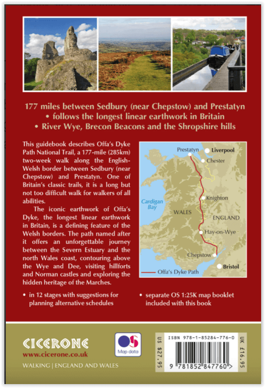
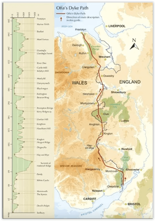
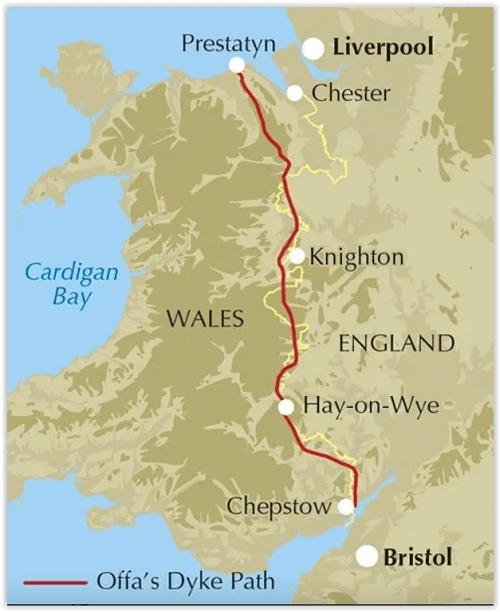
Productomschrijving: Deze gids beschrijft het Offa's Dyke Path National Trail, een langeafstandswandeling van 283 km langs de Engels-Welshe grens tussen Sedbury (bij Chepstow) en Prestatyn. De gids is opgedeeld in 12 etappes met suggesties voor het plannen van alternatieve routes. Met 1:25K OSI (Ordnance Servey) kaart boekje.
Engelse omschrijving: This guidebook describes Offa's Dyke Path National Trail, a 177 mile (283km) long-distance walk along the English and Welsh border between Sedbury (near Chepstow) and Prestatyn. The guidebook is split into 12 stages with suggestions for planning alternative itineraries. With 1:25K OS map booklet.
Seasons:
This walk is exceptional in all seasons, though the Black Mountains and Clwydian range deserve respect in winter conditions, and especially in mist, since there are few landmarks on the Black Mountain ridge.
Centres:
Chepstow, Hay-on-Wye, Kington, Bishops Castle, Montgomery, Welshpool, Oswestry, Llangollen, Denbigh, Prestatyn.
Difficulty:
The trail includes a couple of unavoidably long stages and there are some mountain and moorland stages, but the route poses no special difficulties and caters for walkers of all levels of ability provided that sensible advance planning is undertaken.
Must See:
Geology - limestone gorge of the lower Wye, igneous intrusions around Hergest ridge, Breidden Hills dolerite, limestone escarpments north of Llangollen Uplands - Black Mountain moorlands, remote Clun Forest, Clwydian ridge Lowlands - orchards and meadows, Montgomery canal, broad Severn valley Historical attractions - Tintern abbey and Llanthony priory, border castles, Pontcysyllte aqueduct.
Gekoppelde artikelen

Wandelkaart Offa's Dyke Path- Route Map Booklet - Cicerone • 9781852848941
standaard versieWandelkaart boekje - Offa's Dyke Path - Cicerone Productomschrijving: Kaartboekje van het 177 mijl (283 km) lange Offa's Dyke Path National Trail, tussen Sedbury (bij Chepstow) en Prestatyn. Het pad is in 2 weken te lopen en is geschikt voor wandelaars van alle ervaringsniveaus. Dit compacte boekje met OS 1:25,000 kaarten toont de volledige route en biedt alle kaarten die u nodig heeft, e…
Artikelen uit dezelfde regio

Wandelkaart Shropshire Way National Trail - Harvey maps • 9781851375073
Wandelkaart Shropshire Way National Trail - Harvey maps Productomschrijving: Deze kaart toont de route van het zuidelijke (Shropshire Hills) deel van de Shropshire way. Het bevat, informatie over het vinden van accomodatie, camping en voedsel. Beschrijft ook de route naar de start van de trail. Met gedetailleerde mapping, volledige opschriften op National Grid - kan worden gebruikt met GPS…

Wandelkaartv OL14 Wye Valley, Forest of Dean & Dyfryn Gwy - OS • 9780319263839
Wandelkaartv Wye Valley, Forest of Dean & Dyfryn Gwy - OS Productomschrijving: Parts of Offa's Dyke Path, on the border of England & Wales. Omvat: Wye Valley, Forest of Dean & Dyfryn Gwy, Wye Valley AONB, Daffodil Way, Gloucestershire Way, Herefordshire Way, Jubilee Way, Offa's Dyke Path, Severn Way, Thames & Severn Way, Three Coastal Walk, Wales Coast Path, Wye Valley Walk & Wysis Way…
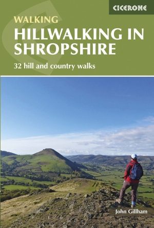
Wandelgids Shropshire Hillwalking guide - Cicerone • 9781852848071
Wandelgids - Shropshire Hillwalking guide - Cicerone Productomschrijving: Wandelgids over 32 wandelroutes in Shropshire in het graafschap West Midlands. De routes variëren van 5km tot 19km, en neemt de hoogtepunten mee zoals de The Wrekin, Wenlock rand, long Mynd en Stiperstones,Castle Ring en Bury Ditches. Vele fietsroutes starten in de buurt van de prachtige steden en dorpen met inbegrip…

Wandelkaart 169 Cirencester & Swindon - England - OSI • 9780319470411
Wandelkaart Cirencester & Swindon- Gloucestershire Omvat ook: Fairford & Cricklade. Productbeschrijving: Kaart nummer 169 in de OS Explorer kaarten reeks heeft betrekking op een gebied van Cirencester en Fairford met een gedeelte van de Cotswolds AONB in het noorden, tot de North Wessex Downs AONB in het zuiden. De nationale routes van Thames pad en Ridgeway vallen onder deze kaart, sa…

Wandelkaart 167 Thornbury- Dursley & Yate - England- OSI • 9780319470398
Wandelkaart Thornbury- Dursley & Yate - Gloucestershire Omvat ook: Berkeley & Wotton-under-Edge. Productbeschrijving: Kaart nummer 167 in de OS Explorer-reeks omvat het gebied ten noorden van Bristol langs de rivier de Severn tussen Engeland en Wales. Hoogtepunten van het gebied zijn ondermeer: Forest of Avon, de Cotswolds en de Wye Valley, met inbegrip van de Cotswold Way Offa's Dyke …