

Landkaart Wegenkaart 7 Zuidwest Engeland & Zuid Wales - OSI
South-west England & South Wales

Korte omschrijving
Wegenkaart Zuidwest Engeland & Zuid Wales - OSI Productomschrijving: Plan your journey with this series of road maps from OS. Showing all major road, rail and ferry links as well as settlem...

Specificaties
- Uitgever: Ordnance Survey
- ISBN-13: 9780319263792
- HOOFDCATEGORIEËN: Wegenkaart - Landkaart
- Activiteiten: Street/Road maps & city plans
- Regio: Cornwall, England, Devon, England, South Wales, South West England
- Land: England, Wales
- Schaal: 1:250000
- Taal: Engels
- Reeks/Serie: OSI Regional UK Roadmaps 1:250.000
Volledige omschrijving
Wegenkaart Zuidwest Engeland & Zuid Wales - OSI
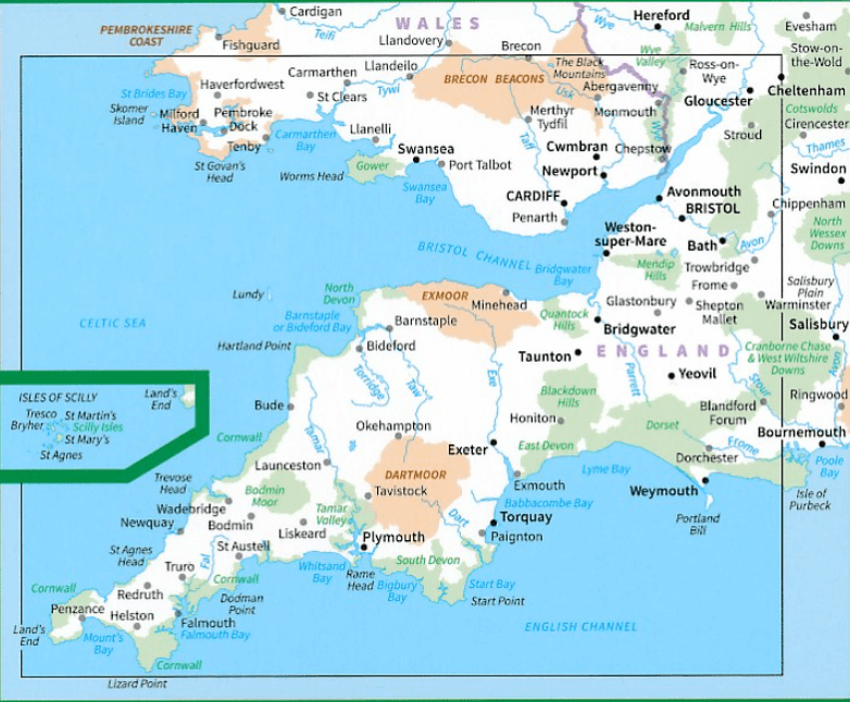
Productomschrijving: Plan your journey with this series of road maps from OS. Showing all major road, rail and ferry links as well as settlements and selected features in 1: 250 000 scale, this is the ideal map for planning trips and holidays by car or cycle.
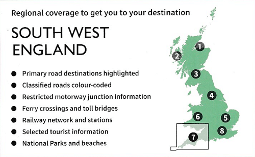
OS Road 7 covers: the south-west England plus south Wales, Devon & Cornwall.
Overzichtskaarten
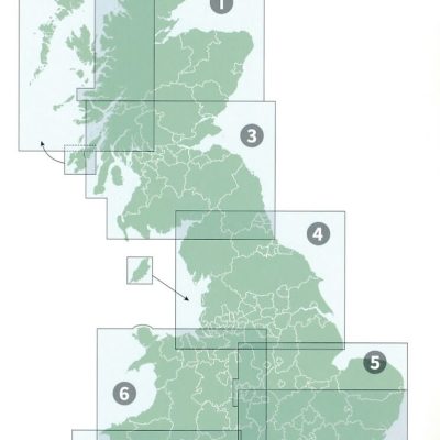
OSI Roadmaps UK 1 > 8 - 1:250.000
OSI Roadmaps UK 1 > 8 - 1:250.000

Producten op de overzichtskaart
Klik op een product om naar de detailpagina te gaan.
- Landkaart Wegenkaart 1 Schotland Noord - OSI
- Landkaart Wegenkaart 2 Schotland West & Western Isles - OSI
- Landkaart Wegenkaart 3 Schotland Zuid & Northumberland - OSI
- Landkaart Wegenkaart 4 Engeland Noord - OSI
- Landkaart Wegenkaart 5 Midlands Oost & East Anglia - OSI
- Landkaart Wegenkaart 6 Wales & Midlands West - OSI
- Landkaart Wegenkaart 7 Zuidwest Engeland & Zuid Wales - OSI
- Landkaart Wegenkaart 8 Zuidoost Engeland - OSI
Artikelen uit dezelfde regio

Reisgds Devon & Cornwall + map (ENG) - Marco Polo • 9781914515415
Reisgds Devon & Cornwall - Marco Polo Productomschrijving: Let Marco Polo Devon and Cornwall guide you around these beautiful English counties. Discover boutique hotels, authentic restaurants and ideas for travel with kids with this handy, pocket-sized, authoritative guide, packed with Insider Tips. Let Marco Polo show you all this beautiful region has to offer!

Wandelkaart OL9 Exmoor NP- Summerset England - OSI • 9780319469279
Wandelkaart Exmoor NP - Summerset England Omvat ook: Barnstaple, Lynton, Minehead & Dulverton Productbeschrijving: Kaart nummer OL9 in de Explorer kaarten reeks is de perfecte metgezel voor diegenen die de schoonheid willen ervaren van wandelen in het Exmoor Nationale Park. Exmoor Nationaal park heeft 1000 km van wandel- en ruiterpaden, rivieren en een overdekte heidegebied. Wandelaars…

Wandelkaart South West Coast Path 3 - Harvey Maps • 9781851376834
South West Coast Path - Harvey Maps Productomschrijving: Het South West Coast path is een dikke 1014 km lang en omvat het volledige South-West-England met daarin Devon & Corwall. Het pad is een National trail en behoort tot de langste routes van Engeland. De route start in Minehead in Somerset en loopt de volledige kust af tot in Poole in Dorset. OPGELET: deze kaart omvat het laatste deel …

Wandelkaart OL28 Dartmoor National Park - OS • 9780319264034
Wandelkaart Dartmoor National Park - OS Productomschrijving: Dartmoor National Park, Devon England. Ontdek de OL-serie van Ordnance Survey: De OL-serie (Outdoor Leisure) van Ordnance Survey is dé referentie voor wie gaat wandelen op de Britse eilanden. Deze topografische kaarten maken deel uit van de Explorer-reeks en bieden ongeëvenaarde nauwkeurigheid en detail op een schaal van 1:…

Wandelkaart 198 Cardigan & New Quay- South Wales - OSI • 9780319470701
Wandelkaart Cardigan & New Quay - Aberaeron South Wales Productbeschrijving: Deze ' dubbel zijdige OS Explorer kaart 198 dekt Cardigan (Aberteifi) in het westen tot Aberaeron in het Oosten in Mid Wales. De Ceredigion Coast Path (Llwybr Arfordir Ceredigion) start vanaf hier, en geeft gemakkelijke toegang tot de kust. De OS Explorer kaart voor Cardigan & New Quay is beschikbaar in zowel de s…