

Wandelgids West Highland Way Map Booklet - Cicerone
Milngavie - Loch Lomond - Rannoch Moor - Fort William


Korte omschrijving
Wandelgidsen Highlands, Schotland van CICERONE Press. Ideaal voor tochten in Schotland.
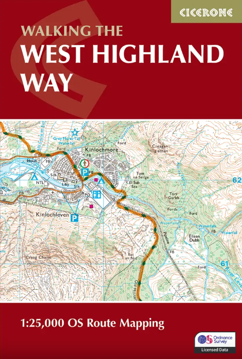
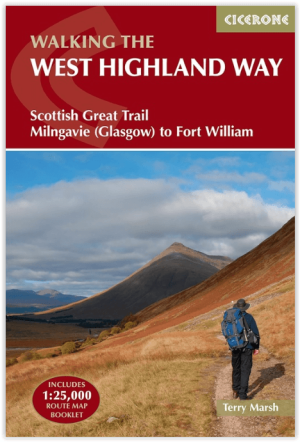
The West Highland Way Map Booklet - Cicerone Productomschrijving: Dit compacte kaartboekje toont de volledige route van de 152,88 km lange Schotse langeafstandsroute West Highland Way, via ...

Specificaties
- Uitgever: CICERONE Press
- ISBN-13: 9781786311788
- HOOFDCATEGORIEËN: Wandelgids
- Activiteiten: Wandelen, Hiking & Trekking
- Auteur: Terry Marsch
- Regio: Highlands, Schotland
- Land: Schotland
- Toepasselijke bergketen: Schotse Highlands, Schotland
- Lange afstand wandelroutes: West Highland Way, Schotland (152 km)
- Schaal: 1:25000
- Editie: 2
- Taal: Engels
- Reeks/Serie: Map Booklet, Cicerone
- Iconische Bergketens van Europa: De Schotse Highlands
- Iconische Wandelroutes: West Highland Way, Schotland
- Scotlands Great Trails: West Highland Way
Volledige omschrijving
The West Highland Way Map Booklet - Cicerone
Productomschrijving: Dit compacte kaartboekje toont de volledige route van de 152,88 km lange Schotse langeafstandsroute West Highland Way, via Loch Lomond en Rannoch Moor. Dit boekje is inbegrepen bij de Cicerone gids voor de route en toont de volledige route op Ordnance Survey 1:25.000 kaarten.
Engelse omschrijving: This compact booklet of maps shows the full route of the 95 mile West Highland Way Scottish Long Distance Route, via Loch Lomond and Rannoch Moor. This booklet is included with the Cicerone guidebook to the trail, and shows the full route on Ordnance Survey 1:25,000 maps.
Seasons:
May-June and September-October avoid the worst of the midges, but suitably experienced backpackers can do this walk at any time of year.
Centres:
Milngavie, Drymen, Crianlarich, Tyndrum, Kinlochleven, Fort William.
Difficulty:
The walking is not difficult for anyone accustomed to regular walks longer than 10 miles, although there is ample scope to shorten almost all of the days, and to offload the pack carrying onto an independent service that will transport your baggage for you.
Must See:
Loch Lomond, Rannoch Moor, Glencoe, Buachaille Etive Mòr, the Devil's Staircase, Lairig Mòr.

Gekoppelde artikelen
Wandelgids West Highland Way - Cicerone • 9781786311771
standaard versieWandelgids West Highland Way - Cicerone Productomschrijving: Wandelgids voor de West Highland Way National Trail, een Schotse langeafstandsroute van Milngavie bij Glasgow naar Fort William van 95 mijl, langs Loch Lomond en over Rannoch Moor. Voorgestelde routes van 6 tot 9 dagen. Inclusief accommodatiegids en uittrekbaar boekje met 1:25K OS-kaarten. Egelse omschrijving: Guidebook to wa…
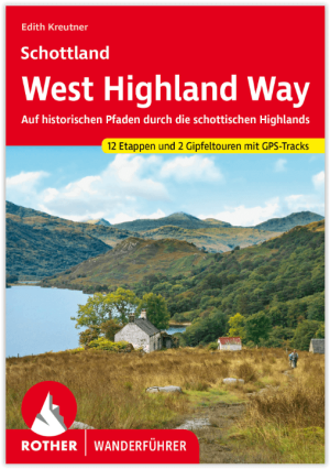
Wandelgids Schottland - West Highland Way - Rother • 9783763347261
standaard versieThe West Highland Way 153 km - Rother Productomschrijving: Op de West Highland Way leer je de mooiste kanten van Schotland te voet kennen: Vanaf de bewoonde uitlopers van Glasgow in de Lowlands leidt dit 150 kilometer lange pad naar het hart van de Highlands bij Fort William. Het Schotse landschap ziet er hier uit als iets uit een prentenboek: het pad voert door ongerepte heidevelden, over…
Wandelgids The West Highland Way - Rucksack Readers • 9781913817213
standaard versieThe West Highland Way - Rucksack Readers Productomschrijving: Een unieke intussen zeer gekende wandelroute, die loopt van Milngavie nabij Glasgow tot Fort William door de Schotse Hooglanden. De Route is 152 km Lang en brengt u door de westelijke Highlands van Schotland starten vanuit Glasgow. Engelse omschrijving: The West Highland Way is the first, and remains the most famous, of Scot…
Artikelen uit dezelfde regio

Wandelkaart 438 Dornoch & Tain- Schotland - OSI • 9780319472903
Wandelkaart Dornoch & Tain - Highland's Schotland Omvat ook: Alness & Invergordon. Productbeschrijving: OS Explorer kaart 438 is een dubbel zijdige kaart en omvat Dornoth tot Alness op de Highlands oostkust, in de omgeving van Easter Ross... Het omvat de Dornoch Firth nationale Scenic Area, Nigg Bay en de steden van Tain en Invergordon. De OS Explorer kaart voor Dornoch & Tain is besch…

Wandelgids 027 Pathfinder Perthshire "big county" Angus & Five OS • 9780319091289
Wandelgids Perthshire, Angus & Five - OS Productomschrijving: Each of the Jarrold Pathfinder titles features 28 circular routes, all tried and tested by seasoned walkers. The routes range from extended strolls to exhilarating hikes, so there is something for everyone. They also contain: - Ordnance Survey mapping; - Background details of each area; - Details of refreshment stop…
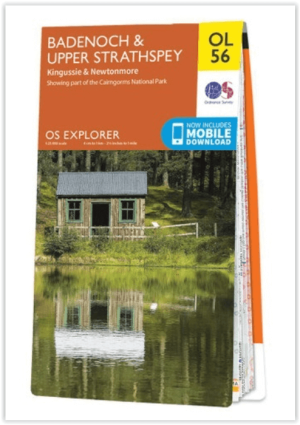
Wandelkaart OL56 Badenoch, Upper Strathspey & Kingussie - OS • 9780319242957
Wandelkaart Badenoch, Upper Strathspey & Kingussie - OS Productomschrijving: Een topografische wandelkaart van deel van de Cairngorms National Park, Omvat: Badenoch, Upper Strathspey, Kingussie & Newtonmore, part of the Cairngorms National Park, Badeoch Way and the national scenic area of the Cairngorms Mountains. Ontdek de OL-serie van Ordnance Survey: De OL-serie (Outdoor Lei…

Wandelgids Walking the Munros Vol 1 - Cicerone Press • 9781786311054
Walking the Munros Vol 1 - Cicerone Productomschrijving: Wandelgids over de Munros in de zuidelijke, centrale en westelijke Highland's. De gids beschrijft 69 uitdagende routes over 139 van de meest iconische 3000f+ bergen in gebieden zoals Glencoe, Bridge of Orchy en Mull. Inclusief routes op Ben More, Ben Alder, Ben Lomond en Ben Nevis, de hoogste berg van de Britse eilanden. Deel 1 van t…

Wandelkaart 448 Strath Naver & Strath Nabhair - OSI • 9780319473009
Wandelkaart Strath Naver & Strath Nabhair & Loch Loyal Omvat ook: Bettyhill. Productbeschrijving: Aan de Noord kust van Schotland volgt OS Explorer kaart 448 Strath Naver tot Loch Naver naar de kust. Dit gebied omvat ook Loch Tongue, Tongue bay en één Munro, alsook de Ben Klibreck (962 m) in het uiterste zuidwesten van de kaart. De OS Explorer kaart voor Strath Naver & Loch loyaal is b…