
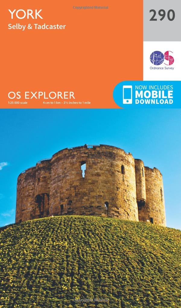
Wandelkaart 290 York Selby & Tadcaster North Yorkshire - OSI
York tot Selby- met inbegrip van de Trans Pennine Way
Korte omschrijving
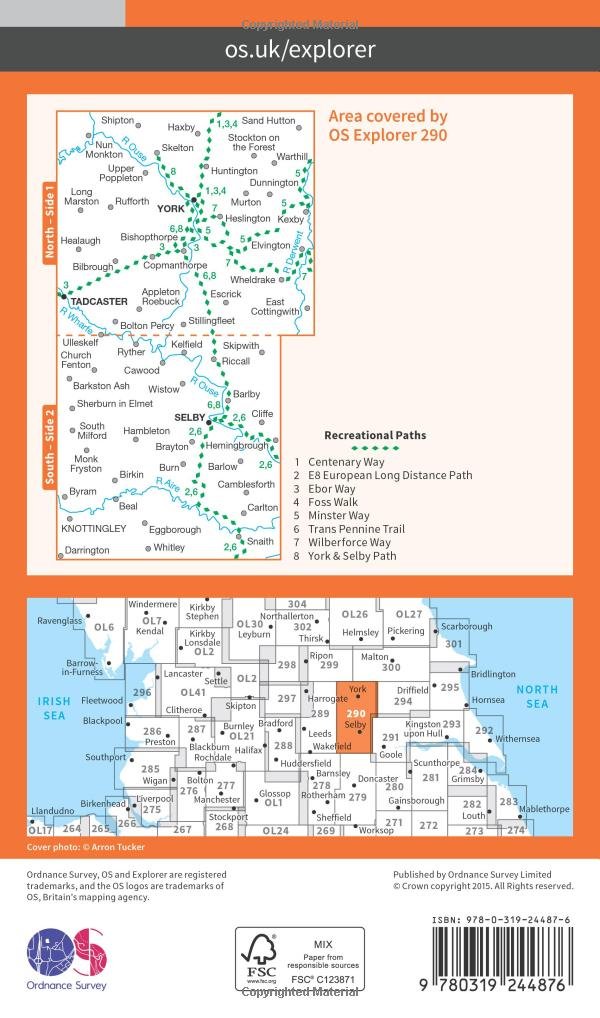
Wandelkaart York- Selby & Tadcaster - North Yorkshire England Productbeschrijving: Deze twee-zijdige kaart (OS Explorer kaart 290) toont York tot Selby, met inbegrip van de Trans Pennine Way...

Specificaties
- Uitgever: Ordnance Survey
- ISBN-13: 9780319244876
- HOOFDCATEGORIEËN: Wandelkaart
- Activiteiten: Wandelen, Hiking & Trekking
- Regio: North Yorkshire, Engeland
- Land: Centraal-Europa
- Schaal: 1:25000
- Afmeting: 13x23
- Taal: Engels
- Reeks: Explorer Series
Volledige omschrijving
Wandelkaart York- Selby & Tadcaster - North Yorkshire England
Productbeschrijving: Deze twee-zijdige kaart (OS Explorer kaart 290) toont York tot Selby, met inbegrip van de Trans Pennine Way en de Ebor Way. U kunt de historische stad verkennen, of verder gaan en de rivier de Ouse volgen. De OS Explorer kaart voor York is beschikbaar in zowel de standaard papieren versie als de weerbestendige 'Actief' versie.
Productdiscription: This two-sided map (OS Explorer 290) shows York down to Selby, including the Trans Pennine Way and the Ebor Way. Explore the historic city, or go further afield and follow the River Ouse. The OS Explorer map for York is available in both the standard paper version and weatherproof 'Active' version.
Locatie op kaart
Gekoppelde artikelen

Wandelkaart 290 York Selby & Tadcaster North Yorkshire - OSI • 9780319244876
standaard versieWandelkaart York- Selby & Tadcaster - North Yorkshire England Productbeschrijving: Deze twee-zijdige kaart (OS Explorer kaart 290) toont York tot Selby, met inbegrip van de Trans Pennine Way en de Ebor Way. U kunt de historische stad verkennen, of verder gaan en de rivier de Ouse volgen. De OS Explorer kaart voor York is beschikbaar in zowel de standaard papieren versie als de weerbestendi…

Wandelkaart 290 York- Yorkshire and the Humber - OSI • 9780319471623
weatherproof versieWandelkaart York- Yorkshire and the Humber England Omvat ook: Selby & Tadcaster. Productbeschrijving: Deze twee-zijdige kaart (OS Explorer 290) toont York tot Selby, met inbegrip van de Trans Pennine Way en de Ebor Way. U kunt er de historische stad verkennen, of verder weg gaan en de rivier de Ouse volgen. De OS Explorer kaart voor York is beschikbaar in zowel de standaard papieren ve…
Overzichtskaarten

OSI Explorer & Explorer Active - Noord Engeland - Lake District
OSI Explorer & Explorer Active - Noord Engeland - Lake District

Producten op de overzichtskaart
Klik op een product om naar de detailpagina te gaan.
- Wandelkaart 275 Liverpool- South West England - OSI
- Wandelkaart 276 Bolton- Wigan & Warrington- Machester - OSI
- Wandelkaart 277 Manchester & Salford - OSI
- Wandelkaart 278 Sheffield & Barnsley- South Yorkshire - OSI
- Wandelkaart 279 Doncaster- South Yorkshire - OSI
- Wandelkaart 280 Isle of Axholme- Lincolnshire - OSI
- Wandelkaart 281 Ancholme Valley- Lincolnshire - OSI
- Wandelkaart 283 Louth & Mablethorpe- Lincolnshire - OSI
- Wandelkaart 284 Grimsby- Cleethorpes & Immingham - OSI
- Wandelkaart 285 Southport & Chorley- Merseyside - OSI
- Wandelkaart 286 Blackpool & Preston- Lancashire - OSI
- Wandelkaart 287 West Pennine Moors- Lankashire - OSI
- Wandelkaart 288 Bradford & Huddersfield- West Yorkshire - OSI
- Wandelkaart 289 Leeds- Harrogate- Wetherby & Pontefract - OSI
- Wandelkaart 290 York- Selby & Tadcaster- North Yorkshire - OSI
- Wandelkaart 291 Goole & Gilberdyke- Yorkshire - OSI
- Wandelkaart 292 Withernsea & Spurn Head- East Riding - OSI
- Wandelkaart 293 Kingston upon Hull & Beverley - OSI
- Wandelkaart 294 Market Weighton & central Yorkshire Wolds - OSI
- Wandelkaart 295 Bridlington- Driffield & Hornsea - OSI
- Wandelkaart 296 Lancaster- Morecambe & Fleetwood - OSI
- Wandelkaart 297 Lower Wharfedale & Washburn Valley - OSI
- Wandelkaart 298 Nidderdale AONB- Yorkshire - OSI
- Wandelkaart 299 Ripon & Boroughbridge- North Yorkshire - OSI
- Wandelkaart 300 Howardian Hills AONB & Malton - OSI
- Wandelkaart 301 Scarborough- Bridlington & Flamborough
- Wandelkaart 302 Northallerton & Thirsk- North Yorkshire
- Wandelkaart 303 Whitehaven & Workington - OSI
- Wandelkaart 304 Darlington & Richmond- North Cleveland
- Wandelkaart 305 Bishop Auckland & Durham - OSI
- Wandelkaart 306 Middlesbrough & Hartlepool - OSI
- Wandelkaart 307 Consett & Derwent reservoir - OSI
- Wandelkaart 308 Durham & Sunderland- England - OSI
- Wandelkaart 314 Solway Firth- Wigton & Silloth - OSI
- Wandelkaart 315 Carlisle- Brampton- Longtown - OSI
- Wandelkaart 316 Newcastle upon Tyne- Northumberland- OSI
- Wandelkaart OL2 Yorkshire Dales- Southern & Western Areas - OSI
- Wandelkaart OL19 Howgill Fells and Upper Eden Valley - OSI
- Wandelkaart OL21 South Pennines - Yorkshire - OSI
- Wandelkaart OL26 North York Moors - Western area - OSI
- Wandelkaart OL27 North York Moors- Eastern area - OSI
- Wandelkaart OL30 Yorkshire Dales - Yorkshire England - OSI
- Wandelkaart OL31 North Pennines- Teesdale & Weardale - OSI
- Wandelkaart OL41 Forest of Bowland & Ribblesdale - OSI
- Wandelkaart OL43 Hadrian's Wall - OSI
Artikelen uit dezelfde regio

Wandelgids Teesdale Way - Cicerone • 9781852844615
Wandelgids - Teesdale Way - Cicerone Productomschrijving: Deze handige gids is ideaal voor degenen die van plan zijn om de 135 km lange Teesdale Way te doorlopen. De route wordt beschreven in acht stappen en heeft betrekking op de gehele 100 mijl van Dufton naar Teesmouth. Elke fase biedt gematigde dagwandelingen en gemakkelijk 2 weken. Het omvat ook routebeschrijvingen voor een selectie …

Wandelkaart 299 Ripon & Boroughbridge North Yorkshire - OSI • 9780319245514
Wandelkaart Ripon & Boroughbridge - North Yorkshire England Omvat ook: Easingwold Productbeschrijving: Kaart nummer 299 in de OS Explorer kaarten reeks is ideaal voor het ontdekken van North Yorkshire rond Ripon en Boroughbridge. Bezoek de kathedraal stad van Ripon en bewonder de Ripon markt, of de Ripon Hornblower, een traditie van de Middeleeuwen. Andere hoogtepunten van het gebied z…

Wandelkaart 100 Malton & Pickering Yorkshire - OSI • 9780319474235
Wandelkaart Malton & Pickering - North Yorkshire England - OSI Productbeschrijving: Landranger kaart 100 bestrijkt het zuidwesten van het North York Moors National Park, en omvat de steden Malton, Pickering, Helmsley en Easingwold. De start van de Cleveland Way die (eindigt) in Helmsley en 177km lang is, of die verschillende wandelpaden volgt langs de pittoreske rivier Derwent. De kaart OS…

Wandelkaart 300 Howardian Hills AONB - OSI • 9780319471722
Wandelkaart Howardian Hills AONB & Malton - North Yorkshire Productbeschrijving: Gecentreerd rond Malton, bevat OS Explorer kaart 300 delen van de Howardian Hills AONB en The Wolds. Met veel mogelijkheden voor het verkennen van zowel het platteland (met inbegrip van het deel van de Yorkshire Wolds Way) en de historische gebouwen zoals Castle Howard, is het ideaal om te wandelen, of te fiet…

Wandelkaart OL41 Forest of Bowland & Ribblesdale - OSI • 9780319469590
Wandelkaart Forest of Bowland & Ribblesdale - North Yorkshire Omvat ook: Pendle Hill, Clitheroe & Settle Productbeschrijving: Kaart nummer OL41 in de OS Explorer kaarten reeks omvat de Forest of Bowland en Yorkshire Dales National Park in de buurt van Clitheroe. Hoogtepunten van het gebied zijn onder andere: Ribble way & Wyre way, Lune Valley walkway en Pendle way, samen met de steden …