

Wandelkaart 302 Northallerton & Thirsk- North Yorkshire
Omvat North Yorkshire rond Thirsk en Northallerton


Korte omschrijving
Wandelkaarten North Yorkshire, Engeland van Ordnance Survey. Ideaal voor tochten in England.
Wandelkaart Northallerton & Thirsk - North Yorkshire England Omvat ook: Catterick & Bedale Productomschrijving: Kaart nummer 302 in de OS Explorer kaarten reeks is ideaal voor het ontdek...

Specificaties
- Uitgever: Ordnance Survey
- ISBN-13: 9780319245545
- HOOFDCATEGORIEËN: Wandelkaart
- Activiteiten: Wandelen, Hiking & Trekking
- Regio: North Yorkshire, Engeland
- Land: England
- Nationale parken: North York Moors NP, England
- TOPO's & Stafkaarten: Topografisch wandelen
- Schaal: 1:25000
- Taal: Engels
- Reeks/Serie: Explorer Series OS
- De Engelse Graafschappen: North Yorkshire, Yorkshire
Volledige omschrijving
Wandelkaart Northallerton & Thirsk - North Yorkshire England
Omvat ook: Catterick & Bedale
Productomschrijving: Kaart nummer 302 in de OS Explorer kaarten reeks is ideaal voor het ontdekken North Yorkshire rond Thirsk en Northallerton. Dit gebied maakt deel uit van de Vale van Mowbray, en heeft meanderende rivieren en golvende landschappen te verkennen, die in detail op deze kaart worden weergegeven. Verken de markt steden Thirsk, Northallerton, Bedale en Catterick, die beide zijden van de rivier de Swale liggen. De OS Explorer kaart voor Northallerton & Thirsk is beschikbaar in zowel de standaard papieren versie en weerbestendige 'Actief' versie
Kaart nummer 302 is een all purpose kaart vol gepakt met informatie om u het gebied te helpen leren kennen. De kaarten bestrijken het land. Elke kaart heeft een oppervlakte van 40 km door 40 km (25 mijl door 25 mijl) en zoals andere kaarten van Ordnance Survey, National Grid-vierkanten worden verstrekt zodat elke functie een unieke referentienummer kan worden gegeven.
Productdiscription: Map sheet number 302 in the OS Explorer map series is ideal for discovering North Yorkshire around Thirsk and Northallerton. This area is part of the Vale of Mowbray, and has meandering rivers and undulating landscapes to explore, which are shown in detail on this map. Explore the market towns of Thirsk, Northallerton, Bedale and Catterick, which lie either side of the River Swale. The OS Explorer map for Northallerton & Thirsk is available in both the standard paper version and weatherproof 'Active' version
Locatie op kaart
Gekoppelde artikelen

Wandelkaart 302 Northallerton & Thirsk- North Yorkshire • 9780319245545
standaard versieWandelkaart Northallerton & Thirsk - North Yorkshire England Omvat ook: Catterick & Bedale Productomschrijving: Kaart nummer 302 in de OS Explorer kaarten reeks is ideaal voor het ontdekken North Yorkshire rond Thirsk en Northallerton. Dit gebied maakt deel uit van de Vale van Mowbray, en heeft meanderende rivieren en golvende landschappen te verkennen, die in detail op deze kaart word…

Wandelkaart 302 Northallerton & Thirsk- England - OSI • 9780319471746
weatherproof versieWandelkaart Northallerton & Thirsk - North Yorkshire England Omvat ook: Catterick & Bedale. Productbeschrijving: Kaart nummer 302 in de OS Explorer kaarten reeks is ideaal voor het ontdekken North Yorkshire rond Thirsk en Northallerton. Dit gebied is onderdeel van de Vale van Mowbray, en heeft zwoele rivieren en golvende landschappen om te ontdekken, die in detail op deze kaart worden …
Overzichtskaarten

OSI Explorer & Explorer Active - Noord Engeland - Lake District
OSI Explorer & Explorer Active - Noord Engeland - Lake District

Producten op de overzichtskaart
Klik op een product om naar de detailpagina te gaan.
- Wandelkaart 275 Liverpool- South West England - OSI
- Wandelkaart 276 Bolton- Wigan & Warrington- Machester - OSI
- Wandelkaart 277 Manchester & Salford - OSI
- Wandelkaart 278 Sheffield & Barnsley- South Yorkshire - OSI
- Wandelkaart 279 Doncaster- South Yorkshire - OSI
- Wandelkaart 280 Isle of Axholme- Lincolnshire - OSI
- Wandelkaart 281 Ancholme Valley- Lincolnshire - OSI
- Wandelkaart 283 Louth & Mablethorpe- Lincolnshire - OSI
- Wandelkaart 284 Grimsby- Cleethorpes & Immingham - OSI
- Wandelkaart 285 Southport & Chorley- Merseyside - OSI
- Wandelkaart 286 Blackpool & Preston- Lancashire - OSI
- Wandelkaart 287 West Pennine Moors- Lankashire - OSI
- Wandelkaart 288 Bradford & Huddersfield- West Yorkshire - OSI
- Wandelkaart 289 Leeds- Harrogate- Wetherby & Pontefract - OSI
- Wandelkaart 290 York- Selby & Tadcaster- North Yorkshire - OSI
- Wandelkaart 291 Goole & Gilberdyke- Yorkshire - OSI
- Wandelkaart 292 Withernsea & Spurn Head- East Riding - OSI
- Wandelkaart 293 Kingston upon Hull & Beverley - OSI
- Wandelkaart 294 Market Weighton & central Yorkshire Wolds - OSI
- Wandelkaart 295 Bridlington- Driffield & Hornsea - OSI
- Wandelkaart 296 Lancaster- Morecambe & Fleetwood - OSI
- Wandelkaart 297 Lower Wharfedale & Washburn Valley - OSI
- Wandelkaart 298 Nidderdale AONB- Yorkshire - OSI
- Wandelkaart 299 Ripon & Boroughbridge- North Yorkshire - OSI
- Wandelkaart 300 Howardian Hills AONB & Malton - OSI
- Wandelkaart 301 Scarborough- Bridlington & Flamborough
- Wandelkaart 302 Northallerton & Thirsk- North Yorkshire
- Wandelkaart 303 Whitehaven & Workington - OSI
- Wandelkaart 304 Darlington & Richmond- North Cleveland
- Wandelkaart 305 Bishop Auckland & Durham - OSI
- Wandelkaart 306 Middlesbrough & Hartlepool - OSI
- Wandelkaart 307 Consett & Derwent reservoir - OSI
- Wandelkaart 308 Durham & Sunderland- England - OSI
- Wandelkaart 314 Solway Firth- Wigton & Silloth - OSI
- Wandelkaart 315 Carlisle- Brampton- Longtown - OSI
- Wandelkaart OL01 Peak District NP & Dark Peak area - OS
- Wandelkaart OL02 Yorkshire Dales - South& Western areas - OS
- Wandelkaart OL04 English Lakes - North Western area - OS
- Wandelkaart OL05 English Lakes - North Eastern area - OS
- Wandelkaart OL06 English Lakes - South Western area - OS
- Wandelkaart OL07 English Lakes - South Eastern area - OS
- Wandelkaart OL19 Howgill Fells & Upper Eden Valley - OS
- Wandelkaart OL21 South Pennines - OS
- Wandelkaart OL26 North York Moors Western area - OS
- Wandelkaart OL27 North York Moors, Eastern area - OS
- Wandelkaart OL30 Yorkshire Dales - Northern & Central areas - OS
- Wandelkaart OL31 Northern Pennines AONB, Teesdale & Weardale - OS
- Wandelkaart OL41 Forest of Bowland & Ribblesdale - OS
- Wandelkaart OL43 Hadrian's Wall- Haltwhistle & Hexham - OS
Artikelen uit dezelfde regio

Wandelkaart 304 Darlington & Richmond- England - OSI • 9780319471760
Wandelkaart Darlington & Richmond - North Yorkshire England Omvat ook: Egglescliffe & Gainford. Productbeschrijving: De dubbel zijdige OS Explorer kaart 304 volgt de rivier de Tees en de Teesdale way, evenals het Tees Forest- en markettown Darlington worden getoont. De Tees Forest host outdoor activiteiten zoals raften, wandelen, loopwadstrijden en mountainbiken. De OS Explorer kaart v…

Wandelkaart 100 Malton & Pickering- Yorkshire - OSI • 9780319474235
Wandelkaart Malton & Pickering - North Yorkshire England - OSI Productbeschrijving: Landranger kaart 100 bestrijkt het zuidwesten van het North York Moors National Park, en omvat de steden Malton, Pickering, Helmsley en Easingwold. De start van de Cleveland Way die (eindigt) in Helmsley en 177km lang is, of die verschillende wandelpaden volgt langs de pittoreske rivier Derwent. De kaart OS…

Wandelkaart 301 Scarborough- Bridlington & Flamborough • 9780319245538
Wandelkaart Scarborough- Bridlington & Flamborough - Yorkshire Productbeschrijving: Kaart nummer 301 in de OS Explorer kaarten reeks heeft betrekking op de oostkust van Yorkshire rond Scarnorough, Bridlington en Flamborough Head. Hoogtepunten van het gebied zijn onder andere: De Cleveland Way, de Yorkshire Wolds Way en de North Sea Trail. De OS Explorer kaart voor Scarborough, Bridlington …

Fietskaart North York Moors - Goldeneye • 9781859652763
Fietskaart North York Moors - Goldeneye Productomschrijving: Het North York Moors National Park beslaat een gebied met hooggelegen, glooiende heidevelden, die in het noorden en westen een steile helling vormen, en in het oosten een ruige, grillige kustlijn. In het zuiden loopt de grond zachter af naar de Vales of Mowbray en Pickering. De Moors worden doorsneden door een reeks kleine stroom…
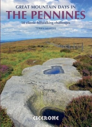
Wandelgids Great Mountain Days in the Pennines - Cicerone • 9781852846503
Wandelgids - Great Mountain Days in the Pennines - Cicerone Productomschrijving: Een inspirerende gids naar 50 klassieke wandelingen op het glooiende landschap van de Walliser. De gesorteerde routes, tussen 6 en 13 mijl in lengte, dekken de klassieke Walliser fells en veenland zoals Whernside, Ilkley Moor en Pendle Hill; verkennen van Noord- en Zuid-Pennines, Yorkshire Dales, Howgills en D…